Download
1 / 12
120 likes | 246 Views
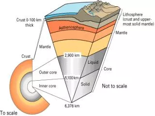
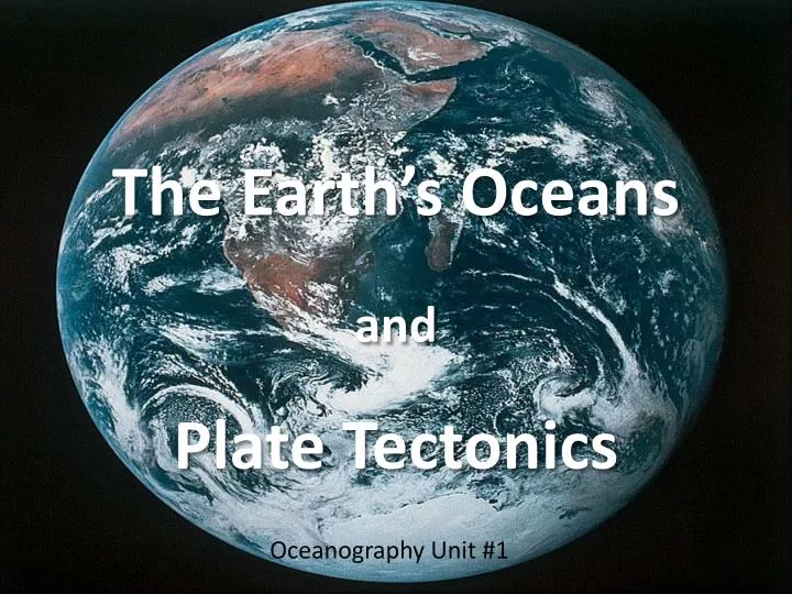
The Earth’s Oceans and Plate Tectonics. Oceanography Unit #1. Our Earth. Earth is between 5.0 and 7.0 billion years old . Crust Mantle Outer core Inner core. The Earth’s Crust. Asthenosphere – an area of weakened crust and molten upper mantle.

E N D
The Earth’s OceansandPlate Tectonics Oceanography Unit #1
Our Earth • Earth is between 5.0 and 7.0 billion years old. • Crust • Mantle • Outer core • Inner core
The Earth’s Crust • Asthenosphere– an area of weakened crust and molten upper mantle. • Lithosphere – the rigid hardened crust. • Crustal types: • Oceanic Crust– found beneath the ocean basins • Continental Crust – found beneath the continents and margins
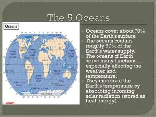
Earth’s Hydrosphere • Oceans are approx. 4.0 billion years old. • Oceans cover approx. 71% of the earth’s surface. • Water? • Oceans = 97.22% • Glaciers = 2.15% • Ground water = .62% • Atmosphere, lakes, rivers, etc. = <.01%
The Ocean Basins Southern Ocean – combination of the most southern Pacific, southern Atlantic, and southern Indian; surrounding Antarctica.
Ocean Topography • Continental shelf – submerged edge of the continent; most biologically active. • Continental slope – descends from shelf down to the deep sea-floor. • Continental rise – sediments that accumulate at the slope’s base. • Abyssal plains – most of the ocean’s floor; avg. depth = 4.0 km. • Seamounts – submarine volcanoes • Trenches – found at base of slope; depth >6.0 km.
Mid-Ocean Ridge System • “Spreading centers”; crustal expansion. • Largest geographical feature on planet. • Total length is over 65,000 km.
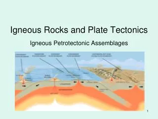
Plate Boundaries • Divergent: • Two or more plates are directed away from each other. • Mid-ocean ridge system • Numerous volcanic eruptions and earthquakes. • Volcanic islands such as Iceland, Azores, and Ascencion. • Lateral: • Two plates slip past each other. • San Andreas Fault (CA). • Numerous large earthquakes
Plate Boundaries • Convergent: • Crustal plates are directed towards each other. • Two continental plates collide: • Build up of crust in to mountain ranges. • Himalayan Mountains • One continental plate and one oceanic plate collide: • Createssubduction zones. • Japan Islands, New Zealand, Andes
Hotspots • Areas where magma punches a hole in thin, weak crust above; Stationary. • Hawaiian-Emperor island chain: