Download
1 / 16
160 likes | 249 Views
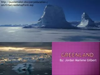
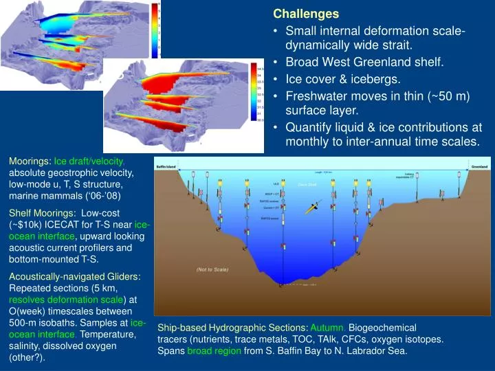
. S. Challenges Small internal deformation scale- dynamically wide strait. Broad West Greenland shelf. Ice cover & icebergs. Freshwater moves in thin (~50 m) surface layer. Quantify liquid & ice contributions at monthly to inter-annual time scales.

E N D
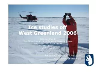
S • Challenges • Small internal deformation scale- dynamically wide strait. • Broad West Greenland shelf. • Ice cover & icebergs. • Freshwater moves in thin (~50 m) surface layer. • Quantify liquid & ice contributions at monthly to inter-annual time scales. Moorings:Ice draft/velocity, absolute geostrophic velocity, low-mode u, T, S structure, marine mammals (‘06-’08) Shelf Moorings: Low-cost (~$10k) ICECAT for T-S nearice-ocean interface, upward looking acoustic current profilers and bottom-mounted T-S. Acoustically-navigated Gliders: Repeated sections (5 km, resolves deformation scale) at O(week) timescales between 500-m isobaths. Samples atice-ocean interface. Temperature, salinity, dissolved oxygen (other?). Ship-based Hydrographic Sections:Autumn. Biogeochemical tracers (nutrients, trace metals, TOC, TAlk, CFCs, oxygen isotopes. Spans broad region from S. Baffin Bay to N. Labrador Sea.
Seaglider and Sensors • Hull length: 1.8 m, Wing span: 1.0 m • Mass: 52 kg • Surface to 1000 m. • Slow: horizontal speed 0.1 - 0.45 m/s (~22 km or 12 nm per day @0.25 m/s) • Vertical speed 0.06 m/s (minimum) • Endurance depends on ambient stratification, dive depth and desired speed • Longest range to date: 3900 km • Longest endurance to date: 31 weeks • Sensors:SBE conductivity & tempreature, SBE43 or Aanderaa optode dissolved oxygen. Fluorometers, backscatter, ADCP may be possible. Operations beneath ice require acoustic navigation (RAFOS), advanced autonomy. Acoustic data upload desirable for ‘insurance’. First section beneath ice-covered western Davis Strait in Dec 2006… the system works, but there have also been setbacks associated with platform reliability. IPY/AON developments include refining under-ice glider system, implementing moored ‘data depot’ for periodic data offload while operating under ice. • ICECAT for shallow shelves, moorings • Samples in ice-threatened near-surface layer. • Shallow element expendable, data logged below. • Inexpensive (~$10k), deploy many. • 2004(1), 2005(2), 2006(4), 2007 (5) • Contributing this technology to Bering Strait, other projects.
Ice • First Glider-based Section Under the Ice: • December 2006 • Fully navigated using RAFOS array. • Fully autonomous operation- glider decided where to go, when to attempt to surface, without human intervention. • Under-ice glider system works, but there have also been setbacks associated with platform reliability. • Observations to within a few meters of ice-ocean interface, roughly 5 km horizontal resolution. Resolved south-flowing, surface-trapped Arctic outflow from CAA.
REMUS Operations offshore of Barrow Pacific Water inflow is concentrated in the region between the coast and Barrow Canyon. The center of Barrow Canyon is only about 20 km offshore of Barrow, with maximum depths of about 120 m. These length scales are well suited to the capabilities of REMUS. • Water mass transformation processes occurring on the Chukchi Shelf (mixing, cooling, and salinity changes due to ice formation and melting) modify the Pacific Water on its way to the Arctic. • The most important transformations occur during winter, beneath sea ice, and are difficult to observe using conventional techniques. • The inflow of modified Pacific Water is critical to maintaining the “cold halocline” in the western Arctic. Plueddemann
The REMUS AUV REMUS is a relatively small (8” daim x 6’ long), light (100 lb) vehicle capable of ~3.5 kt speed and ~12 hr endurance (~75 km along track) with a payload of navigation aids and oceanographic sensors. Propulsion and steering GPS/Iridium antenna MSTL 600 kHz Sidescan sonar Acoustic modem (operates through LBL transducer) Wet-Labs ECO-Puck Triplet Long-BaseLine (LBL) tracking transducer Kearfott T-16 Inertial Navigation System Seabird SBE- 49 pumped CTD RDI 1200 kHz ADCP, up-and down-looking Plueddemann
Cross-Shore Transects The typical cross-shelf hydrography was best characterized by transects from the last mission on 29 August. The warm, fresh surface water (above 20 m) is the Alaskan Coastal Current, which follows the coastal topography after passing through Bering Strait. T/S characteristics below 20 m are consistent with subsurface, summer-water inflow at Bering Strait. Four of the five transects were consistent with this relatively simple picture of coastal hydrography Plueddemann
Basin Scale Acoustic Navigation and Communications(?) Acoustic navigation- GPS analog, critical enabling technology. Acoustic comms- Iridium analog, less important given decreasing seasonal ice cover? • Acoustic Paths • TAP (blue) • ACOUS (red) • 20 Hz source • Basin-wide ranging Gavrilov & Mikhalevsky
Depth: 50 m Depth: 400 m 80 80 -80 -125 -130 -135 -120 70 70 -90 60 60 -100 -105 -115 -120 -100 Frequency, Hz -110 -105 -115 50 50 -110 -85 -95 -110 -100 40 40 -120 -95 -90 -90 30 30 -130 -140 200 400 600 800 1000 1200 200 400 600 800 1000 1200 Range, km Range, km Transmission loss along ACOUS path at 50 m and 400 m modeled for a broadband signal 0-dB SNR for a 50-Watt (~190 dB) source -20-dB SNR for a 50-Watt (~190 dB) source Gavrilov & Mikhalevsky
90W 120 60 C C C a a a n n n a a a d d d a a a 5 00 2000 150 30 35 00 G G G r r r e e e e e e n n n l l l a a a n n n d d d 5 00 180 0 20 00 5 00 40 00 ACOUS source 35 00 20 00 5 00 150 30 R R R u u u s s s s s s i i i a a a 120 60 Notional acoustic network 90E Autonomous sources Acoustic observation paths Cabledtransceiver nodes Cable with shore terminals Gavrilov & Mikhalevsky Cabled/autonomoustransceiver nodes
Most serious problems • Weight, power consumption and reliability of low-frequency sources, especially for mobile platforms 2. Doppler effect for mobile platforms 3. Slow communication rate 4. Accurate timing for mobile platforms 5. Separation of acoustic thermometry/halinometry data from navigational errors. 6,7,… ?
Arctic Species of Interest: most Circumpolar & Subsistence Targets WHALES Bowhead Beluga (white) Narwhal SEALS Ringed, Bearded Harp, Hooded Ribbon, Spotted WALRUS POLAR BEAR Sue Moore
Frequency ranges of cetacean calls ~ hearing capability: audiograms available for few spp. Dolphins Mysticete whales ? ? ? Dave Mellinger and Sara Heimlich Oregon State Univ. & NOAA/PMEL
What Should ANCHOR Participants Do? • Investigate the need for an authorization Letter of Authorization (LOA) Incidental Harassment Authorization (IHA) • Specifications of Transmission will be Required Frequency & Amplitude (Source Level) Where, When (Duty Cycle) & Transmission Loss Proximity to marine mammal concentrations & to human subsistence activities (S-P-R Model) IF low noise levels, short duty cycles & minimum spatial/temporal overlap, seek Finding of No Significant Impact, via memo with NOAA/PR Sue Moore
An Innovative Observational Network for Critical Arctic Gateways: Understanding Exchanges through Davis (and Fram) Strait Craig Lee, Jason Gobat, Beth Curry, Applied Physics Laboratory, University of WashingtonRichard Moritz, Kate Stafford Brian Petrie Bedford Institution of Oceanography Malene Simon Greenland Nature Institute Buoyancy Barrier to Convection (from Bailey, Rhines & Häkkinen) • 0-500m difference between thermal and haline components of dynamic height (blue: S, red: T) • Transport and fresh over-capping of the subpolar gyre and Nordic Seas modulates MOC • Fluxes at major ocean gateways • Understand partitioning between FW exchange west and east of Greenland, impacts on deep water formation and meridional overturning circulation. • CAA/Davis Strait + Fram Strait captures nearly all of the Arctic FW discharge and primary Atlantic inflow. • Technology development for the Arctic Observing Network • Ice-capable gliders • New mooring technologies- ice-ocean interface, shallow shelves, light-weight through-ice (Switchyard). • Acoustic navigation and communications. from Dickson et al, 2005
Pacific Water Transformation Water mass transformation processes occurring on the Chukchi Shelf (mixing, cooling, and salinity changes due to ice formation and melting) modify the Pacific Water on its way to the Arctic. The most important transformations occur during winter, beneath sea ice, and are difficult to observe using conventional techniques. The inflow of modified Pacific Water is critical to maintaining the “cold halocline” in the western Arctic. [ Courtesy of T. Weingartner, U. Alaska ]

![The European North Atlantic shelf [Ocean-Shelf Exchange, internal waves]](https://cdn0.slideserve.com/118374/the-european-north-atlantic-shelf-ocean-shelf-exchange-internal-waves-dt.jpg)