Download
1 / 15
150 likes | 295 Views
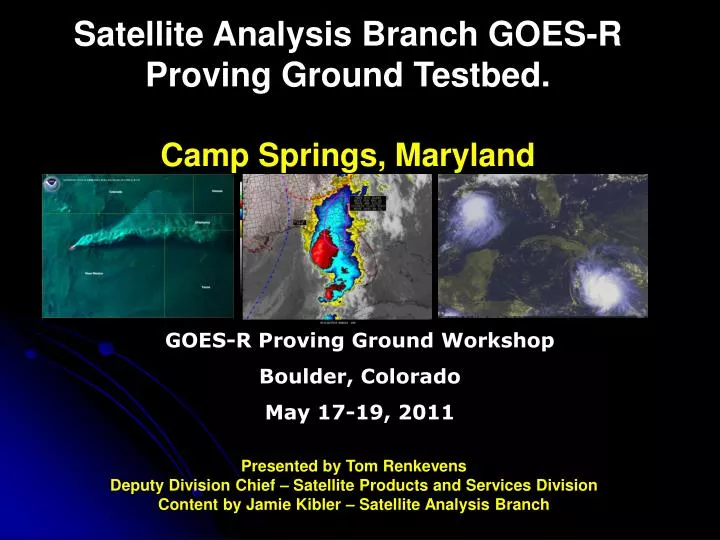
Satellite Analysis Branch GOES-R Proving Ground Testbed. Camp Springs, Maryland. Presented by Tom Renkevens Deputy Division Chief – Satellite Products and Services Division Content by Jamie Kibler – Satellite Analysis Branch. GOES-R Proving Ground Workshop Boulder, Colorado May 17-19, 2011.

E N D
Satellite Analysis Branch GOES-R Proving Ground Testbed.Camp Springs, Maryland Presented by Tom Renkevens Deputy Division Chief – Satellite Products and Services Division Content by Jamie Kibler – Satellite Analysis Branch GOES-R Proving Ground Workshop Boulder, Colorado May 17-19, 2011
Outline of the Presentation • SAB Missions Statement • SAB GOES-R Proving Ground Plan • SAB Products • The Volcanic Ash Program • The Smoke, Fire and Air Quality Program • The Precipitation Program • Conclusion and Final Thoughts
Admin Officer Linda Brown Special Projects Selina Nauman Deputy Director E/SPO Mark Moran (a) SPSD E/SPO5 Dave Benner NOAA Ice Center E/SPO4 Sharolyn Young MOD E/SPO2 Ron Mahmot Wallops CDA E/SPO2 Doug Crawford Fairbanks CDA E/SPO3 Larry Ledlow Corporate Services E/SPOx1 Keith Amburgey Director E/SPO Kathy Kelly Support (E/SPO12) Mike Settles Office of Satellite and Product Operations (OSPO) Deputy: Linda Stathoplos Deputy: Tom Renkevens Operations (E/SPO21) Al McMath Operations (E/SPO11) Joe Perez (acting) Satellite Products (E/SPO51) Ricky Irving Support (E/SPO22) Stephen Howard Satellite Analysis (E/SPO52) Davida Streett Systems Engineering (E/SPO23) Bob Clark Systems (E/SPO13) Alva Barnette Direct Services (E/SPO53) Chris O’Connors Acronyms CDA – Command and Data Acquisition MOD – Mission Operations Division SPSD – Satellite Products and Services Division Engineering (E/SPO14) Cindy Hampton IT Services (E/SPO15) Andre Hammond
Satellite Analysis Branch Mission Statement The Satellite Analysis Branch serves as the operational focal point for real-time imagery products and multi-disciplinary environmental analyses within NESDIS. The Branch's primary mission is to use cutting edge satellite analysis techniques to support disaster mitigation and warning services for U.S. Federal agencies and the international community. Environmental analyses are provided to NWS Warning & Forecast Offices, NCEP Centers, and to oceanographic and other environmental users of NESDIS satellite products. The Branch uses satellite imagery integrated with non-satellite data to analyze fire and smoke, tropical storm, volcanic ash, heavy precipitation, and oil spill, distributing products to a diverse customer base.
SAB GOES-R Proving Ground Plan and Timeline • Formalized list of what products and imagery Satellite Analysis Branch (SAB) analyst would like to see for testing and planning purposes. -Completed • Joint GOES-R proposals were written with the Ocean Prediction Center (OPC) and the Hydrometeorlogical Prediction Center (HPC) for testing and planning purposes. Separate SAB proposals were written for testing and planning purposes for unique programs. - Completed • GOES-R representative selection- Completed • GOES-R representative to ingest GOES-R simulated imagery and products in multiple formats for viewing and testing purposes.– Starting early June 2011 • GOES-R representative will provide feedback to SAB satellite analyst on requested imagery and products.- To be determined • SAB satellite analyst will do their own testing and provide feedback to GOES-R representative.– To be determined • GOES-R representative will provide feedback to researchers and management for possible improvements/changes in GOES-R simulated imagery and products– To be determined
SAB Volcanic Ash Program • The volcanic ash monitoring program at the Satellite Analysis Branch became official in 1987 although volcano monitoring began in the 1970s for the entire world. • The Washington VAAC was established in 1997. The United States, in agreement with the International Civil Aviation Organization (ICAO), has designated the National Environmental Satellite Data and Information Services (NESDIS), Satellite Analysis Branch (SAB), and the National Weather Service (NWS) National Center for Environmental Prediction (NCEP) as the regional Washington Volcanic Ash Advisory Center (VAAC). http://www.ssd.noaa.gov/VAAC/ • GOES-R Simulated Products and Imagery for Testing • Product Developer In Ops • Volcanic Ash: Detection and Height (Mike Pavalonis) - TBD • SO2 detection (Mike Pavalonis) - TBD • Low Cloud and Fog (Mike Pavalonis) - TBD
SAB Volcanic Ash Program • Washington VAAC area of responsibility includes the continental US, southward through Central America, the Caribbean, to 10S in South America and the US controlled oceanic Flight Information Region (FIR). • Washington is 1 of 9 VAACs that cover the globe. Other VAAC’s include Anchorage, Buenos Aires, Darwin, London, Montreal, Tokyo, Toulouse and the Wellington. • Monitoring volcano’s 24 hours a day 365 days a year http://www.ssd.noaa.gov/VAAC/
SAB Volcanic Ash Products • Volcanic Ash Advisory (VAA) which contains satellite information, reports of volcanic ash and a possible ash forecast. • Volcanic Ash Graphic (VAG) – A graphic depiction of ash over an 18 hour period showing extent, movement and size. Graphic is only provided when ash is seen in satellite imagery. • Hybrid Single-Particle Lagrangian Integrated Trajectory (HYSPLIT) model: We provide volcanic ash parameters and data for theHYSPLIT model showing ash dispersion over a 48 hour period. HYSPLIT runs are usually needed with multiple plumes, high ash heights or ash expected to last beyond +12 hours. http://www.ssd.noaa.gov/VAAC/
SAB Smoke, Fire and Air Quality Program In 1998 NOAA/NESDIS/SPSD/SAB began a fire and smoke analysis as smoke from Mexico began moving into the southern US and affecting health, transportation and other forms of industry. The analysis at the time was done in the format of individual sectors. In July 2002 the fire and smoke analysis began on the Hazard Mapping System (HMS) for the continental US and eventually Alaska, Hawaii, Canada and Mexico/Central America. The Hazard Mapping System • GOES-R Simulated Products and Imagery for Testing • Product Developer In Ops • Aerosol Detection (Shobha Kondraguntas) TBD • Fire and Hot Spot Characterization (Chris Schmidt) TBD • Aerosol Optical Depth (Shobha Kondraguntas) TBD • Vegetation Index (Peter Romanov) TBD
Smoke, Fire and Air Quality Products http://www.firedetect.noaa.gov/viewer.htm http://www.ssd.noaa.gov/PS/FIRE/hms.html http://www.ssd.noaa.gov/PS/FIRE/kml.html
SAB Precipitation Program 24/7/365 monitoring of precipitation with emphasis on satellite analysis, short term trends and rainfall estimates Satellite (SPENES) discussion messages 12-planet chat messages Supporting NWS WFO/RFCs Priorities satellite rainfall estimates graphical analysis • heavy rainfall / flash flooding • moderate to heavy winter precipitation • West Coast winter storms • Great Lake snows Precipitation Product available on AWIPS – SPENES is the AWIPS ID and the WMO header for the message is TXUS20 KNES http://www.ssd.noaa.gov/PS/PCPN/
excessive rainfall area • precipitation trends • satellite tropical rainfall • satellite rainfall estimates SAB Precipitation Program 24/7/365 monitoring of precipitation with emphasis on satellite analysis, short term trends and rainfall estimates Supporting NWS NCEP HPC Priorities • 0-6 hr rainfall guidance http://www.ssd.noaa.gov/PS/PCPN/
SAB Precipitation Program GOES-R Simulated Products and Imagery for Testing Product Developer In Ops • Cloud/Moisture Imagery (Tim Schmidt and Dan Lindsey) June 2011 • Derived Motion Winds (Jaime Daniels) October 2011 • RGB Air Mass (John Knaff/Mark DeMaria) August 2011 • Rainfall Rate/QPE (Bob Kuligowski) September 2011 • Derived Stability Indices (Tim Schmidt) September 2011 • Lightning Detection (Scott Rudloski) July 2011 • Convective Initiation (John Walker) July 2011 • Enhance V / Overshooting Top Detection (Kris Bedka) June 2011 • CT Phase, Height, Temperature (Andy Heidinger) September 2011 • Rainfall Potential (Bob Kuligowski) TBD • Probability of Rainfall (Bob Kuligowski) TBD • Cloud Liquid Water (Andy Heidinger and Andi Walter) TBD
GOES-R Proving Ground Workshop Final Thoughts and Concerns • We need to verify GOES-R simulated imagery and products are ready for SAB operational use before launch. • We need to Prepare our satellite analyst for future operations using GOES-R imagery • We need to gain confidence from testing and preparation that imagery and products will meet our operational standards to produce products that satisfy our customer needs • What is the general time frame for testing an individual product and/or imagery. We have heard various time periods. • Once the concern is addressed from the GOES-R representative to the researcher, what will be the process from there and will we get to retest.
GOES-R Proving Ground Workshop – Boulder Colorado Thank you! For additional information please contact Jamie.Kibler@noaa.gov