Download
1 / 45
460 likes | 595 Views
Development of a downscaling prediction system Liqiang Sun International Research Institute for Climate and Society (IRI). Definition. Downscaling – the translation of a forecast to a spatial or temporal resolution that is finer than that of the original forecast. coarse resolution.

E N D
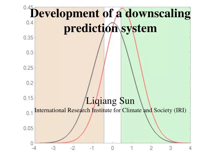
Development of a downscaling prediction system Liqiang SunInternational Research Institute for Climate and Society (IRI)
Definition • Downscaling – the translation of a forecast to a spatial or temporal resolution that is finer than that of the original forecast. coarse resolution fine resolution
Definition coarse resolution statistical model fine resolution dynamical model
GCM forecasts are area-averages, and may not represent a scale at which a forecast is to be used. A typical GCM grid is about 60,000 km2. Six million hectares is a rather large farm! A part of the world according to a GCM... red: land white: water 1 box ~ 90,000 km2
Motivation • Climate can vary dramatically over short distances, especially in the context of precipitation and wind speeds. • Small-scale affects (such as topography) important to local climate could be poorly represented in GCMs Annual mean precipitation over western North America.
Motivation • Teleconnection patterns can have detailed spatial structure, at resolutions too fine for GCMs.
Motivation • GCMs have approx. 20 min. timestep. But GCMs do not simulate sub-monthly weather phenomena well.
Climate downscaling (spatially and temporally) Enhancing the scale and relevance of seasonal climate forecasts and creating information to better support decisions
Downscaling Techniques Dynamical Downscaing - Localized climate information is generated using high resolution regional climate models (RCMs), driven by low resolution global climate models (GCMs), or using a variable resolution global model in whichthe highest resolution is over an area of interest. Statistical downscaling involves relating the large scale climate state to target variables using a transfer function (e.g., regression). predicted large scale climate observed large scale climate Transfer function (statistical model) observed small scale climate predicted small scale climate
Strengt/weakness of SD and DD (1) from: Wilby and Dawson, 2004: Using SDSM Version 3.1-A decision support tool for the assessment of regional climate change impacts.
Statistical downscaling is feasible for many particular regions, and is the appropriate baseline upon to measure the success of the much more costly dynamical approach
Development of Regional Climate Prediction System • choosing GCM forecasts that have good skill over the region of interest • Identifying a group of regional climate models for downscaling • Determining model resolution and domain size • Customization of regional climate models • Observation • Initialization • Programs to nest regional models within GCMs • Ensemble runs of retrospectiveforecast – forecast skill • Statistical post processing of model output to correct model bias • Forecast product • Forecast verification
CLIMATE DYNAMICAL DOWNSCALING FORECAST SYSTEM FOR NORDESTE • HISTORICAL DATA • Extended Simulations • Observations PERSISTED GLOBAL SST ANOMALIES ECHAM4.5 AGCM (T42) NCAR CAMS Persisted SSTA ensembles 1 Mo. lead 10 Post Processing PREDICTED SST ANOMALIES Tropical Pacific Ocean (LDEO Dynamical Model) (NCEP Dynamical Model)(NCEP Statistical CA Model) Tropical Altantic Ocean (CPTEC Statistical CCA Model) Tropical Indian Ocean (IRI Statistical CCA Model) Extratropical Oceans (Damped Persistence) Predicted SSTA ensembles 1-4 Mo. lead 24 RSM97 (60km) RAMS (40km) CPT AGCM INITIAL CONDITIONS UPDATED ENSEMBLES (10+) WITH OBSERVED SSTs IRI FUNCEME Sun et al. (2006)
Development of Regional Climate Prediction System • choosing GCM forecasts that have good skill over the region of interest • Identifying a group of regional climate models for downscaling • Determining model resolution and domain size • Customization of regional climate models • Observation • Initialization • Programs to nest regional models within GCMs • Ensemble runs of retrospectiveforecast – forecast skill • Statistical post processing of model output to correct model bias • Forecast product • Forecast verification
Development of Regional Climate Prediction System • choosing GCM forecasts that have good skill over the region of interest • Identifying a group of regional climate models for downscaling • Determining model resolution and domain size • Customization of regional climate models • Observation • Initialization • Programs to nest regional models within GCMs • Ensemble runs of retrospectiveforecast – forecast skill • Statistical post processing of model output to correct model bias • Forecast product • Forecast verification
Development of Regional Climate Prediction System • choosing GCM forecasts that have good skill over the region of interest • Identifying a group of regional climate models for downscaling • Determining model resolution and domain size • Customization of regional climate models • Observation • Initialization • Programs to nest regional models within GCMs • Ensemble runs of retrospectiveforecast – forecast skill • Statistical post processing of model output to correct model bias • Forecast product • Forecast verification
Model Resolution • The horizontal and vertical resolutions should be fine enough to capture the scales of forcings of interest (e.g., Spatial characteristics of the land surface forcing) 300KM 50KM Model Topography 10KM
Model Resolution (Cont.) 2. Availability of model dynamical and physical parameterizations. All the parameterization schemes are based on a spectral gap between the scales being parameterized and those being resolved on the grid. Therefore, all the model parameterization schemes are model resolution dependent. For example, cumulus parameterization Grid Spacing (KM) 5 20 40 ______|_______|_____________|__________ explicit ??? hybrid GCMs
20km Model Resolution (Cont.) 3. The ratio of driving data versus RCM horizontal resolution is in the range of 3-8 ( for traditional one-way nesting approach). If the downscaling grid space ratio is too large, multiple nesting is sometimes used. 80km 300km
Domain Size • The area of interest is as far as possible from the lateral buffer zone. • Model domain should encompass all regions that include forcings and circulations which directly affect climate over the area of interest. • It is preferable to place the lateral boundaries over the ocean rather than land, especially not over areas of complex topography. • It is preferable not to place the lateral boundaries over the areas with strong convection. • Internal variability usually increases with domain size • Computational Limitation
Domain Size (Cont.) Forecast area Sun et al. (2005)
Development of Regional Climate Prediction System • choosing GCM forecasts that have good skill over the region of interest • Identifying a group of regional climate models for downscaling • Determining model resolution and domain size • Customization of regional climate models • Observation • Initialization • Programs to nest regional models within GCMs • Ensemble runs of retrospectiveforecast – forecast skill • Statistical post processing of model output to correct model bias • Forecast product • Forecast verification
Physics adequacy All the model parameterization schemes are model resolution dependent because the parameterization schemes are based on a spectral gap between the scales being parameterized and those being resolved on the grid.
Development of Regional Climate Prediction System • choosing GCM forecasts that have good skill over the region of interest • Identifying a group of regional climate models for downscaling • Determining model resolution and domain size • Customization of regional climate models • Observation • Initialization • Programs to nest regional models within GCMs • Ensemble runs of retrospectiveforecast – forecast skill • Statistical post processing of model output to correct model bias • Forecast product • Forecast verification
Network of rainfall stations available for the indicated datasets and dates
Development of Regional Climate Prediction System • choosing GCM forecasts that have good skill over the region of interest • Identifying a group of regional climate models for downscaling • Determining model resolution and domain size • Customization of regional climate models • Observation • Initialization • Programs to nest regional models within GCMs • Ensemble runs of retrospectiveforecast – forecast skill • Statistical post processing of model output to correct model bias • Forecast product • Forecast verification
Horizontal and vertical interpolation errors Horizontal: the grid-point spacing and the map projections are different between the RCM and the GCM. Vertical: the grid-point spacing and the coordinates are different between the RCM and GCM. Particularly the difference between the topographic field due to the different resolutions imply that extrapolations below the surface of the driving GCM have to be performed.
Spin-up • Spin-up period is the time that model takes to achieve its climate equilibrium • Spin-up time varies depending on the domain size, season, circulation strength, and surface conditions. Atmospheric component - days Land surface component: top layer 0.1m - weeks root zone 1.0m - months deeper soil >1.0m - years Ocean component: upper ocean 500m - tens years deep ocean >500m - hundreds years
Land Initialization • An offline land model should be used to generate the land initial conditions for the regional climate model, or • use of reanalysis data for land initialization. The resolution of the reanalysis data should be the same as or similar to that of the regional climate model. The reanalysis data should be statistically corrected. 1) calculate the standard anomaly, 2) perform statistically correction 3) corrected anomaly added to the model climatology
Development of Regional Climate Prediction System • choosing GCM forecasts that have good skill over the region of interest • Identifying a group of regional climate models for downscaling • Determining model resolution and domain size • Customization of regional climate models • Observation • Initialization • Programs to nest regional models within GCMs • Ensemble runs of retrospectiveforecast – forecast skill • Statistical post processing of model output to correct model bias • Forecast product • Forecast verification
Update frequency of the driving data • This issue has to do with the temporal resolution of the dataset used to drive the nested RCM. As a rule of thumb, the updated period should be smaller than one quarter of the ratio of the length scale of the phase speed of the meteorological phenomena that we want to get correctly in the model domain. For instance, A typical synoptic system having a horizontal size of 1000 km and a phase speed of 50 km/h would require an updating frequency of at least 5 h. Diurnal variation is important for the tropics, it would require an updating frequency of at least 6 h. 2. Increasing the updating frequency will also introduce nesting noise. The nesting frequency of 3-6 h is mostly used.
Quality of the driving data This issue has basic implications in the concept of nested RCMs because even with a perfect model and perfect nesting scheme, the quality of the driving data used is very important. In case of a GCM driving an RCM, if the GCM large-scale circulation prediction is wrong, good results cannot be expected from the RCM. In other words, “garbage in” “garbage out”. Bias correction for the driving GCM data is recommended
Development of Regional Climate Prediction System • choosing GCM forecasts that have good skill over the region of interest • Identifying a group of regional climate models for downscaling • Determining model resolution and domain size • Customization of regional climate models • Observation • Initialization • Programs to nest regional models within GCMs • Ensemble runs of retrospectiveforecast – forecast skill • Statistical post processing of model output to correct model bias • Forecast product • Forecast verification
Temporal anomaly correlations between the observed and the model ensemble mean rainfall
Geographical distributions of RPSS (%) for the hindcasts averaged over the period of 1971-2000
Development of Regional Climate Prediction System • choosing GCM forecasts that have good skill over the region of interest • Identifying a group of regional climate models for downscaling • Determining model resolution and domain size • Customization of regional climate models • Observation • Initialization • Programs to nest regional models within GCMs • Ensemble runs of retrospectiveforecast – forecast skill • Statistical post processing of model output to correct model bias • Forecast product • Forecast verification
Development of Regional Climate Prediction System • choosing GCM forecasts that have good skill over the region of interest • Identifying a group of regional climate models for downscaling • Determining model resolution and domain size • Customization of regional climate models • Observation • Initialization • Programs to nest regional models within GCMs • Ensemble runs of retrospectiveforecast – forecast skill • Statistical post processing of model output to correct model bias • Forecast product • Forecast verification
Address relevant scales and quantities –climate variables that are both relevant and predictable Precipitation Temperature Extreme events Onset of rainy season Dry spell & wet spell Tropical cyclones …
Development of Regional Climate Prediction System • choosing GCM forecasts that have good skill over the region of interest • Identifying a group of regional climate models for downscaling • Determining model resolution and domain size • Customization of regional climate models • Observation • Initialization • Programs to nest regional models within GCMs • Ensemble runs of retrospectiveforecast – forecast skill • Statistical post processing of model output to correct model bias • Forecast product • Forecast verification
Real-Time Forecast Validation
Development of Regional Climate Prediction System • choosing GCM forecasts that have good skill over the region of interest • Identifying a group of regional climate models for downscaling • Determining model resolution and domain size • Customization of regional climate models • Observation • Initialization • Programs to nest regional models within GCMs • Ensemble runs of retrospectiveforecast – forecast skill • Statistical post processing of model output to correct model bias • Forecast product • Forecast verification