Download
1 / 11
110 likes | 180 Views
Using Virtual Reality to Predict the Spread of Wildfires. Internship Project Innovation for Construction and Engineering Enhancement By: Ronnie Murray 12-3-04 Senior Project 1 ENT496 Information Technology. ICEE Internship. Innovation for Construction and Engineering Enhancement

E N D
Using Virtual Reality to Predict the Spread of Wildfires Internship Project Innovation for Construction and Engineering Enhancement By: Ronnie Murray 12-3-04 Senior Project 1 ENT496 Information Technology
ICEE Internship • Innovation for Construction and Engineering Enhancement • Multidisciplinary research center • Lab located at TEC 231 • 10 workstations • 4 web servers • printer • scanner
Wildfire Destruction Year Fires Acres Year Fires Acres 2003 85,943 4,918,088 1981 249,370 4,814,206 2002 88,458 6,937,584 1980 234,892 5,260,825 2001 84,079 3,555,138 1979 163,196 2,986,826 2000 122,827 8,422,237 1978 218,842 3,910,913 1999 93,702 5,661,976 1977 173,998 3,152,644 1998 81,043 2,329,709 1976 241,699 5,109,926 1997 89,517 3,672,616 1975 134,872 1,791,327 1996 115,025 6,701,390 1974 145,868 2,879,095 1995 130,019 2,315,730 1973 117,957 1,915,273 1994 114,049 4,724,014 1972 124,554 2,641,166 National Interagency Fire Center http://www.nifc.gov/stats/wildlandfirestats.html
Federal Dollars Federal agencies: • Bureau of Land Management • Bureau of Indian Affairs • Fish and Wildlife Service • National Park Service • USDA Forest Service Past 10 years = $8,240,092,600 dollars spent.
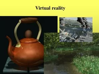
Wildfire Prediction Software • Web-based Distributed Virtual Reality • available online • X3D - International Standard web 3D • new version of VRML Data Input = Data Output + Virtual Model
Wildfire Prediction Fire Simulator developed by Rick Groleau using Rothermel’s models for the prediction of wildfires. The models use factors such as: • fuel density • slope • moisture • atmospheric • humidity • wind speed and direction
Wildfire Prediction Software Output Data Output: rate and direction of spread, intensity, and flame length. Virtual Reality Output: 3D models of the forest and fire spread.
Software Used • AutoDesk VIZ 2005 • Vizx3D by Virtock Technologies Inc. • Plug-ins • Cortona VRML 2.0 Client • Blaxxun Contact 5.1
References Rothermel, R.C. 1983. How to predict the spread and intensity of forest and range fires. USDA Forest Services General Technical Report, GTR INT-143. Ogden, UT: International Forest and Range Experiment Station. Clark, B., Miller, M. (2001) Fire Effects Guide (rep. No NEFS 2394) National Wildfire Coordinating Group. www.blaxxun.com www.3dplants.com www.help3d.com Wildland Fire Statistics, November 18, 2004.http://www.nifc.gov/stats/wildlandfirestats.html www.parallelgraphics.com www.x3dshop.com/techsupport/reference