Download
1 / 32
320 likes | 469 Views
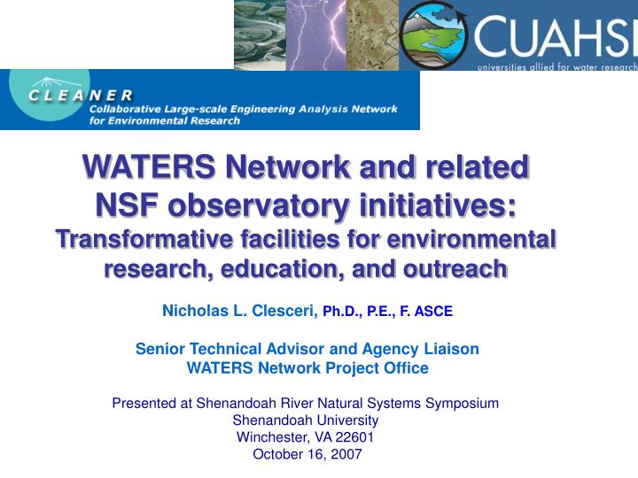
HydroView. WATERS Network and related NSF observatory initiatives: Transformative facilities for environmental research, education, and outreach. Nicholas L. Clesceri, Ph.D., P.E., F. ASCE Senior Technical Advisor and Agency Liaison WATERS Network Project Office

E N D
HydroView WATERS Network andrelated NSF observatory initiatives:Transformative facilities for environmental research, education, and outreach Nicholas L. Clesceri, Ph.D., P.E., F. ASCE Senior Technical Advisor and Agency Liaison WATERS Network Project Office Presented at Shenandoah River Natural Systems Symposium Shenandoah University Winchester, VA 22601 October 16, 2007
Organized by the Shenandoah Valley Science Collaborative Sponsors: U.S. Geological Survey Foundation for Earth Science Great Valley Water Science Forum Shenandoah Valley Regional Water Resources Policy Committee SHENAIR Local Government Committee
Environmental Observatories: a new approach for integrated, field-oriented collaborative research at regional to continental scales Rely on advances in: sensors and sensor networks at intensively instrumented sites shared by the research community cyberinfrastructure with high bandwidth to connect the sites, data repositories, and researchers into collaboratories distributed modeling platforms
The Promise: NSF Blue-Ribbon Panel on Cyberinfrastructure (2003): “a new age has dawned in scientific and engineering research pushed by continuing progress in computing, information, and communication technology, and pulled by the expanding complexity, scope, and scale of today’s challenges. The capacity of this technology has crossed thresholds that now make possible a comprehensive “cyberinfrastructure” on which to build new types of scientific and engineering knowledge environments and organizations to pursue research in new ways and with increased efficiency.”
CLEANER (ENG) + Hydrologic Observatories (GEO) = WATERS Network
The Need…and Why Now? Nothing is more fundamental to life than water. Not only is water a basic need, but adequate safe water underpins the nation’s health, economy, security, and ecology. NRC (2004) Confronting the nation’s water problems: the role of research. ●Water use globally will triple in the next two decades, leading to increases in erosion, pollution, dewatering, and salinization. ● Major U.S. aquifers (e.g., the Ogallala) are being mined and the resource consumed. ● Only ~55% of the nation’s river and stream miles and acres of lakes and estuaries fully meet their intended uses; ~45% are polluted, mostly from diffuse-source runoff. ● From 1990 through 1997, floods caused more than $34 billion in damages in the U.S. ● Of 45,000 U.S. wells tested for pesticides, 5,500 had harmful levels of at least one. ● Fish consumption advisories are common in 30 states because of elevated mercury levels. FY 2008 Administration R&D Budget Priorities: U.S. and global supplies of fresh water continue to be critical to human health and economic prosperity. Agencies are developing a coordinated, multi-year plan to improve understanding of the processes that control water availability and quality, and collect the data needed to ensure an adequate water supply for the future. Agencies should participate in this plan and its implementation.
Four critical deficiencies in current abilities: 1. Basic data about water-related processes at the needed spatial and temporal resolution. 2. The means to integrate data from different media and sources (observations, experiments, simulations). 3. Sufficiently accurate modeling and decision-support tools to predict underlying processes and forecast effects of different engineering management strategies. 4. The understanding of fundamental processes needed to transfer knowledge and predictions across spatial and temporal scales—from the scale of measurements to the scale of a desired management action. Courtesy of Tom Harmon
The Idea The WATERS Network will: 1. Consist of: (a) a national network of interacting field sites; across a range of spatial scales, climate and land-use/cover conditions (b) teams of investigators studying human-stressed landscapes, with an emphasis on water problems; (c) specialized supportpersonnel, facilities, and technology; and (d) integrative cyberinfrastructure to provide a shared-use network as the framework for collaborative analysis 2. Transform environmental engineering and hydrologic science research and education 3. Enable more effective management of water resources in human-dominated environments based on observation, experimentation, modeling, engineering analysis, and design
WATERS Network: MISSION STATEMENT First, to transform our understanding of the Earth’s water and related biogeochemical cycles across spatial and temporal scales to enable forecasting of critical water-related processes that affect and are affected by human activities. Second, to develop scientific and engineering tools that will enable more effective management approaches for water resources in large-scale human-stressed environments.
WATERS Network Grand Challenges • How do we better detect, predict, and manage the effects of human activities and natural perturbations on the quantity, distribution and quality of water in near-real time? • What natural and human factors control the patterns and variability of water cycle processes at scales from local to continental? • Is there a universal theory of Continental Water Dynamics that accounts for patterns and variability, and their evolution over time? From USGS
Network Design Principles: • Enable multi-scale, dynamic predictive modeling for water, sediment, • and water quality (flux, flow paths, rates), including: • Near-real-time assimilation of data • Feedback for observatory design • Point- to national-scale prediction • Network provides data sets and framework to test: • Sufficiency of the data • Alternative model conceptualizations • Master Design Variables: • Scale • Climate (arid vs humid) • Coastal vs inland • Land use, land cover, population • density • Energy and materials/industry • Land form and geology Nested Observatories over Range of Scales: Point (individual sensor sites) Plot (100 m2) Sub-catchment (2 km2) Catchment (10 km2) – single land use Watershed (100–10,000 km2) – mixed use Basin (10,000–100,000 km2) Continental
Vision: WATERS Network Informatics Observatories/ Environmental Field Facilities Sensors and Measurement Facility Modeling and Synthesis
ADVANCES IN SENSORS ARE OCCURRING AT BREATH-TAKING RATES Microcytometry using FlowCam Microbial Genosensor (D. Fries, USF) FlowCAM Images of Zebra mussel veligers Nierzwicki-Bauer, RPI • Depth profiler using computer- controlled, programmable winch sonde package includes • Conductivity • Temperature • Turbidity • DO • pH/ORP • Chlorophyll-a • Internal battery • Data transmitted via cellular modem Solar AUV (SAUV II) Autonomous Undersea Systems Institute (AUSI) Falmouth Scientific Inc. Art Sanderson, RPI Sontek-YSI
WATERS Network cyberinfrastructure Potential Environmental-Hydrological Observatory
WATERS Network CI Planning • CLEANER Cyberinfrastructure Committee is creating a CI program plan with CUAHSI • Two major projects are creating CI prototypes for WATERS (with more to come): • CUAHSI Hydrologic Information System (HIS) project (David Maidment, PI) • NCSA Environmental CI Demonstration (ECID) project (Barbara Minsker and Jim Myers co-leads) • Have jointly proposed a draft common environmental CI architecture • Are demonstrating how observatories can enable adaptive forecasting and management
Environmental CI Architecture: Research Services Integrated CI ECID Project Focus: Cyberenvironments Supporting Technology Data Services Workflows & Model Services Knowledge Services Meta-Workflows Collaboration Services Digital Library HIS Project Focus Analyze Data &/or Assimilate into Model(s) Link &/or Run Analyses &/or Model(s) Create Hypo-thesis Obtain Data Discuss Results Publish Research Process
Environmental CI Architecture: Research Services Integrated CI Supporting Technology Data Services Workflows & Model Services Knowledge Services Meta-Workflows Collaboration Services Digital Library Analyze Data &/or Assimilate into Model(s) Link &/or Run Analyses &/or Model(s) Create Hypo-thesis Obtain Data Discuss Results Publish Research Process
CUAHSI Hydrologic Data Access System http://river.sdsc.edu/HDAS NCDC NASA EPA NWS Observatory Data USGS A common data window for accessing, viewing and downloading hydrologic information
Data Sources NASA STORET Ameriflux Unidata NCDC Extract NCAR NWIS Transform CUAHSI Web Services Excel Visual Basic ArcGIS C/C++ Load Matlab Fortran Access Java Applications http://www.cuahsi.org/his/ Some operational services
Environmental CI Architecture: Research Services Integrated CI Supporting Technology Data Services Workflows & Model Services Knowledge Services Meta-Workflows Collaboration Services Digital Library Analyze Data &/or Assimilate into Model(s) Link &/or Run Analyses &/or Model(s) Create Hypo-thesis Obtain Data Discuss Results Publish Research Process
Meta-Workflow Using CyberIntegrator: • Observatory efforts will involve: • Studying complex systems that require coupling analyses or models of different system components • Real-time, automated updating of analyses and modeling that require diverse tools • CyberIntegrator is a prototype technology to support modeling and analysis of complex systems • Some key features of CyberIntegrator: Integration of heterogeneous tools: GeoLearn, D2K, Kepler/Ptolemy, Excel, Im2Learn, ArcGIS, D2KWS Provenance information gathering: records user’s activities, from data to models to visualization to publication to provide easily reproducible history and make recommendations of next steps to users
History of Recent Planning • CLEANER Project Office established in August 2005 • (Barbara Minsker, UIUC, PI. Six committees (~10-15 members each) have prepared draft reports on: • Science challenges and issues • Cyberinfrastructure needs • Sensors and sensor networks • Organization (consortium possibilities) • Role of social sciences in EOs • Educational plans • A report on modeling needs has also been completed. • See www.watersnet.org
Project Office Responsibilities 1. Community consensus building (a) Identify and engage environmental engineering/hydrologic science communities in consensus-building activities, including development of the science plan (b) Develop strategy to incorporate socio-economic considerations and researchers from that community into WATERS Network (c) Organize community consortium/management entity (d) Work with NSF to involve other relevant government agencies and private sector organizations as WATERS Network partners 2. Develop consensusWATERS Networkconceptual design, including cyberinfrastructure, modeling strategies, and field sites/facilities 3. Develop preliminaryprogram plan, including organizational structure, governance, and operating plans
Recent Progress 1. National Research Council issued (Phase I) report “CLEANER and NSF’s Environmental Observatories” supporting the concept of WATERS Network, and providing advice on science questions and implementation issues (May 2006). Phase II full-scale committee study is underway.
Recent Progress, cont. 2. Tangible progress is being made on the development of cyberinfrastructure needs for WATERS Network: ● Three of the five new CEO:P projects focus on cyberinfra- structure for water resources research (June 2006). ● Hydrologic Information System now has capabilities to extract and merge water data from various databases. ● A prototype “cyberintegrator” is under development to provide a meta-work-flow system to streamline analysis of data from diverse sources and link various models and analysis tools.
Recent Progress, cont. 3. EET and HS jointly are funding 11 “test-bed” projects to gain field experience with EO development and operation. Bales UC-Merced Observatory Design in the Mountain West: Scaling Measurements and Modeling in the San Joaquin Valley and Sierra Nevada Duffy Penn State A Synthesis of Community Data and Modeling for Advancing River Basin Science: the Evolving Susquehanna River Basin Experiment Graham U Fla Design and Demonstration of a Distributed Sensor Array for Predicting Water Flow and Nitrate Flux in the Santa Fe Basin Hondzo U Minn Wireless Technologies and Embedded Networked Sensing: Application to Integrated Urban Water Quality Management Just U Iowa Clear Creek Environmental Hydrologic Observatory: from Vision toward Reality Minsker U Illinois An Environmental Information System for Hypoxia in Corpus Christi Bay: A WATERS Network Test-bed Moore U Montana Linking Time and Space of Snowpack Runoff: Crown of the Continent Hydrologic Observatory Paerl UNC FerryMon, Unattended Water Quality Monitoring Utilizing Advanced Environmental Sensing Piasecki Drexel Demonstration and Development of a Test-Bed Digital Observatory for the Susquehanna River Basin and Chesapeake Bay Stevens Utah State Tools for Environmental Observatory Design and Implementation: Sensor Networks, Dynamic Bayesian Nutrient Flux Modeling, and Cyberinfrastructure Advancement Welty UMBC Quantifying Urban Groundwater in Environmental Field Observatories: a Missing Link in Understanding How the Built Environment Affects the Hydrologic Cycle
NSF is planning a phase -2 test bed competition in FY 08/09
The WATERS Network Plan can assist in developing a “Shenandoah Valley Water Resources Science Plan” to provide decision-makers with the ability to better see how policy actions affect future watershed conditions.