Download
1 / 20
200 likes | 315 Views
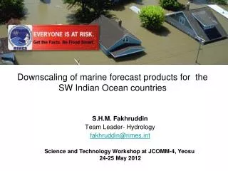
Downscaling of marine forecast products for the SW Indian Ocean countries. S.H.M. Fakhruddin Team Leader- Hydrology fakhruddin@rimes.int. Science and Technology Workshop at JCOMM-4, Yeosu 24-25 May 2012. Discussion Topics. About RIMES User Need Assessment Marine Forecasts

E N D
Downscaling of marine forecast products for the SW Indian Ocean countries • S.H.M. Fakhruddin • Team Leader- Hydrology • fakhruddin@rimes.int Science and Technology Workshop at JCOMM-4, Yeosu 24-25 May 2012
Discussion Topics • About RIMES • User Need Assessment Marine Forecasts • An Integrated System
Purpose and objectives • Purpose: Provide early warning services for enhanced preparedness, response, and mitigation of natural hazards, according to differing needs and demands of its Member States • Objectives: • Facilitate establishment and maintenance of core regional observation and monitoring networks and ensure data availability for early warning • Provide regional tsunami watch within the framework of UNESCO Intergovernmental Oceanographic Commission (IOC) • Support National Meteorological and Hydrological services for providing localized hydro-meteorological risk information within the framework of the World Meteorological Organization (WMO) • Enhance warning response capacities at all levels (national to community) within each national early warning framework
Governance • Council • Heads of NMHSs/ national scientific and technical agencies generating multi-hazard early warning information, empowered to make policy decisions, on behalf of governments, concerning regional early warning arrangements for enhanced preparedness for, response to, and mitigation of natural hazards • Chair: Government of India • Secretariat • Carries out the decisions and tasks assigned by the Council, and provides support to the Program Unit in managing the regional early warning center • Government of Maldives (Presidential Task Force led by the H.E. Vice President of Maldives) serves as Administrative Secretariat;Government of Mongolia (Ministry of Foreign Affairs) as Program Secretariat • Program Unit • Responsible for the day-to-day operation and management of the regional early warning center and the implementation of programs and activities • Co-located with the RIMES regional early warning Center
Council Secretariat Director, Program Unit Support to Hydro-Met Services Tsunami Watch Provision Societal Applications Program Management Chief Scientist Tsunami Early Warning Team Leader Climate Risk Management Chief Program Management Chief Scientist Climate Change Seismologist ICKM Specialist Climate Impact Assessment Team Chief Scientist Seasonal Forecasting Finance Officer Oceanographer Climate Forecast Application Team Chief Scientist Severe Weather Human Resource and Administration Officer Seconded Scientists (6) Project Teams Synoptician Telecommunications Specialist Hydrologist Team Leader Early Warning System Analysts (2) Seconded Scientists (2) Earthquake Hazard and Risk Assessment Expert Warning Coordination Scientist System Analyst Tsunami Hazard and Risk Assessment Expert Decision-support Tool Development Specialist GIS and Survey Specialist Capacity Building Specialist Project Teams Organizational Chart
Indian Ocean Forecast System • Oceanographic parameter forecasts are generated by a suite of state-of-the art numerical models, which are customized to simulate and predict the Indian Ocean features. • Important models: Wave Watch III, Mike, WAM, and Regional Ocean Modeling System (ROMS). (NCMRWF, ECMWF, and NCEP), etc
Forecasts Parameter • Wave and swell (height, direction, and period) • Sea surface current • Sea surface temperature • Mixed Layer Depth • Depth of the 20 degree isotherm (as a measure of thermocline) • Wind speed • Tide prediction
Spatial and temporal services • Location-specific forecast (3 days - 3 hourly interval) • Coastal forecast (7 days - 3 hourly interval) • Regional forecast (7 days - 3 hourly interval) • Indian Ocean forecast (5 days - 6 hourly interval) • Global forecast (5 days - 6 hourly interval)
User Needs Southwest Indian Ocean countries have identified the need for • user-relevant marine forecast information to meet the continued and expanding requirements of the maritime user community to ensure safety of life and property at sea • support integrated coastal management, and • reduce societal impacts of marine-associated hazards
System Development • developing the system to support the regional and national marine forecast information to the SW Indian Ocean countries by down-scaling the INCOIS marine forecast products • Develop web-base interface for disseminate the operational marine forecast products in customized form
Downscaling Regional Products • nesting grid concept with the coarse resolution in the open ocean and finer resolution to the target areas can be applied. • The system outputs are included wave height and direction, sea surface current, sea surface temperature, mixed layer depth and depth of 20 degree isotherm. These regional forecast products can be utilized for dynamic downscaling to practical scale of the SW Indian Ocean countries.
Graphical grid presenting the forecast parameters e.g. wave and swell, wind, sea surface temperature Marine forecast charts to present the downscaling wave and swell forecast for Island level (Credit: http://www.incois.gov.in/Incois/indofos_islands.jsp)
Time series plot of the forecast parameters Wave and swell at offshore forecasted points (Credit: http://www.wrh.noaa.gov/pqr/quicklook_marine.php) Web-base interactive interface for presenting marine forecast products in the regional and national scale (Credit: http://www.marine.tmd.go.th/wam.html
Advisory statement for the specific areas advised by countries
Downloadable reports on marine forecast summary and email sending system