Download
1 / 23
230 likes | 329 Views
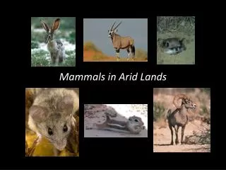
Using Satellite Imagery to detect changes in Vegetation in Arid Environments. Kelley Keese GIS in Water Resources. Land Use. Elevation. Southern Nevada Mojave Desert 130 km NW Las Vegas 22 km x 28 km. Vegetation Production Data. 87% Shrubland 2.5% Grassland 10% Bare 0.5% other.

E N D
Using Satellite Imagery to detect changes in Vegetation in Arid Environments Kelley Keese GIS in Water Resources
Land Use Elevation • Southern Nevada • Mojave Desert • 130 km NW Las Vegas • 22 km x 28 km Vegetation Production Data 87% Shrubland 2.5% Grassland 10% Bare 0.5% other (Ron Green, pers com) Study Site Nevada
AVHRRAdvanced Very High Resolution Radiometer • Provides 4 – 6 band multipectral data • NOAA polar-orbiting satellite series • Data from the University of Arizona • Bi weekly composites of maximum NDVI; 1989 - 2003 • Tiff format : data presented 0 – 255 bit scale • ftp://aria.arizona.edu/pub/usndvi_vc/GeoTIFFS/
Normalized Difference Vegetation Index from AVHRR (C 2 – C 3) / (C 2 + C 3) Channel 1 - chlorophyll causes considerable absorption Channel 2 - spongy mesophyll leaf structure leads to considerable reflectance (Tucker1979, Jackson et al.1983, Tucker et al. 1991).
Methods • Crop the data • Convert to NDVI scale of –1 to 1 • Compute an average for months of Feb-July • Compute the “departure from average” • Generate tables of NDVI values to compute the aerial average for each month • Did this 90 times!!!! … and generated tables for 6 years • More Raster calculations to compute the average for each month • 36 more Raster calculations to compute the DA (monthly – mean)
Departure from Average February 1995 Avg = 0.160
Departure from Average March 1995 Avg = 0.193
Departure from Average April 1995 Avg = 0.203
Departure from Average May 1995 Avg = 0.216
Departure from Average June 1995 Avg = 0.211
Departure from Average July 1995 Avg = 0.189
Departure from Average February 1998 Avg = 0.190
Departure from Average March 1998 Avg = 0.210
Departure from Average April 1998 Avg = 0.200
Departure from Average May 1998 Avg = 0.280
Departure from Average June 1998 Avg = 0.235
Departure from Average July 1998 Avg = 0.248
Conclusions Study shows that vegetation in desert systems is very responsive to water availability 1 km resolution satellite data does indeed detect changes in vegetation in arid environments Implications:
Implications Water Resources Evapotranspiration (ET) plays a critical role in controlling groundwater recharge Understanding response of vegetation to climate forcing should help us better determine system response to climate change Need to understand climate/vegetation dynamics to estimate potential impact of land use change on water resources (e.g. brush control) Contaminant Transport and Remediation Phytoremediation: use of plants to clean up toxic waste sites Some engineered barrier designs for waste containment depend primarily on ET to minimize water movement into underlying waste