Download
1 / 17
170 likes | 172 Views
This guide provides valuable information and tools for conducting a comprehensive assessment of a watershed, including gathering background records, conducting visual assessments, and using GIS data.

E N D
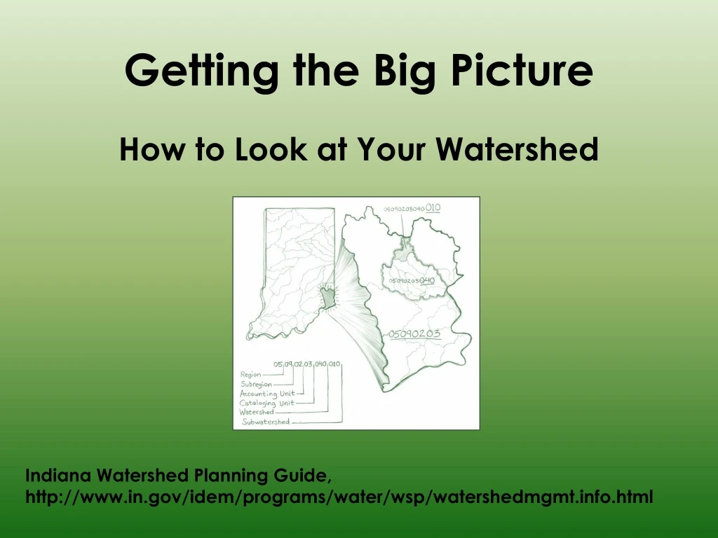
Getting the Big Picture How to Look at Your Watershed Indiana Watershed Planning Guide, http://www.in.gov/idem/programs/water/wsp/watershedmgmt.info.html
Before You Monitor Water Quality • A onetime background investigation of the waterbodies and watershed • Town and county records • Maps • Photos • Existing studies and reports • Industrial discharge records • Oral histories • Talk to residents and stakeholders www.gobroomecounty.com USGS Watershed Inventory Workbook for Indiana, https://engineering.purdue.edu/SafeWater/watershed/inventoryf.pdf
Before You Monitor Water Quality • A visual assessment of the waterbodies and watershed • Walk along the stream • Drive through the watershed • Note key features and document findings with photos, text, maps libizblog.files.wordpress.com
Initial Watershed Survey Uses • Screening for pollution problems • Identifying potential sources of pollution • Identifying sites for monitoring
Watershed Location and Boundaries • Define geographic scope and hydrology of watershed • USGS map of hydrologic units • USGS topographic maps • Storm drain “maps” from local or municipal government offices • Stream headwaters, length, and flow path • Inflows and outflows for lakes and wetlands Watershed Inventory Workbook for Indiana
Physical Features of Watershed • Soils • Floodplains & floodways • Topography of the watershed • Geology • Karst (sinkhole) areas
Land Use and Land Cover • Current land use • Potential land use (zoned) • Impervious area
GIS Atlas for Indiana • http://igs.indiana.edu/arcims/index.cfm • Many data layers • Reference (county boundaries, contours, etc.) • Infrastructure (roads, dams, etc.) • Agriculture and Land Cover (land cover, crops, soil associations, impervious surfaces, etc.) • Environment (CAFOs, NPDES, etc.) • Hydrography (waterbodies, floodplains) • Watersheds and Water Quality (boundaries, impairments, data) • Geology
Track Land Cover Changes 2001 1992
Investigate Land Use in Floodplain 2001 Floodplain 2002 Impaired Stream 2003
Web Soil Survey • (http://websoilsurvey.nrcs.usda.gov/) • Access to soil and related information needed to make land use and management decisions • Provides all the information available in a County Soil Survey (i.e., SSURGO soil data, the aerial photo backdrop, plus all tables) • Convenient because it will aggregate and analyze the information for exactly the area you need
Visual Assessment of Watershed • Residential and Urban Areas • Locate subdivisions, and observe which subdivisions have detention ponds • Map sewered and non-sewered residential areas • Observe sediment from construction areas • Locate large impervious areas, and observe runoff management from impervious areas • Locate large turfed areas; observe management • Locate bridges and evaluate roads Watershed Inventory Workbook for Indiana
Visual Assessment of Watershed • Locate wastewater treatment plants, industries, and other types of regulated facilities • Characterize farming activities • Use and storage of pesticides, fertilizers, and animal waste • Locate potential erosion areas • Characterize forest land • Public versus private • Logging activities
Visual Assessment of Watershed • Locate mining areas and potentially impacted water resources • Observe current condition of streams, lakes, and wetlands, and how adjacent land uses may be affecting them • Identify social, economic, and historic features of watershed that are important to building a solid watershed management plan USGS
Developing the Monitoring Plan • Summarize findings from the initial survey • Identify information gaps • Identify potential water quality problem areas that should be sampled • Identify potential major pollutant sources that should be assessed via water quality sampling