Download
1 / 33
330 likes | 416 Views
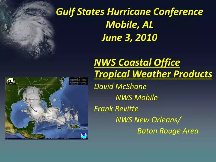
Gulf States Hurricane Conference Mobile, AL June 3, 2010. NWS Coastal Office Tropical Weather Products David McShane NWS Mobile Frank Revitte NWS New Orleans/ Baton Rouge Area . Topics. Changes to National Hurricane Center Products for 2010

E N D
Gulf States Hurricane Conference Mobile, ALJune 3, 2010 NWS Coastal Office Tropical Weather Products David McShane NWS Mobile Frank Revitte NWS New Orleans/ Baton Rouge Area
Topics • Changes to National Hurricane Center Products for 2010 • Local National Weather Service Tropical Storm/Hurricane Products and Services for Coastal Area • Discussion
Changes to Tropical Cyclone Watch/Warning Lead Times in 2010 Lead time virtually unchanged while skill in track forecasting has improved NHC in fact frequently does issue watches and warnings at longer lead time than Directive indicates Key evacuation decisions now need to be made before 24 h and in some cases before 48 h Some jurisdictions, businesses, and schools still tag closure decisions to warning or watch Coastal County Population, Texas to Maine 53% of the U.S. population now lives within 50 miles of the coast Population Year
Tropical Storm Watches and Warnings Tropical Storm Watchtropical storm conditions (sustained winds of 39 to 73 mph) are possible within the specified coastal area within 48 hours Tropical Storm Warning tropical storm conditions (sustained winds of 39 to 73 mph) are expected somewhere within the specified coastal area within 36 hours
Hurricane Watches and Warnings Hurricane Watchhurricane conditions (sustained winds of 74 mph or higher) are possible within the specified coastal area. Because hurricane preparedness activities become difficult once winds reach tropical storm force, the hurricane watch is issued 48 hours in advance of the anticipated onset of tropical-storm-force winds Hurricane Warning hurricane conditions (sustained winds of 74 mph or higher) are expected somewhere within the specified coastal area. Because hurricane preparedness activities become difficult once winds reach tropical storm force, the hurricane warning is issued 36 hours in advance of the anticipated onset of tropical-storm-force winds
In some cases, we were already doing it… Tropical storm force winds begin affecting Texas coast about 48 hrs later Hurricane Watch issued for Texas coast at 4PM CDT on Wed Sep. 10
Saffir-Simpson Hurricane Wind Scale Surge, rainfall, and pressure fit the scale like a square peg in a round hole KATRINA (3) IKE (2) CHARLEY (4) http://www.nhc.noaa.gov/aboutsshs.shtml
NHC Forecast Cone • Represents the probable track of the center of the tropical cyclone. • Formed by connecting circles centered on each forecast point (at 12, 24, 36 h, etc.) • Size of the circles determined so that, say, the actual storm position at 48 h will be within the 48-h circle 67% of the time.
New Public Advisory Format Section headers added Storm information first Changes to watches and warnings in the current advisory are highlighted Bulleted summary of all watches and warnings in effect
New Public Advisory Format Section headers Discussion of forecast motion and intensity and other pertinent information Storm hazards and impacts, shown by type
Gustav Damage AP Photos Coastal Hurricane Hazards and NWS Weather Forecast Office Products Fatality from falling tree Lafayette, LA Water overtops Industrial Canal New Orleans, LA
NWS – Weather Forecast Office Tropical Weather Products WFO has traditionally issued text products to complement NHC products and give additional detailed information for the local area Often lengthy and difficult to sort through the information. Specific Tropical Weather Products Hurricane Local Action Statement Inland Hurricane/Tropical Storm Watches and Warnings Extreme Wind Warning Extreme winds associated with Category 3, 4 or 5 Hurricanes Traditional NWS text products are also issued during tropical events Tornado Watches, Tornado Warnings, Flash Flood Warnings, etc.
HURRICANE KATRINA LOCAL STATEMENT NATIONAL WEATHER SERVICE NEW ORLEANS LA 1015 AM CDT SUN AUG 28 2005 ...HURRICANE KATRINA NOW A CATEGORY 5 HURRICANE PACKING SUSTAINEDWINDS OF 175 MPH... ...DIRECT STRIKE OF POTENTIALLY CATASTROPHIC AND LIFE THREATENING HURRICANE EXPECTED... ...RUSH PROTECTIVE MEASURES TO COMPLETION AND LEAVE THE AREA NOW!... ...MORE HEADLINES..... ...AREAS AFFECTED... IN SOUTHEAST LOUISIANA...THE FOLLOWING PARISHES ASSUMPTION...ST JAMES...MORE PARISHES... IN COASTAL MISSISSIPPI...THE FOLLOWING COUNTIES HANCOCK...HARRISON...JACKSON ...WATCHES AND WARNINGS... A HURRICANE WARNING IS IN EFFECT FROM EAST OF MORGAN CITY EAST TO THE ALABAMA-FLORIDA BORDER AREA. THIS INCLUDES THE METRO NEW ORLEANS AREA...AND THE MISSISSIPPI COAST. ...STORM INFORMATION... AT 10 AM CDT...THE CENTER OF HURRICANE KATRINA WAS LOCATED NEAR LATITUDE 26.0 NORTH...LONGITUDE 88.1 WEST OR ABOUT 225 MILES SOUTHEAST OF THE MOUTH OF THE MISSISSIPPI RIVER. MAXIMUM SUSTAINED WINDS ARE NEAR 175 MPH...WITH HIGHER GUSTS. HURRICANE KATRINA IS A CATEGORY FIVE HURRICANE ON THE SAFFIR SIMPSON SCALE. MORE INFORMATION. ...PRECAUTIONARY/PREPAREDNESS ACTIONS... PROTECT YOU AND YOUR FAMILYS LIVES. FOLLOW LOCAL EMERGENCY MANAGERS RECOMMENDATIONS AND LEAVE HURRICANE WARNING AREA NOW BEFORE WEATHER CONDITIONS WORSEN. MORE INFORMATION. MANDATORY EVACUATION ORDERS ARE IN EFFECT FOR MOST SOUTHEAST LOUISIANA PARISHES AND COASTAL MISSISSIPPI COUNTIES. RESIDENTS SHOULD FOLLOW EVACUATION RECOMMENDATIONS FROM LOCAL PARISH OFFICIALS. ...STORM SURGE FLOOD AND STORM TIDE IMPACTS... KATRINA IS EXPECTED TO MAKE LANDFALL ALONG THE NORTHERN GULF OF MEXICO COAST AS A CATASTROPHIC LIFE THREATENING HURRICANE. WHILE EXACT LOCATION LANDFALL IS UNCERTAIN AT THIS TIME...SIGNIFICANT AND LIFE THREATENING STORM SURGE 18 TO 22 FEET ABOVE NORMAL IS POSSIBLE NEAR AND TO THE RIGHT OF THE LANDFALL AREA. MORE INFORMATION.... ...WIND IMPACTS... EAST TO NORTHEAST WIND OF 20 TO 25 MPH SHOULD CONTINUE OVER THE REGION TODAY...THEN INCREASE LATE THIS AFTERNOON AND CONTINUING TONIGHT. TROPICAL STORM FORCE WINDS ARE LIKELY TO OVERSPREAD THE COASTAL AREAS THIS EVENING MORE INFORMATION. KATRINA IS FORECAST TO MOVE ASHORE AS CATEGORY FIVE HURRICANE... SIMILAR IN STRENGTH TO HURRICANE CAMILLE IN 1969. MORE INFORMATION... ...RAINFALL... RAINFALL TOTALS OF 8 TO 10 INCHES...MORE INFORMATION.... ...NEXT UPDATE... THE NEXT LOCAL STATEMENT WILL BE ISSUED AROUND 130 PM CDT. $$
Extreme Wind Warning -Example BULLETIN - EAS ACTIVATION REQUESTED EXTREME WIND WARNING NATIONAL WEATHER SERVICE NEW ORLEANS-BATON ROUGE LA 943 AM CDT MON SEP 15 2008 THE NATIONAL WEATHER SERVICE HAS ISSUED An * EXTREME WIND WARNING FOR THE ONSET OF SUSTAINED WINDS OF 115 MPH OR GREATER FOR... WASHINGTON PARISH IN SOUTHEAST LOUISIANA ST. TAMMANY PARISH IN SOUTHEAST LOUISIANA PEARL RIVER COUNTY IN SOUTHERN MISSISSIPPI HANCOCK COUNTY IN SOUTHERN MISSISSIPPI * UNTIL 1130 AM CDT * AT 940 AM CDT...NATIONAL WEATHER SERVICE DOPPLER RADAR INDICATED THE LEADING EDGE OFINTENSE EYEWALL WINDS ASSOCIATED WITH VERY DANGEROUS HURRICANE ALPHA MOVING THROUGH SOUTHEAST LOUISIANA AND SOUTH MISSISSIPPI. NORTHERN PORTION OF THE INTENSE EYEWALL PRODUCING EXTENSIVE DAMAGING WINDS FROM NEAR SLIDELL TO 15 MILES EAST OF PICAYUNE ...MOVING NORTH AT 18 MPH. * EXTREME WINDS ARE EXPECTED TO AFFECT... ST TAMMANY AND WASHINGTON PARISHES IN SOUTHEAST LOUISIANA HANCOCK AND PEARL RIVER COUNTIES IN SOUTH MISSISSIPPI THE ONSET OF DESTRUCTIVE WINDS WITH GUSTS OF 100 TO 120 MPH CAN BE EXPECTED SHORTLY. THESE DESTRUCTIVE WINDS WILL PRODUCE WIND DAMAGE SIMILAR TO A TORNADO OVER LARGE AREAS. SEEK SHELTER ON THE LOWEST FLOOR OF THE BUILDING IN AN INTERIOR HALLWAY OR ROOM SUCH AS A CLOSET. STAY AWAY FROM WINDOWS AND REMAIN IN YOUR SAFE SHELTER UNTIL THE EYEWALL PASSES. LAT...LON 3042 8935 3045 8958 3034 8975 3023 8984 • Event driven product • Sustained winds of 115 mph or greater (Cat 3,4,or 5) • Duration- 2 hr or less • Several parishes/counties • Wording similar to a tornado warning.
Graphical Hurricane Local Statement • Graphics depicting hazard is automatically generated on NWS Office work station sent to web site. • Pre-set risk levels – low, medium high TS Ida – Storm Surge Hazard
Webinars, and Conference Calls • Positive Step Forward – • Ability to display graphics depicting hazards and • Interact, explain and clarify critical information with emergency managers and decision makers.
Challenges • Tropical Cyclone Forecasts Have Errors – location, intensity, etc • Risk Associated with those errors may range from minor to catastrophic and life threatening. • How do we effectively communicate hazard and risk to aid decision process?
NHC Forecast Cone Represents the probable track of the center of the tropical cyclone. Formed by connecting circles centered on each forecast point (at 12, 24, 36 h, etc.) Size of the circles determined so that, say, the actual storm position at 48 h will be within the 48-h circle 67% of the time.
3- and 5-Day Error Cones slight reduction in size due to lower track errors
Remember - Forecast Error Can Occur “Along” The Predicted Tack Hurricane Gustav Excellent forecast of pinpointing area of coast impacted Hurricane moved onshore earlier than suggested by the 72 hour forecast Tropical storm conditions arrived ~12 hours earlier.
Tropical Storm/Hurricane Wind Probability • Wind Probability data is available both in tabular data and graphical format. • Graphical depiction of areas with greatest wind threat.
Suppose this 48 H forecast – 115 knots – deterministic SLOSH forecast 10 feet
30 miles further west 6 feet
30 miles further east 17 feet
Gustav Surge Based on Advisory 31 – Storm surge concentrated near track over Terrebonne Parish.Radius of Max Wind 30 mi
Gustav SLOSH estimate using a larger wind field (50 nm Radius of Max Wind)
SLOSH MEOW developed to account for uncertainty in track and intensity forecasts
Storm Surge Probabilitiesbased on Gustav Advisory 28 Heights which have a 10% chance of being exceeded Probability of Storm Surge Exceeding 8 Feet
Storm Surge Probabilities “Ida” Advisory 28 Heights which have a 10% chance of being exceeded Probability of Storm Surge Exceeding 8 Feet google earth mapping- kml file
Storm Surge Probability Info Available on NHC Web Site • Initiated whenever a hurricane watch or warning is in effect (~ 36 hours before the arrival of tropical storm force winds) • Available ~20-30 minutes after advisory release
Questions / Comments • Contact Information • Frank Revitte – New Orleans/Baton Rouge Area • 985-649-0357 x223 • David McShane – Mobile • 251-633-6443 NWS Web Sites • www.weather.gov • Select area on map.