Download
1 / 24
240 likes | 370 Views
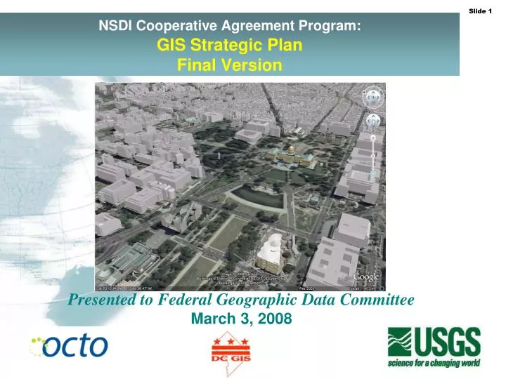
NSDI Cooperative Agreement Program: GIS Strategic Plan Final Version. Presented to Federal Geographic Data Committee March 3, 2008. The DC GIS Strategic Plan Final Version. Presented by: Barney Krucoff Many Slides and Template by:. National Context.

E N D
NSDI Cooperative Agreement Program:GISStrategic Plan Final Version Presented to Federal Geographic Data Committee March 3, 2008
The DC GIS Strategic PlanFinal Version Presented by: Barney Krucoff Many Slides and Template by:
National Context • National Spatial Data Infrastructure (NSDI) • Federal Geographic Data Committee (FGDC) & National States Geographic Information Council (NSGIC) “Fifty States Initiative” • Cooperative Assistance Program (CAP) Grant Support • GIS Strategic Planning and Business Planning Guidance • Lessons Learned From Other CAP Grant Recipients
District of Columbia (we have it easy) This isn’t New York, NY. If you (NSDI) can’t make it, here you can’t make anywhere! • Basic Facts • Capital of the United States • 68.7 square miles / 177.4 square kilometers • 581,000 residents • 1,000,000+ day time population • State • City • County
GIS Strategic & Business Planning Process: Project Background Outreach to stakeholders was a key part of the process, to gather input and support for a collaborative District-wideeffort • DC Agencies • Independent DC Agencies • Federal Agencies • Academic Institutions • Private Sector • Nonprofits • Citizens
Strategic Planning Process: Overview Followed the guidance and used the templates published by FGDC&NSGIC: key steps: • Stakeholder workshops -- in December 2007 and one in March 2008 (over 40 people attended each one) • GISSC meeting presentations and feedback – at project outset in September 2007, more recently in June 2008, and again today (October 6, 2008) • Departmental and stakeholder interviews, and scheduled teleconferences – January 208 – July 2008 • On-line survey questionnaire – conducted in May 2008 (15 comprehensive responses to over 50 questions) • Ad hoc meetings and telecommunications – throughout the project performance period (September 2007 – July 2008) • Strategic Plan Working Group (SPWG) sessions -- one in January 2008 and one in June 2008 • Document review and topical research (e.g. data profiling and analysis of the DC GIS Data Catalog)—throughout project (September 2007-July 2008) • Iteration on draft documents -- first, second, and final drafts (with interim drafts on parts of the plan documents)
DC GIS Federated Data Model: Endorsed by the Planning Process Federation: “A group of various bodies or parties that have united to achieve a common goal” • The Outer Rim • Front line agencies • Federation Participants • Specific dataset responsibility • The Center • GIS Steering Committee • OCTO GIS Staff • Hosting data and services • One Stop Geospatial Stop • The Standards Connect • Adherence is federation membership responsibility • Support efficient distribution • Enable common shared tasks
What was requested from NPS and why WHAT DC has requested NPS’s most rigorous property boundary data. WHY The red line (DC property map) and green line (NPS park boundary) should be coincident. This happens all over town and is important to many DC agencies. Business is slowed including: permitting, school renovations, parks & recreation, economic development, and planning. The NPS has new data that should be more accurate than the green line, but has refused to provide it to DC.
History of Request for Property Boundaries 1. For over a year DC Office of Planning then DC Office of the Chief Technology Officer attempted to obtain the new NPS property data prepared with tax payer funds. NPS-NCR would not provide the data unless DC would: - not share the data with contractors; - waive fees for the Recorder of Deeds and the Office of Surveyor - sign an agreement in perpetuity (not allowed by law). 2. May 10, 2006: OCTO filed FOIA Request No. 2006-00473 with NPS-NCR. 3. May 25: NPS-NCR replied, promising to respond within 20 business days. 4. July 10: After no action by NPS-NCR for over 20 business days, OCTO sent a follow-up letter to NPS-NCR. 5. July 24: After 51 business days NPS-NCR denied OCTO’s request for a fee wavier, but offered to provide the requested data for $2,450. 6. August 2: OCTO agreed to pay the $2,450. 7. September 5: After 70 business days, NPS-NCR reversed its position “upon reflection” and denied the request based on FOIA exemptions 2 and 5. 8. September 28: DC filed FIOA appeal 2006-214 with the US Department of Interior. 9. Interior is required to process the appeal within 20 business days. The appeal is still pending. 10. Assistant Secretary of Interior, Thomas Weimer, was briefed on this matter in October 2006 and February 15, 2007. 11. February 2008, Interior finally ruled on our appeal. We got some of what we wanted, but not the vector data or the metadata.
DC GIS Program Weaknesses • The Mayor’s Order that established the GISSC is not fully implemented, and the governance model is not satisfactoryto all members, and turnover amongst those who participate is high • Data gaps exist for a few key themes, such as utilities, federal properties, and high-resolution elevation data in the District • There is a “broken partnership” with components of the National Park Service (NPS) responsible for property data • Data sharing in the Metro Washington area is not consistently practiced by neighboring jurisdictions, which is an impediment to emergency services having a Common Operating Picture (COP) based on the same data; while this is not a DC GIS Program issue, it is a regional deficiency of concern to the FGDC in terms of NSDI development and homeland security situation awareness • Members of the GISSC have been mostly passive on strategic matters • While there is some key support at high-levels, much of DC executive leadership is lacking in knowledge of GIS and its problem-solving applications • User demand and utilization statistics are lacking for DC GIS applications and Web services
Strategic Planning Results: Refined Mission Statement Old Mission Statement • The Mission of the DC Geographic Information System (DC GIS) is to improve the quality and lower the cost of services provided by the DC Government through the effective application of geospatial technology. New Mission Statement • The Mission of DC Geographic Information System (DC GIS) is to improve the quality and lower the cost of services provided by the DC Government, through the District’s collective investment and effective application of geospatial data and systems. Furthermore, DC GIS will reach beyond the DC Government by continuing to make DC GIS data freely and publicly available to the fullest extent possible in consideration of privacy and security.
Strategic Planning Results: Goals • The planning process resulted in six long-term (five- year) goals to achieve continued success and improvements, as listed below: • Ensure that state and local needs are met by focusing resources on geospatial data, systems, and program activities that are in alignment with District priorities • Develop and operate enterprise mapping data, geospatial applications, and Web services that enhance the utility, reduce the cost, and expand the interoperability of citywide and agency IT systems • Provide outstanding customer service and training that enable DC GIS users and stakeholders to leverage the full power of GIS technology • Sustain and improve GIS coordination and partnerships in the District of Columbia, the region, and the nation • Be innovative and adapt to the changing market for geospatial technology • Apply GIS in ways that increase revenue and reduce costs for the District
Action Plan / Improved Governance I. OCTO will: • Seek endorsement of Mayors Order 2002-27 from the current Mayor, Adrian M. Fenty, after refinements as necessary • Convene an Expanded Executive Board for the GISSC, chaired by OCTO and made up of senior representatives of the current permanent members (Office of the Chief Technology Officer, District Department of Transportation, Office of Planning, and the Office of the City Administrator) plus: • Schedule an official “GISSC Annual Budget Meeting” for September of each year to review the past year’s spending, and the DC GIS Business Plan’s spending plan for the year ahead
Strategic Planning Results: Action Plan (cont’d) II. The GISSC Executive Board will: • Conduct a vote amongst the Executive Board to endorse and adopt this Strategic Plan as a guide to the continuing operations of DC GIS and GISSC governance reform, including by reference the official adoption of the DC Government Federated Geospatial Data Model and associated best practices • Develop Bylaws for the governance of GISSC III. The Full GISSC will: • Meet at least quarterly • Be open to all; including federal agencies, universities, non-profit organizations, private sector users, and geospatial vendors • Serve as a forum for the exchange of information and ideas • Provide advice to the GISSC Executive Board and to OCTO • Adopt GIS technical standards
Strategic Plan: Measuring Success • The long-term programmatic goals articulated in this Strategic Plan will bereviewed annually by the GISSC Executive Board (as proposed by this plan) to determine their enduring relevance to the overall DC GIS Program • The short-term action items and spending will be reviewed at the GISSC Annual Budget Meeting in September of each year(proposed in this plan)
Feedback on 50+ States Initiative • What are the CAP Program strengths and weaknesses? The combination federal funding (FGDC) and involvement (USGS) give credibility to the planning process. Weakness is the small amount of funding compared with other federal programs. • Was the assistance you received sufficient or effective? Yes, the Federal Geographic Data Committee and the District’s United States Geological Survey liaison were an important and constructive part of the planning process. • Bottom line FGDC bought a stronger partner!
Looking to the Future FGDC & NSGIC Criteria • Current criteria is at the program management level • Future criteria should be more specific and go further: • Data: Does the state/federal partnership have framework+ themes developed, maintained, distributed? This assume there is an active Federal partner/program in place. • Systems/Clearinghouse: Is data and metadata available as OGC Compliant Web Services? • Coordination: Is geospatial included in the these specific initiatives: (give a long list of how states and locals should be working with you) • DHS • DOI • DOT • DHS/CDC • EPA • Census • NOAA • DOA