Download
1 / 56
560 likes | 696 Views
Maps. The Earth. can be shown on a globe,. or on a world map. A continent, like North America,. can be shown on a map, too. And a country, like France,. can be shown on a map. On a political map, different colors can mean different countries.

E N D
On a political map, different colors can mean different countries.
Look—Germany is purple,and Spain is red.What color is France?
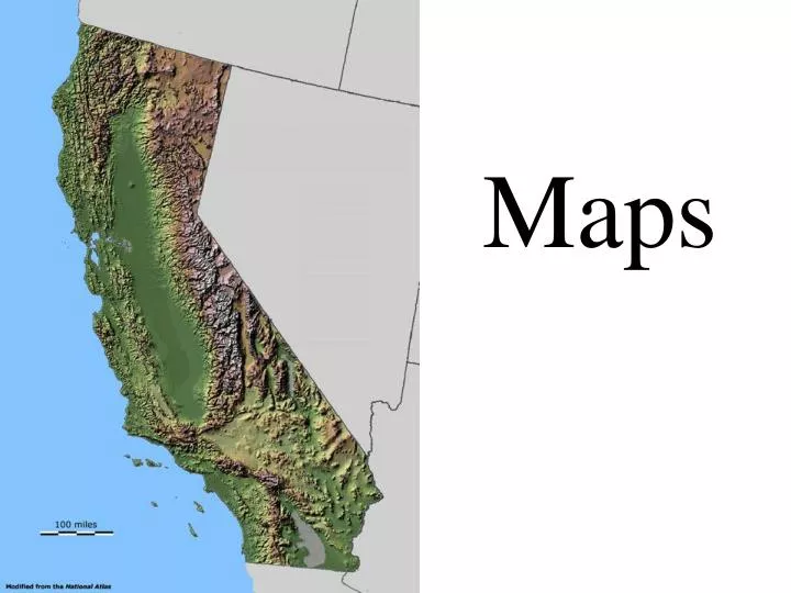
Sometimes, different colorsmean different states.What color is California?
The lines between countries are the borders. Can you find the border line between the United States and Canada?
On most maps, cities are shown as little dots. Can you find some cities on this map?
Sometimes, a capital ofa country is shown with a star.Do you see some stars on this map? Do you see the capitals of China and India?
as red lines, like theInterstate Highways on this United States map.
You can find out what different lines and marks on a map mean, from the map key or legend.It’s in a box that looks like this.
There is another kind of map,called a relief map. It shows tall mountains in brown and low plains in green.
Smaller blue lines run into the big line. Those are rivers, too.
The Nile is the longest river in Africa. Can you find the Nile? Do you see other rivers?
On most maps, light blue means an ocean, sea, or lake. Can you find some lakes on this map?
And do you see theoceans on this map?(The land is colored green.)