Download
1 / 66
660 likes | 739 Views
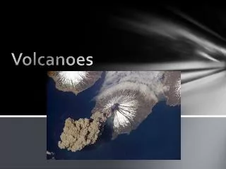
Volcanoes. Welcome to Washington - the 42 nd State. Why are we in Washington?. How are volcanoes different in Washington than Hawaii?. The evergreen state. Space needle – built for the 1962 World’s Fair. Pike’s place market – you can get anything from fish to tulips. Honey – I’m home.

E N D
Why are we in Washington? How are volcanoes different in Washington than Hawaii?
Pike’s place market – you can get anything from fish to tulips
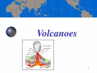
Cascade Range • We’re in Washington because of the volcanoes in the Cascade Range
The tiny Juan de Fuca plate is subducting under the North American Plate – this created the chain of volcanoes
What mountains make up the Cascade Range • Mount Thielsen • Mount Stuart • Mount Lassen • Mount Shasta • Mount Rainier • Mount St. Helens
Mount Thielsen: Mount Thielsen is one of the "pointiest" mountains in the world, but the firm rock of the summit pinnacle makes it an easy climb.
Mount Stuart is a massive rocky pyramid that utterly dominates the view from Longs Pass.
Mt. Shasta and the prominent "heart", surrounded by narrow snowfields, from the town of Mt. Shasta.
The massive, icy form of Mount Rainier in the classic view from the Paradise Inn area on the south side of the mountain.
Mt. St. Helens is on an ocean-continent subduction boundary (the Juan de Fuca plate is subducting under the N. American plate). Mt. St. Helens is an active stratovolcano.
Realizing their dangerous situation, the pilot put the plane into a steep dive to gain speed, and thus was able to outrun the rapidly mushrooming eruption cloud that threatened to engulf them. The Stoffels were fortunate to escape, and other scientists were fortunate to have their eyewitness account to help unscramble the sequence and timing of the quick succession of events that initiated the May 18 eruption.The collapse of the north flank produced the largest landslide-debris avalanche recorded in historic time. Detailed analysis of photographs and other data shows that an estimated 7-20 seconds (about 10 seconds seems most reasonable) elapsed between the triggering earthquake and the onset of the flank collapse. During the next 15 seconds, first one large block slid away, then another large block began to move, only to be followed by still another block. The series of slide blocks merged downslope into a gigantic debris avalanche, which moved northward at speeds of 110 to 155 miles an hour. Part of the avalanche surged into and across Spirit Lake, but most of it flowed westward into the upper reaches of the North Fork of the Toutle River. At one location, about 4 miles north of the summit, the advancing front of the avalanche still had sufficient momentum to flow over a ridge more than 1,150 feet high. The resulting hummocky avalanche deposit consisted of intermixed volcanic debris, glacial ice, and, possibly, water displaced from Spirit Lake. Covering an area of about 24 square miles, the debris avalanche advanced more than 13 miles down the North Fork of the Toutle River and filled the valley to an average depth of about 150 feet; the total volume of the deposit was about 0.7 cubic mile. The dumping of avalanche debris into Spirit Lake raised its bottom by about 295 feet and its water level by about 200 feet.- NEXT PAGE - Schematic cross sections of Mount St. Helens showing the cryptodome of magma that produced the bulge and the three major blocks that collapsed to form the debris avalanche (After USGS Professional Paper 1250). Compare with photographs in "The Catastrophic First Minute."
Graphic shows the amount of material displaced by the 1980 blast
1300 ft of the summit vanished Debris avalanche was more than half a cubic mile 235 square miles were devastated by blast cloud and volcanic debris 57 people dead or missing Miles of road and bridges destroyed Crater left was 1.2 miles wide, 2.4 miles long, 2000 ft deep May 18, 1980 activity