Download
1 / 56
560 likes | 662 Views
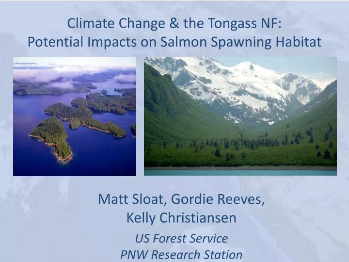
Climate Change & the Tongass NF: Potential Impacts on Salmon Spawning Habitat. Matt Sloat, Gordie Reeves, Kelly Christiansen US Forest Service PNW Research Station. Funding provided by:. Additional assistance provided by: TNF, UCSB Marine Science Institute,

E N D
Climate Change & the Tongass NF:Potential Impacts on Salmon Spawning Habitat Matt Sloat, Gordie Reeves, Kelly Christiansen US Forest Service • PNW Research Station
Funding provided by: Additional assistance provided by: TNF, UCSB Marine Science Institute, UC Davis, Oregon State University, and USFS PNW RS.
Objectives: • Determine the vulnerability of watersheds on the Tongass National Forest to the potential impacts of climate change. • Focus on changes in flood disturbance in response to trends for a warmer, wetter climate. • Determine the impact of increases in mean annual flooding on spawning habitat for Pacific salmon.
Future climate models Historic climate Climate Regional hydrologic model Field measurements and digital elevation model (DEM) Historic mean annual flood (Q2) Future mean annual flood (Q2) Hydrology Morphologic predictions hbf, wbf, S, D50 static morphology Geomorphology dynamic adjustment historic morphology Flow depth h Habitat Reach-averaged excess Shields stress (τ*/ τ*c) Confined valley Unconfined valley Suitable spawning reaches (D50:7 – 50 mm; hbf≥ 0.5 m;wbf≥ 2 m; Probability of scour mortality <0.50) Critical scour probability
Future climate models Historic climate Regional hydrologic model
Future climate models Historic climate Regional hydrologic model Q2= 0.004119*A0.8361*(ST+1) -0.3590 *P 0.9110 *(J+32)1.635 Q2 A ST P J = Mean annual flood magnitude = Drainage area = Area of lakes = Mean annual precipitation = Mean January temperature Curran et al. (2003) Estimating the magnitude and frequency of peak streamflows for ungagged sites on stream in Alaska . . . USGS Water Resources Investigations Report 03-4188.
Why focus on mean annual floods? RIVERS ARE THE AUTHORS OF THEIR OWN GEOMETRY • Given enough time, rivers construct their own channels. • A river channel is characterized in terms of its bank-full geometry. • Bank-full geometryis defined in terms of river width and average depth at bank-full discharge. • Bank-full discharge(~Q2) is the flow discharge when the river is just about to spill onto its floodplain.
Historic climate Regional hydrologic model Historic mean annual flood (Q2) Historic conditions characterized from 1977 – 2000 Q2= 0.004119*A0.8361*(ST+1) -0.3590 *P 0.9110 *(J+32)1.635 Q2 A ST P J = Mean annual flood magnitude = Drainage area = Area of lakes = Mean annual precipitation = Mean January temperature Curran et al. (2003) Estimating the magnitude and frequency of peak streamflows for ungagged sites on stream in Alaska . . . USGS Water Resources Investigations Report 03-4188.
Historic climate Regional hydrologic model Field measurements and digital elevation model (DEM) Historic mean annual flood (Q2) Morphologic predictions hbf, wbf, S, D50 NetMap’s attributed and routed stream layer in southeast Alaska was used to delineate fish habitats and to calculate hydrographic and morphologicalvariables (www.terrainworks.com)
Historic climate Regional hydrologic model Field measurements and digital elevation model (DEM) Historic mean annual flood (Q2) DEM-derived channel slope Morphologic predictions hbf, wbf, S, D50
HC (>0.35) HC (>0.08–0.35) AF (>0.08) Colluvial HC (<0.08) AF (<0.08) Cascade MM, MC ES LC, FP, PA Step-pool Plane-bed Pool-riffle High Low Gradient
CA SP PB PR ES
Reach-level channel response potential to changes in sediment supply and discharge (modified from Montgomery and Buffington 1997) Plane-bed Cascade Step-pool Pool-riffle Transport Response High Low Slope
Historic climate Regional hydrologic model Field measurements and digital elevation model (DEM) Historic mean annual flood (Q2) Morphologic predictions hbf, wbf, S, D50 Zynda, T. (2005). Development of regional hydraulic geometry relationships and stream basin equations for the Tongass National Forest, Southeast Alaska. Unpublished Master’s Thesis, Michigan State University, Lansing MI.
Historic climate Regional hydrologic model Field measurements and digital elevation model (DEM) Historic mean annual flood (Q2) Bank-full channel depth (hbf) Morphologic predictions hbf, wbf, S, D50
Historic climate Regional hydrologic model Field measurements and digital elevation model (DEM) Historic mean annual flood (Q2) Morphologic predictions hbf, wbf, S, D50 Surface substrate size characterized by median grain size (D50) and predicted by : D50= (ρhS)1-n/(ρs-ρ)kgn (Buffington et al. 2004) where k and n are empirical constants relating bank-full Shields stress and total bank-full shear stress in southeast AK streams.
Historic climate Regional hydrologic model Spatially explicit prediction of median gravel size is used to assess the extent of reaches with suitable size gravel for salmon spawning Field measurements and digital elevation model (DEM) Historic mean annual flood (Q2) D50 range 7 – 50 mm Morphologic predictions hbf, wbf, S, D50
Historic climate Regional hydrologic model Field measurements and digital elevation model (DEM) Historic mean annual flood (Q2) Morphologic predictions hbf, wbf, S, D50 historic morphology Reach-averaged excess Shields stress (τ*/ τ*c) τ* = ρghS/(ρs – ρ)gD50 τ*c=0.15 S0.25 (Lamb et al. 2008) Critical scour probability Pscour(≥ 30 cm) = e(-30 (3.33e(-1.52 τ*/τ*c)) (Haschenburger 1999; Goode et al. 2013)
Historic climate Regional hydrologic model Field measurements and digital elevation model (DEM) Historic mean annual flood (Q2) Morphologic predictions hbf, wbf, S, D50 historic morphology Reach-averaged excess Shields stress (τ*/ τ*c) Suitable spawning reaches (D50:7 – 50 mm; hbf≥ 0.5 m;wbf≥ 2 m; Probability of scour mortality <0.50) Critical scour probability
Future climate models Historic climate Regional hydrologic model
Future climate models Regional hydrologic model Future mean annual flood (Q2) • Future conditions were • considered at 2 time-steps: • 2040 – 2049 • 2080 – 2089
A warmer, wetter future for SE AK will produce larger mean annual floods (Q2) 2040 2080 Percent increase Percent increase
A warmer, wetter future for SE AK will produce larger mean annual floods Predicted increase in southeast AK flood magnitude Median: 18% 28%
Future climate models Regional hydrologic model Field measurements and digital elevation model (DEM) Future mean annual flood (Q2) Morphologic predictions hbf, wbf, S, D50 static morphology Flow depth h Reach-averaged excess Shields stress (τ*/ τ*c) Unconfined valley Confined valley Suitable spawning reaches (D50:7 – 50 mm; hbf≥ 0.5 m;wbf≥ 2 m; Probability of scour mortality <0.50) Critical scour probability
Static channel morphology Unconfined channels hnew≈ hbf (McKean and Tonina 2013) New h Depth (h) hbf Q2 New Q2 Flood magnitude (Q)
Static channel morphology Confined channels Qbf= 3.732*wbf*hnew* √(g*hnew*S)*(hnew/D50)0.2645 (Parker et al. 2007) New h Depth (h) hbf Q2 New Q2 Flood magnitude (Q)
Future climate models Regional hydrologic model Field measurements and digital elevation model (DEM) Future mean annual flood (Q2) Morphologic predictions hbf, wbf, S, D50 static morphology Flow depth h Reach-averaged excess Shields stress (τ*/ τ*c) Unconfined valley Confined valley Suitable spawning reaches (D50:7 – 50 mm; hbf≥ 0.5 m;wbf≥ 2 m; Probability of scour mortality <0.50) Critical scour probability
Future climate models Regional hydrologic model Field measurements and digital elevation model (DEM) Future mean annual flood (Q2) Morphologic predictions hbf, wbf, S, D50 static morphology dynamic adjustment Flow depth h Reach-averaged excess Shields stress (τ*/ τ*c) Confined valley Unconfined valley Suitable spawning reaches (D50:7 – 50 mm; hbf≥ 0.5 m;wbf≥ 2 m; Probability of scour mortality <0.50) Critical scour probability
Mutual adjustment of stream channel parameters to changing discharge • Slope does not change. Readjusting river valley slope involves moving large amounts of sediment over long reaches, and typically requires long geomorphic time (thousands of years or more). • Bank-full width and depth change. Rivers can readjust their bank-full depths and widths over relatively short geomorphic time (decades to centuries). • D50 changes. Rivers can readjust surface grain size over short geomorphic time (years to decades).
Dynamic channel morphology Unconfined channels Depth (h) hbf Q2 Flood magnitude (Q)
Dynamic channel morphology Unconfined channels hnew= Qbf2/5/g1/5 (Parker et al. 2007) New hbf Depth (h) New Q2 Flood magnitude (Q)
Dynamic channel morphology Confined channels hbf Depth (h) Q2 Flood magnitude (Q)
Dynamic channel morphology Confined channels hnew= Qbf2/5/g1/5 (Parker et al. 2007) New hbf Depth (h) New Q2 Flood magnitude (Q)
Future climate models Historic climate Regional hydrologic model Field measurements and digital elevation model (DEM) Historic mean annual flood (Q2) Future mean annual flood (Q2) Morphologic predictions hbf, wbf, S, D50 static morphology dynamic adjustment historic morphology Flow depth h Reach-averaged excess Shields stress (τ*/ τ*c) Confined valley Unconfined valley Suitable spawning reaches (D50:7 – 50 mm; hbf≥ 0.5 m;wbf≥ 2 m; Probability of scour mortality <0.50) Critical scour probability
Spawning habitat response to increased flood magnitude: 2040 2040 static morphology 2040 dynamic morphology Percent change Percent change
Spawning habitat response to increased flood magnitude: 2040 Static median: 12% Dynamic median: 17% Loss is greater if morphological adjustment keeps pace with increased flood magnitude
Spawning habitat response to increased flood magnitude: 2080 2080 static morphology 2080 dynamic morphology Percent change Percent change
A warmer, wetter future for SE AK will produce larger mean annual floods Static median: 18% Dynamic median: 22% Loss is greater if morphological adjustment keeps pace with increased flood magnitude
Historic (1977- 2000) D50: 78 km Scour > .50: 19 km 59 km Probability of egg mortality from scour < 50% > 50%
2040 static D50: 78 km Scour > .50: 26 km 52 km Probability of egg mortality from scour < 50% > 50%
D50: 78 km Scour > .50: 30 km 48 km 2080 static Probability of egg mortality from scour < 50% > 50%
2040 dynamic D50: 76 km Scour > .50: 24 km 52 km Probability of egg mortality from scour < 50% > 50%
D50: 73 km Scour > .50: 26 km 47 km 2080 dynamic Probability of egg mortality from scour < 50% > 50%
This framework provides tools for: • Identifying watersheds, streams, • and reaches with high resilience to • impacts of climate change. • Monitoring trends in salmon • spawning habitat. • Prioritizing areas for habitat • improvement (e.g., lwd placement, • flood plain connectivity). • Guiding more detailed watershed • assessments and salmon population • models. Probability of egg mortality from scour < 50% > 50%
Conclusions: • Mean annual flood magnitudes may increase ~ 28% by 2080 (high spatial variability).
Conclusions: • Mean annual flood magnitudes may increase ~ 28% by 2080 (high spatial variability). • Larger floods will potentially reduce salmon spawning habitat by ~ 18 – 22%, but there is high spatial variability due to geomorphic context.
Conclusions: • Mean annual flood magnitudes may increase ~ 28% by 2080 (high spatial variability). • Larger floods will potentially reduce salmon spawning habitat by ~ 18 – 22%, but there is high spatial variability due to geomorphic context. • The spatially-explicit framework we describe provides tools that can help managers reduce or avoid habitat loss through climate adaptation strategies.
Conclusions: • Mean annual flood magnitudes may increase ~ 28% by 2080 (high spatial variability). • Larger floods will potentially reduce salmon spawning habitat by ~ 18 – 22%, but there is high spatial variability due to geomorphic context. • The spatially-explicit framework we describe provides tools that can help managers reduce or avoid habitat loss through climate adaptation strategies. • Salmon population responses to changes in spawning habitat will vary among the species considered (e.g., differences in phenology, spatial distribution, life history).


![Facing the Impacts of Climate Change: Indian SMEs and Adaptation Training Programme [Date] [Time]](https://cdn3.slideserve.com/6765596/slide1-dt.jpg)