Download
1 / 52
630 likes | 1.1k Views
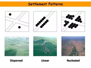
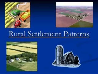
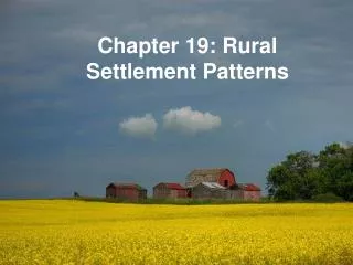
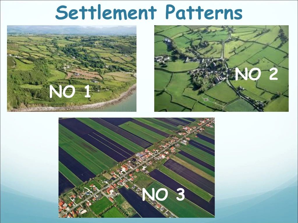
Settlement Patterns. NO 2. NO 1. NO 3. SETTLEMENT PATTERNS. Settlement pattern refers to the way that settlements are arranged or spaced out in an area There are three types of settlement pattern: DISPERSED. Where settlements are scattered with large spaces between them. NUCLEATED

E N D
Settlement Patterns NO 2 NO 1 NO 3
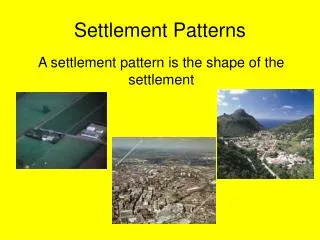
SETTLEMENT PATTERNS Settlement pattern refers to the way that settlements are arranged or spaced out in an area There are three types of settlement pattern: DISPERSED. Where settlements are scattered with large spaces between them. NUCLEATED Where settlements are all clustered together LINEAR. Where settlements are all lied up in a row.
DISTRIBUTION OF TOWNS IN IRELAND • Why are towns located where they are • HISTORIC FACTORS • PHYSICAL FACTORS
Historic Social Factors • Viking Settlements • Vikings were sea traders so they established their settlements along the coast • Norman Settlements • The Normans weren’t as fussy as the Vikings they tended to set up their towns where they could be defended & where they could get food. • Primacy of Dublin • Dublin is by far Irelands biggest city and has caused many other cities to grow close to it.
VIKINGS Vikings were sea traders so established their settlements in a Linear pattern along the coast.
THE NORMANS NORMANS CAME TO IRELAND FROM NORTH FRANCE VIA ENGLAND ESTABLISHED CASTLES AND SETTLEMENTS IN THE SOUTH AND EAST BECAUSE IT WAS CLOSEST TO WHERE THEY CAME FROM
Where did they settle To the East and South of the island close to where they came from On fertile land. So they could grow crops Beside rivers. For a water supply and for transport? DEFENSIVE SITES: Lots of native irish wanted them out and regulalry attacked their settlements
In class copies Settlements can also be arranged in a linear pattern along majout routes like the Motorway from Dublin to cork
SETTLEMENT PATTERNS Settlement pattern refers to the way that settlements are arranged or spaced out in an area There are three types of settlement pattern: DISPERSED. Where settlements are scattered with large spaces between them. NUCLEATED Where settlements are all clustered together LINEAR. Where settlements are all lied up in a row.
Primate City Primate city is the countries largest city that is twice as big as the next biggest city E.G: Dublin is over twice as big as Cork. Dublin is a Primate City A PRIMATE CITY IS NOT THE CAPITAL CITY OR BIGGEST CITY
The Primacy of Dublin • Dublin is a primate city. • A primate city is a city that is twice as big as the second biggest city in the same country. • For example, Dublin is twice as big as Cork, so it is a primate city. Can you name any other primate cities in the other countries.
Why did Dublin become a Primate City? • Dublin is where the government of Ireland sits. 2. It is Ireland’s main port. 3. It is Ireland’s main transport focus. (Air, Sea, Rail, Roads). 4. It is Ireland’s most important educational, cultural, and commercial centre. Dublin is therefore a zone of attraction for migrants, and foreign direct investment.
A nucleated pattern of settlement has emerged around Dublin.
Physical Factors • Altitude • Relief • Land Quality • Drainage
ALTITUDE The Altitude here is 500m above sea level SEA LEVEL Altitude is how high a place is above the flat surface of the sea or Sea Level. Its colder and windier the higher up we go.
Why do we not build towns on the side or top of mountains THERE ARE TWO KEY REASONS Too hard to build on a high altitude Its exposed so colder and windier at a high altitude
RELIEF SHAPE OF THE LANDSCAPE EG. HILLY, FLAT, LOW LYING etc. Its easier to build on a flat surface.
Land Quality Most towns are located in areas of fertile land. Traditionally towns developed because farmers would come to town and sell their produce. Its easier to build on good land than boggy poor land.
DRAINAGE Most towns developed near rivers but not in locations where the river might flood
The Influence of Resources & Terrain on Settlement • The following factors influence where towns and villages develop. 1. Altitude – Little settlement occurs in upland areas. They are too cold, wet, and windy. It is also too difficult to build in the mountains. 2. Rivers – Rivers attract settlement. In the past they were important for water, transport, and food. Fertile soil is also found alongside many rivers which is good for farming. Many towns also developed at bridge points. 3. Land Quality – Fertile land attracts settlement. This is why more people settled in the south and east of Ireland. The land is less fertile in the west. With reference to the OS Map of Caher, explain in detail 3 reasons why the town of Caher developed at this place.
DRY POINT SITE A high point which will not flood. Many town grew at dry point sites
BRIDGES Bridges are meeting points. People selling produce would gather at bridges and towns eventually grew here.
Settlement in the Netherlands - Polders • The Netherlands is a small country with a population of 16 million people. • It has the highest population density in Western Europe. • The people have reclaimed areas of land from the sea. This new land is called a Polder. Polders have given new farmland and space to live How were the polders created? • A large dam was built across the mouth of a large coastal inlet. • Water was pumped out of the inlet, making it dry land. • Roads were built and farms were laid out on the land. • People moved onto the land.
Settlement Patterns on the Polders • Settlement on the polders is in a planned radial pattern. • A large town was built in the centre of the polder. It provides all the services needed for the population who live there. • Smaller villages were built in a radial pattern around the main town.
KEY POINTS • Land reclaimed from the sea is known as a Polder. • The Netherlands has more of its population living in Polders than any other country. • Farmhouses in Dutch polders are usually arranged in a Planned Linear Pattern along straight roadways
The Polders as Overspill Zones • The polders have acted as overspill zones for many people who lived in the large cities like Amsterdam and Rotterdam. • People have moved from these cities and settled on the polders.
The Functions ofNucleated Settlements Nucleated settlements (towns and villages) provide many different functions to the people who live there. Settlement typeFunction Village Small range of services, groceries, petrol, church, school. Market More services, banking, supermarket, clothes shops Defensive Began on easily defended sites. Castle or ruins remain. Resource based Town develops around a coal mine, or other mineral mine. Port Town developed at a port or docks. Residential People live there but travel to nearby city to work each day. Recreational Town developed around beach or other leisure facility. Ecclesiastical A religious function, caters for people’s spiritual needs.
Settlement in a River Basin – The Shannon • Many towns have developed along the course of the River Shannon. • These towns developed for many different reasons. For e.g. • Foynes is a port settlement. • Athlone started as a defensive settlement. • Clonmacnoise started as an Ecclesiastical settlement. • Killaloe has a leisure function for boating activities in Lough Derg.
Different Functions of Limerick City • Limerick began as a defensive settlement. The Vikings settled in Limerick. The Normans settled there later and built King John’s Castle. • Limerick later developed into a market town. It grew as a bridge point of the River Shannon. It became a route focus. Limerick’s port also helped the town to grow as a market town. • Limerick has many functions today. It has an important residential function with many suburbs around the city centre. It also has an important educational function with 3 third level colleges.
Settlement in a River Basin – The Rhine • The River Rhine is one of the busiest and most important rivers in Europe. • It is used to transport huge amounts of goods into Europe. • Many large towns and cities have developed along the course of the Rhine.
Change in Function Over Time - Navan • Settlements may change their function over time. • Navan first developed as a market settlement. • In the 1970’s Navan also became a resource-based settlement when the largest lead and zinc mine in Europe was opened there. This brought new wealth and jobs to the area. The population increased as a result. • Navan has also developed a residential function. Many people who work in Dublin live in Navan. They commute to Dublin each day to work.
Large Scale Industrial Development - Clarecastle • Clarecastle in Co. Clare is another example of a town whose function has changed over time. • It began as a bridging point over the River Fergus. The Normans built a castle there in the 13th century so the town had a defensive function. It also had a port function. • In the 1970’s a large chemical factory opened in the town. This factory brought new jobs to the area and money to the local economy. • Clarecastle’s main function today is a manufacturing function.