Download
1 / 19
190 likes | 287 Views
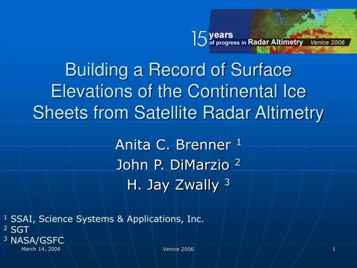
Building a Record of Surface Elevations of the Continental Ice Sheets from Satellite Radar Altimetry. Anita C. Brenner 1 John P. DiMarzio 2 H. Jay Zwally 3. 1 SSAI, Science Systems & Applications, Inc. 2 SGT 3 NASA/GSFC. Seasat Geosat-GM Geosat-ERM ERS-1-GM ERS-1-ERM ERS-2 GFO

E N D
Building a Record of Surface Elevations of the Continental Ice Sheets from Satellite Radar Altimetry Anita C. Brenner 1 John P. DiMarzio 2 H. Jay Zwally 3 1 SSAI, Science Systems & Applications, Inc. 2 SGT 3 NASA/GSFC Venice 2006
Seasat Geosat-GM Geosat-ERM ERS-1-GM ERS-1-ERM ERS-2 GFO Envisat ICESat 1978 1980 1982 1984 1986 1988 1990 1992 1994 1996 1998 2000 2002 2004 2006 Ice Sheet Satellite Altimetry Venice 2006
Seasat Geosat ERM GFO ERS-1 ocn ERS-1 ice Envisat ERS-2 ice ICESat L1 ICESat L2A Greenland Coverage Edited based on successful GSFC V4 retracking Venice 2006
Geosat GFO Envisat ICESat – L2A Antarctic Coverage ERS-2 Venice 2006
NASA/GSFC Ice Sheet Radar Altimetry data sets • High precision elevations and geolocations • Consistent data sets for all missions • Ease in availability and usability icesat4.gsfc.nasa.gov • Contains all useable Greenland and Antarctic Ice Sheet and surrounding sea ice data (ICESat data available at nsidc.org) Venice 2006
Challenges in Ice Sheet Altimetry Retrieval • Atmospheric corrections require models • Dual-frequency ionosphere not useable over changing surfaces • Radiometer only accurate over oceans • Temporal and geospatial change in Surface reflectance affects range measurement • Radar penetration and volume back-scattering cause irregularities in returns • Over the sloping, undulating surfaces the return can come from anywhere within the large beam-limited footprint (16km for ERS) • Decrease in range accuracy – due to beam attenuation • Ambiguous measurement location • Loss of track Venice 2006
Ice Sheet Radar Return Combined Return Surface Component Sub surface Volume Scattering Component Mean elevation is measured to mid-point on surface Return ramp Ridley and Partington 1988 Venice 2006
Retracking ice sheet radar returnsGSFC V4 retracker Single ramp function Mean Surface Double ramp function The GSFC V4 Retracker fits a function to the radar return Waveform. The Mean Surface is measured to the reflection point β(3) of the first ramp Venice 2006
Maximum Amplitude Retracking ice sheet radar returnsThreshold method Threshold retracker to where Waveform = DC+% (max amp-DC) DC line A threshold retracker “tracks” to the waveform location where the Amplitude is a percentage of the maximum amplitude after taking Into account the DC noise level. Venice 2006
Antarctica Radar AltimetryRetracking Results Ht profiles:* GSFC V4, R1 * GSFC V4, R2; * – 10% th * Unretracked Return Waveform Tracking Point GSFC V4 ret fn Waveform Intensity Plot * GSFC V4, Ramp 1 * GSFC V4 Ramp 2 ERS-1 Antarctic Ice Sheet Venice 2006
Surface Slope and Affects Schematic Description of Slope-Induced Error over Planar Surface, Elevation error ≈ H * alpha^2/2.0 Venice 2006
NASA/GSFC Ice Sheet Radar Altimetry data sets • Corrections Applied to Surface Elevations • Tides*– UTCSR 3.0 models • Ionosphere correction* – IRI 90/95 models • Tropophere corrections* - • Seasat, Geosat, ERS-1,2 – NCEP reanalysis (2.5 deg grid) from NCAR • GFO, Envisat – NCEP 6 hr model prediction • Instrument corrections • GSFC V4 retracker range correction* • Seasat, Geosat –NASA/NOAA timing biases applied • ERS-1,2 – ESA supplied USO and SPTR corrections *Indicates correction is available on the data record Venice 2006
NASA/GSFC Ice Sheet Radar Altimetry data Sets • GSFC Slope Correction – on data records – not applied • Orbits – range increments available to use the following orbits • Seasat – PGS-4, GEM-T2, JGM-2, JGM-3 • Geosat GM –NPO, JGM-2, JGM-3 • Geosat ERM –NAG, GEM-T2, JGM-2, JGM-3 • GFO – OOD, GSFC MOE (Lemoine) • ERS-1 – D-PAF, JGM-2, JGM-3, DGM-E04 • ERS-2 – D-PAF, JGM-3, DGM-E04 • Envisat – D-PAF Venice 2006
Measuring Altimeter Precision with Crossovers • Location calculated by finding the intersection of the latitude vs longitude functions for each set of passes. • Elevation calculated by linearly interpolating the surrounding elevations to calculate H1 and H2. • Relative accuracy or Precision - calculated from the standard deviation of crossing arc elevation differences for near-time-coincident intra-mission data Venice 2006
Satellite Altimetry Relative precision over Greenland ERS-2 near time-coincident Crossovers Venice 2006
ENVISAT-ICESat time-coincident Crossovers Measure relative accuracy No slope correction NASA range correction applied to correct for slope-induced error LHS – Histograms of ENVISAT-ICESat Crossover elevation residuals RHS – Percent of Envisat retrieved elevations that agree to within the abscissa value of the ICEsat results Venice 2006
Greenland with slope correction Antarctica with slope correction Antarctica no slope correction Greenland no slope correction ENVISAT-ICESat time-coincident Crossovers Measure relative accuracy Using the NASA range correction to correct for slope-induced Error brings ENVISAT elevations Closer to ICESat results Surface Slope (deg) Venice 2006
Envisat-ICESat time coincident Greenland Crossover Statistics Standard Deviation of Envisat- ICESat crossovers Mean of Envisat- ICESat crossovers NASA/GSFC V4 retracker 10 % Threshold Retracker Venice 2006
Summary • NASA/GSFC has archived Ice sheet altimetry data sets with precise elevations • Precision over flat, non-sloping surface from crossover analysis • Seasat – 40cm Geosat – 27cm • GFO – 42cm ERS-1 ocn – 31cm • ERS-1 ice – 69cm ERS-1 ice – 64 cm • Envisat – fine – 27cm • Intra-satellite crossover statistics for the 10 % threshold retracker show a lower standard deviation for all slopes but a slightly higher mean at the higher slopes compared to GSFC V4 • Inter-satellite crossover statistics between Envisat and ICEsat show the 10% threshold retracker yields a higher mean difference than the GSFC V4 but comparable standard deviations. • The GSFC Slope correction method reduces the mean error up to 0.8 deg slope, and significantly improves the agreement between Envisat and ICEsat measurements • Envisat fine mode precision relative to ICESat laser retrievals • Non-sloping surface - 43cm ± 1m • Over .7-.8 deg slope - -90cm ± 26m • Envisat fine mode has higher precision over the ice sheets than ERS-1 ocean mode or ERS-1 and 2 ice mode and coverage comparable to ERS-1 ice mode Venice 2006


![K a = [ H + ] [ C 2 H 3 O 2 - ] [ HC 2 H 3 O 2 ]](https://cdn2.slideserve.com/5089471/slide1-dt.jpg)