Download
1 / 26

E N D
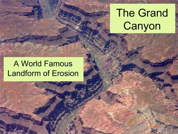
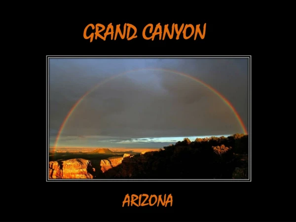
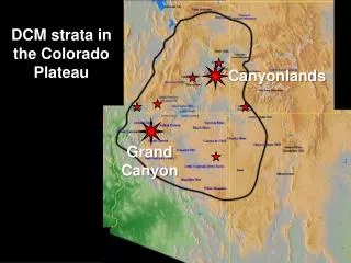
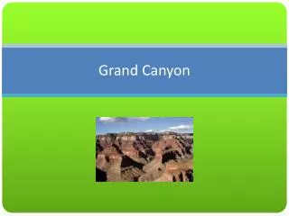
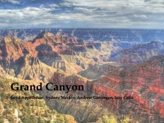
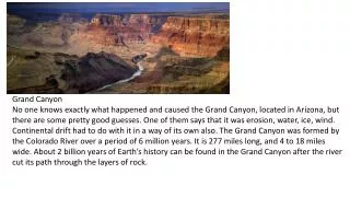
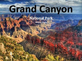
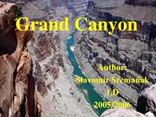
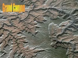
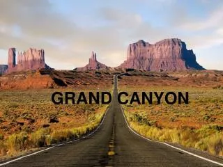
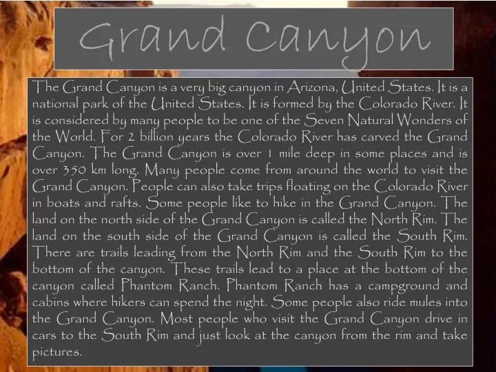
Grand Canyon The Grand Canyon is a very big canyon in Arizona, United States. It is a national park of the United States. It is formed by the Colorado River. It is considered by many people to be one of the Seven Natural Wonders of the World. For 2 billion years the Colorado River has carved the Grand Canyon. The Grand Canyon is over 1 mile deep in some places and is over 350 km long.Many people come from around the world to visit the Grand Canyon. People can also take trips floating on the Colorado River in boats and rafts. Some people like to hike in the Grand Canyon. The land on the north side of the Grand Canyon is called the North Rim. The land on the south side of the Grand Canyon is called the South Rim. There are trails leading from the North Rim and the South Rim to the bottom of the canyon. These trails lead to a place at the bottom of the canyon called Phantom Ranch. Phantom Ranch has a campground and cabins where hikers can spend the night. Some people also ride mules into the Grand Canyon. Most people who visit the Grand Canyon drive in cars to the South Rim and just look at the canyon from the rim and take pictures.
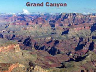
Grand Canyongallery by Maciej Matuszewski
Masai Mara The Masai Mara is a large reserve in south-west Kenya. It covers about 1530 km2. The Sand,Talek& Mara are the major river in the reserve. It is famouse for it's animals a big population of Big Cats, game, zebra, giraffe, Thomson's gazelle etc. We can also find there: hippopotamuses, elephants, lions & the population of cheetah & black rhinos, which are threatened nowadays. Over 450 species of birds livethere.
Every year from July to October the Great Migration of animals can be observed in the Masai Mara. It is one of the most impressive natural events in the world. A lot of zebras and Thomson's gazelles migrate therein search of food. Masai Mara is losing animals species very fast. The most endangeretd species are: giraffes, impalas, warthogs, topis & water-bucks. The Great Emigration By Daria Matlakowska
Timanfaya Timanfaya is a natural park. It is situated on a beautiful volcanic island Lanzarote witch is a part of Canary Islands. In years 1730 to 1736 there were a lot of volcanic eruptions there. In those time everyday during six years from about three hundred craters flowed about 48 million cubic meters of lava. Timanfaya is about 51 square kilometres.
Timanfaya Even now, you can feel the Timanfaya volcanic island nature because stones located a few centimetres under the ground are up to 100 degrees and at a depth of 10 meters temperature reaches 600 degrees. One of the most important people who lived on Lanzarote was Cesar Manrique. He was a Spanish painter, carver and architect and he hasgot a very strong impact on the present appearance of the island. On the picture you can see a logo of Timanfaya made by Cesar Manrique. by Jakub Pierzchała
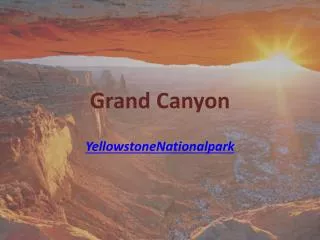
Yellowstone National park
About park • Yellowstone National Park, established by the U.S. Congress and signed into law by President Ulysses S. Grant on March 1, 1872, is a national park located primarily in theU.S. state of Wyoming, though it also extends into Montana and Idaho. The Yellowstone was the first national park in the world, and is known for its wildlife and its many geothermal features, especially Old Faithful Geyser, one of the most popular features in the park. It has many types of ecosystems, but the subalpine forest is dominant. • Yellowstone National Park spans an area of 3,468 square miles (8,980 km2), comprising lakes, canyons, rivers and mountain ranges. Yellowstone Lake is one of the largest high-altitude lakes in North America and is centered over the Yellowstone Caldera, the largest supervolcano on the continent. The caldera is considered an active volcano; it has erupted with tremendous force several times in the last two million years. Half of the world's geothermal features are in Yellowstone, fueled by this ongoing volcanism. Lava flows and rocks from volcanic eruptions cover most of the land area of Yellowstone. The park is the centerpiece of the Greater Yellowstone Ecosystem, the largest remaining, nearly intact ecosystem in the Earth's northern temperate zone.
Yellowstone in past and today • Indigenous Americans have lived in the Yellowstone region for at least 11,000 years. The region was bypassed during the Lewis and Clark Expedition in the early 1800s. Aside from visits by mountain men during the early to mid-1800s, organized exploration did not begin until the late 1860s. The U.S. Army was commissioned to oversee the park just after its establishment. In 1917, administration of the park was transferred to the National Park Service, which had been created the previous year. Hundreds of structures have been built and are protected for their architectural and historical significance, and researchers have examined more than 1,000 archaeological sites. By Mateusz Rachubik
Tsaratanana Volcanicmassif
Tsaratanana - volcanic massif in northern Madagascar. The maximum height 2876 m (Maromokotro - an extinct volcano, the highest peak of the island). In the highest, the western part, a nature reserve. Equatorial humid climate of the mountain. Annual rainfall exceeds 2000 mm. Dense network of streams with radial layout. The lower parts of slopes are covered with tropical forests to mountain communities above, there are shrubby heather and scrub.
Amazon The Amazon Basin is the part of SouthAmerica drained by the Amazon River and its tributaries. The basin is located mainly (40%) in Brazil, but also stretches into Peru and several other countries. The South American rain forest of the Amazon is the largest in the world, covering about 8,235,430 km2 with dense tropical forest. For centuries, this has protected the area and the animals residing in it.
Not all of the plants and animals that live in the Amazon Basin are known because of its huge unexplored areas. No one knows how many species of fish there are in the river. Plant growth is dense because of the heavy rainfall. One tropical fruit tree that is native to the Amazon is the abiu. There are thousands of plants, all in different colors, sizes, and shapes. Also, there are many vines and huge trees that give shade when the weather is hot. By Magda Rybojad
SAHARA The Sahara ("The Greatest Desert") is the world's largest desert. At over 9,000,000 square kilometres, it covers most of Northern Africa, making it almost as large as the United States or the continent of Europe. The desert stretches from the Red Sea, including parts of the Mediterranean coasts, to the outskirts of the Atlantic Ocean. To the south, it is limited by the Sahel: a belt of semi-arid tropical savanna that comprises the northern region of central and western Sub-Saharan Africa.
General characteristics of the landscape of the Sahara Sahara, on the landscape consists of rocky desert which after some time due to weathering of rocks formed gravel and sandy desert. Often you can meet grooves made by the river called uedami, and large deposits of salt called embedded. Location of water are called oasis. On the plots are grown wheat, millet, barley, and gardens can be found peach trees, orange, lemon and palm, without whom can not do any oasis. One of the biggest problems of the inhabitants of the oasis is highly salinated water, because farmers have to dehydrate the field orf salt water, and use this channel. Main mineral wealth is oil and natural gas. By Ewa Rybojad
Islands on the lake: • There are lots of islands on this lake: • Uros (a group of floating islands), everythink is made by reed there, and people life on these islands. • Amantaní • Taquile • Isla del Sol • Isla de la Luna • Suriqui The most popular island is Isla del Sol. There are lots of relics. By Wojciech Bartoszek
Cango Caves The Cango Caves are located in Precambrian limestones at the foothills of the Swartberg range near the town of Oudtshoorn in the Western Cape Province of South Africa. The principal cave is one of the country's finest, best known and most popular tourist caves and attracts many visitors from overseas. Although the extensive system of tunnels and chambers go on for over four kilometers, only about a quarter of this is open to visitors, who may proceed into the cave only in groups supervised by a guide. Tours are conducted at regular intervals on most days - there is a "Standard Tour" which takes an hour and an "Adventure Tour" which takes an hour and a half. The "Adventure Tour" consists of crawling through narrow passages and climbing up steep rock formations guided by small lights. The caves contain spectacular halls and grand limestone formations (on both tours) as well as some rather small passages on the Adventure Tour.
Gallery Filip rynkiewicz
Tsitsikamma National Park
Tsitsikamma • The Tsitsikamma National Park is a coastal reserve on the Garden Route in South Africa. It is well known for indigenous forests, dramatic coastline, and the Otter Trail. On 6 March 2009 it was amalgamated with the Wilderness National Park and various other areas of land to form the Garden Route National Park. • The park covers an 80 km long stretch of coastline. Nature's Valley is at the western end of the park, and the main accommodation is at Storms River Mouth. Near the park is the Bloukrans Bridge, the world's highest bungee jump at 216m. By Ignacy Bogusz