Download
1 / 22
220 likes | 311 Views
CLARK COUNTY RESEARCH UPDATE. PM 10 Emissions Studies Presentation to Air Quality Forum May 10, 2005. PM 10 Emissions Studies. Paved Road Emissions –Alternative Technologies Native Desert Emissions Factor. PAVED ROAD EMISSIONS. Components of Study Sampling route Field sampling

E N D
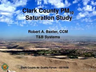
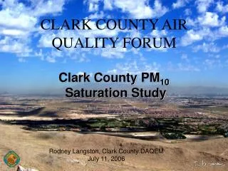
CLARK COUNTYRESEARCH UPDATE PM10 Emissions Studies Presentation to Air Quality Forum May 10, 2005
PM10 Emissions Studies • Paved Road Emissions –Alternative Technologies • Native Desert Emissions Factor
PAVED ROAD EMISSIONS • Components of Study • Sampling route • Field sampling • Next steps
COMPONENTS OF STUDY • Mobile Systems (SCAMPER and TRAKER) • AP-42 Silt Sampling • QA/QC Of Basic Sampling Instruments • Data Analysis & Comparison
TRAKER • Particle Sensors • TSI DustTrak 5820 • Grimm Particle Size Analyzer 1.108 • GPS
AP-42 SAMPLING • Contracted With UNLV – CEE • Sampled 24 Sites • 10 Sites Previously Sampled By Clark County • 14 New Sites • Will Compare AP-42 Results To Mobile Sampling Systems
COMPONENTS OF STUDY (Continued) • Data Analysis and Comparison • CONDUCTED BY UNLV – Dr. Teng • Provides 3rd Party Assessment • Analysis Of Data From 2 Mobile Systems, A-42 Silt Results, & Other Factors • QA/QC Looked At Operation Of Basic Sampling Instruments
SAMPLING ROUTE Route Included 5 Classes Of Roads • Freeway • Major Arterial • Minor Arterial • Collector • Local
SAMPLING ROUTE • Segments Of Each Road Class Within The Cities Of Las Vegas, North Las Vegas, Henderson, & Unincorporated Clark County • Include Road Segments With AP42 Silt Sampling History
NEXT STEPS • Phase III Study – Development Of Refined Emissions Inventory For PM10 Maintenance Plan • New Study – Characterize Paved Road Silt Reservoir Depletion For Projecting Future Emissions
Questions? Please contact: Department of Air Quality and Environmental Management (DAQEM) (702) 455-5942
Native Desert Emissions Factor Why determine or refine? • One of the driest places on Earth • 4.4 inches of average annual rainfall • Low vegetative cover • Highly alkaline soils – powdery • Windy weather leading to soil erosion • Committed to do research in PM10 Plan
Native Desert Emissions Factor How much dust from Vacant Land?
Native Desert Emissions Factor How ? Working section
Native Desert Emissions Factor Method • Field reconnaissance & site characterization • Selected 32 sites representing 7 of 9 major USGS soil Wind Erodibility classifications • Test as-found, then destroy crust Intentionally broke crust with gravel rake • Three runs stable, 3 unstable
Native Desert Emissions Factor Results • Data undergoing analysis • Preliminary data suggests the threshold wind speeds found in 1995 were accurate • Winds speeds of 25 MPH and or gusts of 40 MPH used in PM10 Plan and Natural Events Action Plan are valid
Questions? Please contact: Department of Air Quality and Environmental Management (DAQEM) (702) 455-5942