Download
1 / 40
400 likes | 644 Views
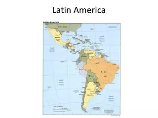
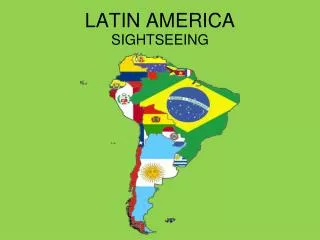
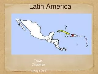
Latin America. Physical Geography. Regions. Latin America can be divided into separate regions based on physical geography or cultural geography. Regions. If we look at physical geography Latin America has four distinct regions:. Mexico Central America The Caribbean South America.

E N D
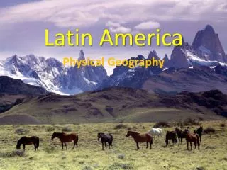
Latin America Physical Geography
Regions • Latin America can be divided into separate regions based on physical geography or cultural geography.
Regions • If we look at physical geography Latin America has four distinct regions: Mexico Central America The Caribbean South America
The Caribbean Islands • The Caribbean Islands are archipelagoes or groups of islands. The major archipelagoes are: • The Greater Antilles - Cuba, Jamaica, Hispaniola (Composed of Haiti and the Dominican Republic), and Puerto Rico • The Lesser Antilles Think of some other archipelagoes around the world!
Regions • If we look at language Latin America can be roughly divided into: • Spanish speaking countries • Portuguese speaking countries • Other European languages such as English, French, and Dutch
Mountains • Latin America has several large mountain ranges such as: • The Andes • The Sierra Madre Occidental and Orientals
The Andes • The Andes Mountains extend from Columbia to the southern tip of Chile and they are over 4,000 miles long. At some points the Andes are over 300 miles wide and large portions of Peru, Ecuador, Chile, and Bolivia have very high elevations.
Altiplano • Where the Andes are widest there are high flat plains called altiplanos. People live and farm in these areas but the temperature is cool all year long and it can be difficult to grow food.
Sierra Madres • The Sierra Madre Oriental and Occidentals run along the east and west coast of Mexico. Between these two mountain ranges lie the Mexican Plateau.
Highlands • The Brazilian Highlands are a geographic region that covers most of eastern, central, and southern Brazil. This area has rolling hills and a tropical wet and dry climate zone.
Rivers and Waterways • A few important rivers and waterways are: • The Amazon River • The Rio Grande • The Orinoco • The Parana • The Panama Canal
The Amazon River • The Amazon River is located in South America and it drains a large area that is known as the Amazon Basin. The Amazon has many tributaries, which are smaller rivers that flow into a larger river.
The Amazon River • Much of the Amazon River is navigable, which means large boats can travel up it to transport goods to the cities located along its banks.
The Rio Grande • The Rio Grande is a good example of how a river can be a physical barrier between two countries. Part of the Rio Grande is a border between the United States and Mexico.
The Panama Canal • The Panama Canal is an important waterway that cuts through the isthmus of Panama. The canal is human made and was completed in 1914. The canal eliminated the long trip around Cape Horn, the southernmost tip of South America.
Climate • Most of Latin America is in the low latitudes. The two predominant climate zones in Latin America are: • Tropical Wet • Tropical Wet and Dry
Climate • The equator runs through Ecuador and Brazil. The area near the equator is known as the low latitudes and is warm all year. • The seasons in South America are reversed from our seasons because they are in the Southern Hemisphere. When it is winter in Virginia it is summer in Argentina.
Climate • A tropical wet climate zone gets precipitation on a daily basis and a high temperature. Tropical rainforests grow in tropical wet climate zones. • A large portion of Brazil, Venezuela, Columbia, and Central America have a tropical wet climate.
Climate • Tropical wet and dry climates have a rainy season and dry season. Normally, this type of climate zone has grasslands. A large portion of Brazil is tropical wet and dry.
Climate • Some parts of Latin America are dry. • Most of Mexico has an arid to semi-arid climate zone. • The west coast of Latin America has a desert called the Atacama Desert.
Climate • The Atacama Desert is created by orographic precipitation, which is caused by mountains. The Andes Mountains block rain clouds and create a rain shadow.
Vegetation • Tropical rainforest • Pampas - Temperate grassland located in Argentina. • Llanos - Tropical grassland located in Colombia and Venezuela. • Cerrados - Tropical grasslands located in Brazil.
Vertical Zonation • Vertical zonation is the idea that different types of plants grow at different elevations because the temperature becomes colder as you gain elevation.
Natural Disasters • Latin America has many earthquakes and volcanoes because part of it is located on the Ring of Fire. In general, Peru, Ecuador, Chile, and the west coast of Mexico have many active volcanoes. The Caribbean Sea also has many volcanoes.
El Nino • El Nino is a variation in the ocean and atmospheric temperatures in the Pacific Ocean. When the ocean temperature increases it causes ocean currents to reverse direction and can impact the weather in Latin America in many different ways.