Download
1 / 24
240 likes | 368 Views
OCR GEOGRAPHY A LEVEL H083. Teaching from September 2008. BACKGROUND. Current OCR GCE Specifications GCE Specification A – most popular Spec B Key characteristics 1 optional examiner marked coursework unit 1 AS and 1 optional A2 skills papers Mandatory Physical and Human Units.

E N D
OCR GEOGRAPHY A LEVEL H083 Teaching from September 2008
BACKGROUND • Current OCR GCE Specifications • GCE Specification A – most popular • Spec B • Key characteristics • 1 optional examiner marked coursework unit • 1 AS and 1 optional A2 skills papers • Mandatory Physical and Human Units
BACKGROUND Development of 1 Specification for Teaching from September 2008 3 person Spec Development team • Chris Martin – current Spec A (and new Spec Chief) • David Payne – current Spec B Chief and now PE for F762 • Steve Hoyle – current PE for 2685 Investigative report unit
BACKGROUND Spec developed using knowledge gained in developing and running current GCE Specs Basis of new Spec - perceived strengths of current Specs Plus new content drawn from subject association and centre feedback Continuity with relevancy
BACKGROUND Conforms to QCA subject criteria Also worked with QCA following submissions of drafts Acted upon QCA recommendations Spec rationale Skills development Key concepts for each unit topic highlighted Associated Skills also embedded in Spec content
Spec Overview • Covers a wide range of concepts relevant to young people today • Concepts explored at a variety of scales and locations • F763 Units build on content of AS units – broadens focus • Maintain balance between physical & human • Maintain a link with previous specification & link better to GCSE - continuity
Unit F761 Managing Physical Environments Content River Environments Coastal Environments Cold Environments Hot arid and semi-arid environments Focus - • Characteristics and processes that shape them • Development and management • Sustainability
Unit F762 Managing Change in Human Environments Content Managing urban change Managing rural change The energy issue The growth of tourism Focus - • Social, economic and environmental impacts • Development and management • Sustainability
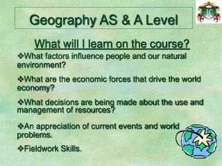
AS Units Range of scales People – environment interaction Skills – use and interpret maps, GIS images Fieldwork – no assessed unit or skills paper but integrated into course content Topics for study – relevant but resourced
Unit F763 Global Issues Choice of 3 Topics (at least 1 from Environmental Issues and at least one from Economic Issues) Environmental Issues Earth Hazards Ecosystems and Environments under threat Climatic hazards Economic Issues Population and resources Globalisation Development and inequalities
Unit F763 Global Issues • Interaction of Human and Physical – brings together strands of AS study • Consolidate and broaden AS skills in wider global context • Individual research including fieldwork on F763 content which draws on AS Unit content also • More advanced Stats use, interpretation and evaluation • Further application of GIS and modern technology
Unit F764 Geographical Skills Synoptic unit Aims to assess research and fieldwork skills Draws on knowledge from AS and F763 research and fieldwork Stages in investigation from identification of hypothesis to evaluation results NB - No report submitted with exam
Schemes of Assessment F761 Managing Physical Environments 1.5 hours, 75 Marks 2 sections to examination – 3 questions to be answered Section A - 2 questions from 4 data response. 4 parts to each question (4, 6,6, 9 marks – 25 marks each) 1 from Rivers or Coasts AND 1 from Hot Semi Arid or Cold Section B 1 question to answer from 4 extended writing questions 1 question per topic 25 marks each question
Schemes of Assessment F762 Managing Change in Human Environments 1.5 hours, 75 Marks 2 sections to examination – 3 questions to be answered in total Section A - 2 questions from 4 data response (based on resource). 4 parts to each question (4, 6,6, 9 marks – 25 marks each) 1 from Urban or Rural Coasts AND 1 from Energy or Tourism Section B 1 question to answer from 4 extended writing questions 1 question per topic 25 marks each question
Schemes of Assessment F763 Global Issues 2.5 hours, 90 Marks 2 sections to examination – 5 questions to be answered in total Section A - 3 questions from 6 (at least 1 from 6 on Environmental Issues and 1 from 6 on Economic Issues) Identifying issues and strategies in response to data stimuli. 10 marks each at least 1 on Environmental and 1 on Economic) Section B 2 essay style questions to answer At least 1 from 6 on Environmental Issues and 1 from 6 on Economic Issues 30 marks each question
Schemes of Assessment F764 Geographical Skills 1.5 hours, 60 Marks 2 sections to examination – 3 questions to be answered Section A - 1 questions from 3 data response. 3 parts to each question (5,10,5 marks – 25 marks each) Based on stimulus material maps, satellite images, statistical information Section B 2 extended writing questions to answer Skills and techniques used during geographical research 20 marks each question
OCR Support Currently working with GA on teacher Support booklet (out soon) INSET – Get ready dates pre Xmas Get started dates – starting from Spring 2008 Heinemann currently working with developers and OCR on officially endorsed publication Schemes of Work and Sample Lesson plans have been written – on website soon
OCR Support Feedback from INSET on new GCE Spec • guidance needed on F764 • Care needed with wording on AS units • SAM for F763 – too resource heavy – more reading time We do listen
OCR contacts • Website: www.OCR.org.uk • Customer contact centre • Tel: 01223 553 998 • Fax: 01223 552 627 • Email:general.qualifications@ocr.org.uk Tim Kendrick-Jones – Geography Subject Officer
Assessment AS – F761 – Managing Physical Environments Section A – 2 qus from 4 Hot Arid and Semi-Arid Environments (a)Use Fig. 4 to describe the main features of the climate at Tamanrasset. [4] • Explain the ways in which climate influences the vegetation in hot arid and semi-arid environments. [6] • Explain the formation of one named landform that occurs in hot arid andsemi-arid environments. [6] (d) Comment on the problems associated with the sustainable management of two contrasting hot arid and semi-arid environments. [9]
Assessment AS – F762 – Managing Change in Human Environments Essay choice One from 4 (on topic not covered in Section A) 7 With reference to named examples, explain why the exploitation of energy resources brings both opportunities and problems to local communities. [25]
Assessment AS – F763 – Global Issues Section A - Issue question 3 from 6 (at least 1 on Economic and 1 on Environmental) 5. Resources 13 and 14 focus on transportation in a semi-rural area in Worcestershire. Suggest the possible issue(s) indicated and appropriate strategies that could be used to manage its impact. [10]
Assessment AS – F763 – Global Issues Extended writing question Choice of 1 from 6 qus on Economic Issues and 1 from 6 on Environmental Issues Economic Issues 13 ‘Rising demand rather than shortage of supply is the cause of resource shortages.’ To what extent do you agree with this statement? [30]
Assessment AS – F764 – Geographical Skills Skills question One from 3 (based on resources in Insert) • Figs 6, 7 and 8 show the area in and around Edinburgh being used as part of a land use survey to answer the following question: ‘Does the intensity of land use decrease with distance from the centre of Edinburgh?’ (a) With reference to Figs 6, 7 and 8, assess the suitability of this research tool for gathering such information. [5] (b) How can relevant statistical and computer based techniques be used in the analysis of patterns of land use? [10] (c) Outline the uses of GIS in geographical modelling and simulations. [5]


![A-level MIRACLES [OCR]](https://cdn3.slideserve.com/5454972/a-level-miracles-ocr-dt.jpg)