Download
1 / 27
290 likes | 438 Views
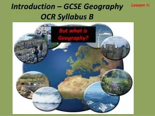
OCR GEOGRAPHY B. COASTS. QUESTIONS FOR INVESTIGATION. How do systems ideas help us to understand physical processes? What processes and factors are responsible for distinctive coastal landforms? Why is the management of coastlines becoming increasingly important?.

E N D
OCR GEOGRAPHY B COASTS
QUESTIONS FOR INVESTIGATION • How do systems ideas help us to understand physical processes? • What processes and factors are responsible for distinctive coastal landforms? • Why is the management of coastlines becoming increasingly important?
Why is the coast called a multi-use resource? • Over 4 billion people live in coastal areas and this number is expected to rise rapidly in the next 50 years. • This means it is very important for us to be able to understand the physical processes and economic demands which shape this land
Why is the coast called a multi-use resource? Coastal areas are a valuable resource for: • Industrial Development: coasts can offer large areas of flat land and access to shipping for the import of raw materials and the export of the finished product • Transportation: growing industrial globalisation and trade has meant industrial ports are increasingly important. Also the growth in cruise holidays has seen some ports grow • Recreational Activities: increasing wealth and leisure time have increased the demand for water sport activities
Why is the coast called a multi-use resource? • Residential Development: coastal areas are seen as attractive places to live because of the scenery and the recreational activities they can offer • Nature Conservation: salt marsh and sand dune habitats are important environments for rare plant and animal species
How are coasts shaped by physical processes? THE COASTAL SYSTEM EROSION AND WEATHERING TRANSPOTATION DEPOSITION
How are coasts shaped by physical processes? MARINE EROSION • ABRASION: during heavy storms waves have the energy to pick up large amounts of sand and pebbles. These are thrown against the rock and erode the land away • HYDRAULIC PRESSURE: where the waves break against the base of the cliff the sheer force of water hitting the cliff breaks of pieces of rock and erodes the cliff • ATTRITION: sand particles and pebbles collide against each other and are broken down into smaller pieces
How are coasts shaped by physical processes? COASTAL WEATHERING • SOLUTION: sea water is corrosive and will slowly dissolve chalk and limestone. Salt crystals are formed as the water evaporates, these crystals grow in size causing the rock to break • WETTING/DRYING: softer rocks such as clay expand and contract as they become wet and dry out. This weakens the rocks and the rock can crumble due to erosion • MASS MOVEMENT: rock falls, mudslides and landslides are common features of cliff coastlines because of waves weakening the base of the cliff and sub-aeriel processes at the top of the cliff
What landforms are associated with destructive coastlines? • As waves approach the shore they pick up sediment. Breaking waves force water and sediment up a beach as SWASH when gravity pulls it back down a beach it is known as BACKWASH • Waves which remove sediment from a beach are called DESTRUCTIVE WAVES because the remove a lot of material and create a high level of hydraulic action
How does he sea transport material? The sea transports material it has eroded by a process known as LONGSHORE DRIFT
How are coastal land forms created by deposition? • Waves that deposit sediment are referred to as CONSTRUCTIVE WAVES because they help to build up beach material often producing wide, flat beaches that are important to the tourism industry
How are coastal land forms created by deposition? THE FORMATION OF SPITS AND BARS Spits and bars are ridges of sand and shingle that have been formed by material deposited by breaking waves. They usually develop where: • Large amounts of sediment are being moved along the coast by longshore drift • There is a sudden change in the direction of the coastline • The sea is shallow enough to allow the deposited matrial to reach the surface
How are coastal land forms created by deposition? • Where deposited material joins up two land areas this landform is called a TOMBOLO
How does the coastline provide a natural defence against flooding? • The coastline has always provided an important buffer zone between the sea and the surrounding lowlands • Coastal salt marshes and mangrove forests provide a natural barrier against storms, absorbing wave energy and providing a barrier against high tides • With rising sea levels Sustainable Management of coastlines will become increasingly important
How does removing coastal wetlands increase the risk of flooding? • In many areas of the UK salt marshes have been drained for farming or development • This drained land is then protected by a sea wall. At high tide the sea will often reach the sea wall and may eventually collapse • In extreme cases this has been blamed for increasing the impact of many natural disasters such as the 2004 Thailand tsunamis
How can coastal areas be protected? • Hard engineering: controls the sea by building barriers between the sea and the land, or forces the wave to break before it reaches the land • Soft engineering: works with the natural environment by protecting the beach so the beach can absorb the waves energy before it reaches the land • Managed retreat: involves allowing the sea to flood inland until it reaches higher land, where the natural shape of the land will prevent any further flooding
How can coastal areas be protected? REVETMENTS Sloping ramps that face the sea and absorb the waves energy
How can coastal areas be protected? RIP-RAP (ROCK ARMOUR) Large boulders piled up in front of cliffs or sea walls
How can coastal areas be protected? SEA WALL A concrete barrier that protects areas from wave attack and flooding. The curve deflects the energy
How can coastal areas be protected? GABIONS Wire cages filled with rocks and stacked to form a barrier against the waves
How can coastal areas be protected? OFF-SHORE BREAKWATER (REEF) Rock structures are built parallel to the coast and force the wave to break before it reaches the land
How can coastal areas be protected? GROYNES Wooden or concrete barriers built at right angles to the beach. They both absorb the waves energy and rap sediment behind them to maintain the beach
Case Studies • Blakeney Point, Norfolk: natural sea defences • Pevensey Bay, East Sussex: sustainable coastal management • Cuckmere Estuary, East Sussex: coastal flood protection