Download
1 / 16
160 likes | 167 Views
CE 394 – GIS in Water Resources. Rio Bravo – Rio Grande Water Resources Simulation Exercise Jason Batchelor EWRE – LBJ Joint Degree. Rio Bravo – Rio Grande. Outline Background Purpose Model / Simulation Theory GIS Work Methods Results Future Work Questions. Background.

E N D
CE 394 – GIS in Water Resources Rio Bravo – Rio Grande Water Resources Simulation Exercise Jason Batchelor EWRE – LBJ Joint Degree Rio Bravo - Rio Grande Water Resources Simulation Exercise
Rio Bravo – Rio Grande • Outline • Background • Purpose • Model / Simulation Theory • GIS Work • Methods • Results • Future Work • Questions Rio Bravo - Rio Grande Water Resources Simulation Exercise
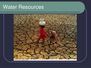
Background • Rio Bravo – Rio Grande is entirely adjudicated • Two treaties, 1906 & 1944, apportioned water between US & Mexico • Scope of this project is from Rio Conchos to Gulf; 1944 Treaty states amount of water to US shall “not be less, as an average amount in cycles of five consecutive years, than 350,000 acre-feet annually.” • Dispute over “Water Debt” • IBWC / CILA operate reserviors Rio Bravo - Rio Grande Water Resources Simulation Exercise
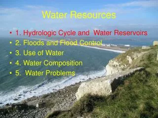
Geography Lesson • Major Features • Rio Bravo – Rio Grande • Reservoirs • Rio Conchos • Pecos River • Rio Salado • Border Cities Rio Bravo - Rio Grande Water Resources Simulation Exercise
Purpose • Use GIS as an integrated graphic display in a watershed modeling exercise. • In February 2002, the LBJ School of Public Affairs hosts a simulation exercise wherein, the United States and Mexico will examine water quantity and water quality issues along the Rio Bravo - Rio Grande. The exercise will utilize the OASIS water resources model to examine the operation of the river and reservoirs, as well as the decisions and interaction of the participants. Rio Bravo - Rio Grande Water Resources Simulation Exercise
Simulation Theory • Purpose is to generate dialogue and new approaches to problem solving. • Allows participants to make decisions and see the effects without repercussion. • First time many participants will be in the same room. • One month time steps, using historical meteorological and weather data to provide hydrological data. Rio Bravo - Rio Grande Water Resources Simulation Exercise
Model • OASIS with OCLTM, Hydrologics, Inc. developed and written by Dan Sheer • Models human behavior, rather than trying to maximize a system • Rules vs Goals • www.hydrologics.net Rio Bravo - Rio Grande Water Resources Simulation Exercise
GIS • Three Levels of Production 1. Base map with OASIS schematic 2. Display time step results for Irrigation Districts 3. Fully developed Graphic User Interface Rio Bravo - Rio Grande Water Resources Simulation Exercise
Why GIS? • OASIS, only outputs graphs & tables Rio Bravo - Rio Grande Water Resources Simulation Exercise
GIS – Base Map • Contacted Miguel Pavon, at the Border Information Center at TNRIS • Received shapefile of the basin • Problems with the data Rio Bravo - Rio Grande Water Resources Simulation Exercise
GIS - Problems Should be ovelapping Undefined Projection for rgbasin.shp Rio Bravo - Rio Grande Water Resources Simulation Exercise
GIS – Problem Solving Now to create and add all of the necessary data layers Rio Bravo - Rio Grande Water Resources Simulation Exercise
GIS – OASIS Schematic Excel .dbf table Latitude & Longitude in DD Display XY Event Rio Bravo - Rio Grande Water Resources Simulation Exercise
GIS – Multi-Layers Rio Bravo - Rio Grande Water Resources Simulation Exercise
Future Work • Irrigation Districts • Graphical User Interface Rio Bravo - Rio Grande Water Resources Simulation Exercise
Acknowledgements • Miguel Pavon, BIC at TNRIS • Tanya Hoogerwerf • Dr. Dan Sheer, Hydrologics • Dr. David Maidment • Dr. David Eaton, LBJ Rio Bravo - Rio Grande Water Resources Simulation Exercise