Download
1 / 9
90 likes | 190 Views
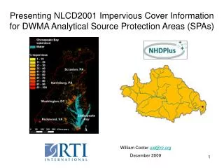
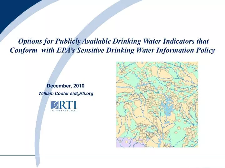
Options for Publicly Available Drinking Water Indicators that Conform with EPA’s Sensitive Drinking Water Information Policy. December, 2010 William Cooter sid@rti.org. Making Sensitive Information “Non-Sensitive”. Consider Several Alternatives:.

E N D
Options for Publicly Available Drinking Water Indicators that Conform with EPA’s Sensitive Drinking Water Information Policy December, 2010 William Cooter sid@rti.org
Making Sensitive Information “Non-Sensitive” Consider Several Alternatives: • (1) Develop Indicators for Sensitive Drinking Water Information Based on Suitably Large Polygon Units (HUC12s) • (2) Present Sensitive Drinking Water Information in Terms of Proximity to Non-Sensitive Information • (3) NHDPlus Aquatic Areas of Investigation (Aq-AORs) NEW!
(1) Develop Indicators for Sensitive Drinking Water Information Based on Suitably Large Polygon Units (e.g., HUC12s) Surface Water Facility Points within HUC12s The numbers of surface drinking water facilities (intakes, reservoirs, or springs) were determined for each HUC12 subwatershed. NOTE: Could also be implemented just presenting the number of drinking water SYSTEMS with source waters within HUC12s Example for Chesapeake Bay Basin
(2) Present Sensitive Drinking Water Information in Terms of Proximity to Non-Sensitive Information Could create a web service to generate proximity information for each RCRA LQG: Yes – within a SPA or No – not within a SPA
NEW(3) NHDPlus Aquatic Areas of Investigation (Aq-AORs) Currently being Implemented for CERCLA 108(b) Hardrock Mining Rule Development
NHDPlus Aquatic Areas of Investigation (Aq-AORs) for Indicator Development • Is a certain type of information present (Yes or No) within the Aq-AOR? • Proximity analyses could use surface and groundwater SPAs • Could apply a wide range of other cross-program information (much of which is already in the DWMA) • Could be applied for many types of point representations of EPA-regulated facilities • Indicator results can be generate nationally for rule development or status and trends tracking • NHDPlus-based Aq-AOR frameworks can also be applied on a site specific basis for management decisions for specific facilities
108b Mines/Facilities within Drinking Water Source Protection Areas(Surface Sources)
108b Mines/Facilities within Drinking Water Source Protection Areas(Groundwater Sources)
Options for Publicly Available Drinking Water Indicators that Conform with EPA’s Sensitive Drinking Water Information Policy December, 2010 William Cooter sid@rti.org