Download
1 / 84
870 likes | 1.1k Views
Key topic/Chapter 8.. .Political Geography. Key Terms:. Balance of power Boundary 3. City-state 4. Colonialism 5. Colony 6. Compact state Elongated state Federal state Fragmented state Frontier. 11. Gerrymandering 12. Imperialism 13. Landlocked state 14. Microstate

E N D
Key Terms: Balance of power Boundary 3. City-state 4. Colonialism 5. Colony 6. Compact state Elongated state Federal state Fragmented state Frontier 11. Gerrymandering 12. Imperialism 13. Landlocked state 14. Microstate 15. Perforated state 16. Prorupted state 17. Sovereignty 18. State 19. Unitary state
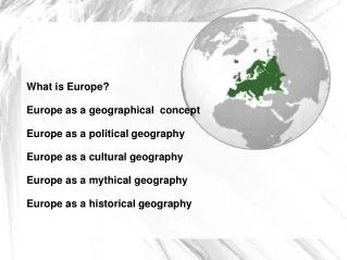
Political boundaries are not painted onto the surface of the earth yet they are often more real to people than any natural divisions like mountains or rivers. One of our Earth’s most fundamental cultural characteristics (and one we take for granted) is the division of our planet into a collection of spaces occupied by individual countries. Political Geography is the study of the location and organization of the earth’s surface into a collection of political units. Sixty years ago there were just over 50 countries in the world. As of 2011, there were 191 countries in the UN. New countries are being born (or attempts to create them) all the time. Depending on whose view you take, there are now 196. Chapter 8…Political Geography
The World in 1914. Most of the world was controlled by European countries. There were only 57 independent countries (states) in 1914.
Globalization has brought more connections between peoples around the world. However, this has not stopped (and has sometimes caused) friction between countries and cultural groups over political control of territory. Most of today’s wars are over differences in culture and greed for territory (and Nationalism). • State: A State is an organized political area ruled by an established government that has control over its own foreign and internal affairs. (The 50 United States are incorrect usages of the term.) A State occupies a defined territory and has a permanent population. A country is the same thing as a State. • Sovereignty: Independence from control of its internal affairs by other states. To truly be a State (country) you must have sovereignty. • There can be problems in defining states because other states may disagree that a state has the right to exist. N & S Korea, Vietnam (during the war in the 1950’s-1970’s) Israel and Palestine, China and Taiwan, are prime examples. • Microstates: Countries which are very small. The smallest state recognized by the UN is Monaco. (.6 square miles)
Luxembourg.Almost the size of New Jersey Monaco. The size of downtown Cleveland.
The Principality of Sealand. Is this really a country? http://www.sealandgov.org
What does it take to be a country? • Let's start with what defines a State or an independent country. • An independent State (another name for a country): • Has space or territory which has internationally recognized boundaries (boundary disputes are OK). • Has people who live there on an ongoing basis. • Has economic activity and an organized economy. A country regulates foreign and domestic trade and issues money. • Has the power of social engineering, such as education. • Has a transportation system for moving goods and people. • Has a government which provides public services and police power. • Has sovereignty, meaning it controls its own destiny. No other State should have power over the country's territory. • Has external recognition. A country has been "voted into the club" by other countries. Other countries recognize it as a country.
Nation: People of the same ethnicity or culture, for example Native American Cherokee Nation and German Nation. A nation differs from a country in that a country generally contains lots of ethnic groups and a nation might not have land of its own. Gator or Seminole Nation are non-official versions of a nation. A nation may or may not have land of its own. • Nation-State: A state (country) whose territory is occupied by ONE particular ethnicity (nation) and that country is theirs…ISRAEL or Japan. • Stateless nation: a nation without its own state; the Kurds in the Middle East. • Multi-state nation: a nation that stretches across more than one country; the Kurds in S Turkey and N. Iraq or the Arab Nation or the Koreans…one people politically divided into 2 countries. • Multinational-State: A state which has more than one LEGAL nation in it. Cypress and the UK are good examples.
Multiethnic state: State with more than one ethnicity. Most countries are multi-ethnic. Nationality: The country you legally belong to. City-state: Found mostly in the ancient world, a city-state is a country that is made up of a city and the surrounding farmland. Colony: A territory that is legally tied to a sovereign state rather than being completely independent. Puerto Rico, Guam and the US Virgin islands are example of U.S. colonies.
(Multi-state nation) State & Nation–Both the multinational state and the stateless nation situations have the potential for armed conflict
The Island of Cypress is an example of a multinational state with conflicts between the multinations. Though cypress is a country, the northern part is controlled by Turkey and the southern part by Greece. Turkey wants Cypress to be broken into two countries. Peace between the two groups is kept by British troops.
The break-up of a country: The once Multi-national state of Yugoslavia broke into various new states in the 1990’s. The break-up was bloody and painful.In Bosnia, the territory occupied by Bosnians and Serbs was so dis-contiguous that there was no way to divide the area along ethnic lines.
Colonialism: The planned effort by a country to establish settlements and to impose political, economic, and cultural control on a territory. The Europeans created a great boom of colonialism from the 1500’s to the late 1800’s. This was done to establish: 1. The spread of Christianity. 2. To provide resources and markets for the European’s economy and goods. 3. As an indicator of their power. The US joined this race for Colonies in the very late/early 1900’s. God, Gold, Glory. • Boundaries: An invisible line which marks the extent of a state’s territory. Boundaries result from a combination of natural physical features like rivers and mountains, and cultural features like languages and religion. Boundary locations often are difficult to set and frequently cause conflict. • Types of Boundaries: In earlier history, frontiers rather than set boundaries separated states. A frontier is a zone where no state exercises complete control. A boundary is a thin, invisible, imaginary line. (Where does your space end and the space of the person seating next to you begin?) A frontier area is either sparsely populated or uninhabited and so wasn’t important to most states. In our old west days of the 1800’s, most of the land out west was unclaimed (by white settlers or states ) for long periods of time. Today, almost all frontiers in the world have been replaced by set boundaries. Antarctica is the last frontier on the planet’s surface. • Boundaries are of two types: physical and cultural. Physical boundaries coincide with significant features of the natural landscape like water, mountains, and deserts, while cultural boundaries follow the distribution of cultural characteristics. Neither is better or more natural, and many boundaries are combinations of both. The best boundaries are those to which all parties involved agree.
Physical boundaries: Mountain boundaries are effective since they are difficult to cross and because they are rather permanent. Desert boundaries can also be effective as they are hard to cross and sparsely populated. Water boundaries (rivers, lakes, oceans) are the most common features used for boundaries. Water boundaries are usually in the middle of the water but sometimes are on one side or the other by agreement of the states involved. Rivers can change their course and sometimes this causes a problem. • Cultural boundaries: These are boundaries that coincide with differences in ethnicity, especially language and religion. If the boundaries of a state match the boundaries of an ethnic group it is a nation-state. Boundaries which do not follow some physical form are also considered to be cultural boundaries and they will be straight lines or some other geometric shape. Much of the border between the US and Canada is a line drawn at the 49 degree latitude line and doesn’t follow a physical course.
Rivers Make Poor Boundaries.The Missouri-Kansas boundary was originally surveyed along the midline of the Missouri River, but the river has since shifted to a new course. A similar situation exists between Illinois and Missouri along the Mississippi River.
NATURAL BOUNDARIES • Natural Boundaries are those on recognizable physical features, such as mountains, rivers, lakes. • Even though these natural boundaries seem like a good idea, in practice there are problems. • Along mountain ranges – China and India • Along rivers – Mississippi • ARTIFICIAL BOUNDARIES • The alternative to natural boundaries are geometric boundaries or artificial boundaries. • Mason-Dixon Line • An antecedent boundaryis one drawn before an area is well populated and prior to the cultural landscape features. • The 49th parallel separating the U.S. and Canada • Boundaries drawn after the development of the cultural landscape are termed subsequent boundaries. • There are two types of subsequent boundaries. • Consequent boundary– which is a border drawn to accommodate existing cultural differences • (Northern Ireland and Ireland). • A Superimposed Boundaryis a boundary imposed on an area by a conquering or colonizing power that is unconcerned about pre-existing cultural patterns. Europeans did this to Africa in the 1800’s. • Irredentism is when ethnicities in separate countries seek to reunite. This causes conflicts. • RELICT BOUNDARIES • A relict boundaryis a former boundary line that once had meaning but no longer functions as such, usually marked by landscape features (forts, castles). The Roman Empire’s old boundaries. • The abandoned castles dotting the frontier zone between Wales and England is a relict boundary.
Geometric boundaries: boundaries which follow some latitude or longitude line or which follow some agreed upon course that is not physical. The 600 mile border between Chad and Libya is a straight line drawn across the desert. • Religious boundaries: Although religious differences often coincide with boundaries between states, only a few cases of this were actually planned this way. When the British turned over ownership of South Asia to India and Pakistan, the British used the differences in the religions of Hinduism and Islam to make the border. Ireland and Northern Ireland are similar examples.
Antecedent, cultural geometric border Subsequent Physical border US/Canadian border at the 49th parallel. This is an antecedent, cultural and geometric border.
US/Canada border marker in the rocky mountains between Montana and Canada. No one here for miles and miles.
Language boundaries: Language is an important cultural characteristic for drawing boundaries, especially in Europe. European languages have such formal lines of spelling and grammar that they make good ways to distinguish different nationalities. However, just because people don’t speak the same language or just because they do, that doesn’t mean they will make one good country or that they should be separated into more than one. • Boundaries inside states: Another important aspect of boundaries is that they often exist inside states to separate certain sections of the state for some particular use. These include American states like FL, NY, etc., also counties, cities, and voting districts. At the country level, today‘s modern State governments are organized into two main types: Unitary or Federal States. Confederation is a 3rd type but rarely used. • Unitary States: Unitary states are states whose government’s power is mostly in one place. This is usually the capitol city where most or all decisions for the entire country are made. France is a good example of a unitary state. The national government dominates local government giving the local government little power.
Democracy: There is no one person in charge. Citizens control. In a pure democracy every citizen votes on everything. Representative democracy: Citizens elect representatives to make the decisions for them. Citizens have the right to change the representatives. Citizens may elect a person to be in charge. This is also know as a republic. Monarchy: Rule is by a king with a royal family Dictatorship: Rule is by one person who rules as they wish for as long as they wish/can. Anarchy: No government exists. Rule is by whoever has the most/biggest weapons. Totalitarian government: Government has complete rule over the people. Total control in what the people say and do.
U.S. Government The Government of the US is not Unitary. Power is divided between the National government and local governments. This is the federal system. • Federal: • strong central government • some power given to regional and state governments • Republic: • elected representatives • written constitution • not a monarch Confederate: form of government could be both Federal and Republic but the key point is that the places agreeing to belong to this country reserve the right to leave it at anytime if they don’t like the way things are going. Confederate states usually don’t last very long. Why?
Federal States: Federal states divide government’s power between a national government and a local one. The national government has some power and the local governments have the rest. The US is the first Federal government in history and our system has spread throughout the world. • Five basic shapes of states: Compact, prorupted, elongated, fragmented, and perforated. • Compact States: These are very efficient states as the distance from the center to any boundary does not vary greatly. The capitol is often (but not necessarily) close to the center of the country which makes for easier communication (France, Uganda). • Prorupted States: A state which may be compact except for a large projecting extension sticking out from the main body of the country. This happened usually because of the state trying to gain access to something or to disrupt a rival state from having something (Democratic Republic of the Congo, Namibia). The strip often becomes an area of argument between countries.
Elongated States: States which are long but narrow. (Chile, Gambia) Elongated states may suffer from communication problems. • Fragmented States: A fragmented state contains several discontinuous pieces of territory. There are two kinds of fragmented states; those with parts separated by water and those with parts separated by other states. (Indonesia, Alaska) • Perforated States: A state that completely surrounds another one is a perforated state. South Africa and Lesotho are the best examples. • Landlocked States: Are states which have no access to a sea without passing through another state’s territory. (Lesotho, Zambia, Bolivia) These states are at the mercy of other states for transportation of goods. Conflicts are very possible.
shapes Shapes of States Which is perforated, South Africa or Lesotho? Lesotho is also Landlocked. Enclave
Because of their panhandles, both West Virginia and Florida are ____________ answer… Namibia's panhandle connects with the Zambezi river. (Prorupted)
Exclaves:An enclave is defined in international law as any portion of a state that is entirely surrounded by the territory of another state.Exclaves may be difficult to maintain or to protect from being taken over by the country which surrounds them.
Kaliningrad belongs to Russia. It is another example of a exclave.
Café on the border between The Netherlands and Belgium…Dutch laws require the Dutch side to close one hour before the Belgium side.
Elongated states Compact states Mini-states Micro-States (enclaves)
Fragmented States Prorupt State Perforated & Fragmented State
National core areas from which nation-states developed Fragmented States Elongated states Landlocked mini-states: Andorra, Liechtenstein, Luxembourg. Landlocked micro-states: San Marino, Vatican City Compact states Landlocked States Prorupt State Mini-states Perforated & Fragmented State Micro-States (enclaves)
Nationalism: Double-edged sword. • Nationalism can bring a people together and provide a strong centripetal force holding the country together in a nation-state. Pride in your nation, culture. History together. • Nationalism, particularly when carried to extremes, can be a divisive, centrifugal force working to tear a country apart when it is exercised in a multi-national state. Different nations sometimes want their own state. • When a nation occupies a rather contiguous territory within a multi-national state, that can make separatist movements more likely to develop and/or succeed.
In Yugoslavia, hatredshad been passed from one generation to the next. With the end of the totalitarian communist system, ethnic hatreds surfaced and led to violence and independence movements tearing Yugoslavia apart in the 1990’s
The break-up of a country: The once Multi-national state of Yugoslavia broke into various new states in the 1990’s. The break-up was bloody and painful.In Bosnia, the territory occupied by Bosnians and Serbs was so dis-contiguous that there was no way to divide the area along ethnic lines.
Geography and voting; Electoral Geography: Voting to pick your leaders is one of the most important things that happens in modern countries. How many representatives each state or area gets to send to the government is another. How much power you have in government depends on your area or state populations. What happens when the population of a state or area changes? Voting districts: In our government system, local areas are divided into voting districts based on roughly equal populations. Each district gets to elect a representative to the state government. IF THE MAJORITY OF VOTERS WITHIN THE DISTRICT ARE FROM ONE PARTY THIS GIVES THAT PARTY AN ADVANTAGE IN THE ELECTION. To keep the districts fair, they are redrawn after each 10 year census. (The dominating party in the state legislature handles this process.) Remember, each district should be about the same size in population and there is an advantage to your party if there are more voters from your party in the district. Redrawing the districts to benefit the party in power is called… Gerrymandering.
Gerrymandering? The purpose of Gerrymandering is for one party to control the election by deciding who votes in which district. By making sure that your party has more voters in the district than the other party, you should win the election. Notice Massachusetts district #4 (yellow). Why is it so curved and only slightly connected in several places? In most states the boundaries of the districts are redrawn every 10 years (after the US census population statistics are known) by the party who controls the state legislature.
Voting district population laws say that each district must be about the same size in population and that all of it has to be continuous…it all touches (no exclaves). LA’s voting districts meet those rules, but could there still be some Gerrymandering?
Three types of Gerrymandering: 1. “Wasted vote” spread the opposite parties’ members out throughout many districts so they are always the minority. 2. “Excess vote” put all of the opposition parties’ voters into a few districts. (You win 5 districts they win 3, you outnumber them.) 3. “Stacked vote” link likeminded voters together by wildly shaped boundary lines. • The U.S. Supreme Court ruled Gerrymandering to be illegal but it still continues, for as long as a state legislature doesn’t make it obvious, they can set their districts the way the party in power wants them to be. Geography matters in elections.
Geopolitics in the election of a president. What states are most important to spend your time and $ in?
Quiz yourself: A mountain is an example of a _____ boundary. religious, physical, cultural, language, geometric. 2. 60 years ago there were just over _____ countries in the world. 3. In our government system, local voting areas are divided into ______ _______ based on roughly equal populations. 4. The two main types of boundaries are physical and _________. 5. To truly be a state (country) a place must have ___________. 6. A state (country) whose territory is occupied by ONE particular ethnicity and that country is theirs…ISRAEL…is a ______-_______ 7. A territory that is legally tied to a sovereign state rather than being completely independent is a __________ 8. A ________ state contains several discontinuous pieces of territory. 9. A state that completely surrounds another one is a ________ state. 10. The type of government in which some power is given to separate regions of the country. The countries' power is split between a national and local governments. 11. Boundaries which follow some latitude or longitude line or which follow some agreed upon course that is not physical. 12. One political party trying to cheat in elections by creating the voting district boundaries to help their party win.
Answers: 1. Physical 2. 50 3. Voting districts 4. Cultural 5. Sovereignty 6. Nation state 7. Colony 8. Fragmented 9. Perforated 10. Federal 11. Antecedent 12. Gerrymandering
Political Geography and Controlling the World: • Geopolitics: Area of Human Geography that attempts to explain by looking at space and place, why some countries are powerful and others are not. Geopolitics looks for spatial reasons for the importance of places on the earth. (Why is the Persian Gulf so important? Why is California so important in an US election for president?) • Chokepoints: Areas on the planet which are extremely important because control of that spot controls some important resource or transportation point. (Panama Canal) • Mahan’s “The Influence of Sea Power Upon History.” The first book to explore the importance of sea power to the life of a country. Countries with powerful navyscontrol the world. He wrote this in the late 1700’s.
From these points, much of the world’s supply of oil can be cut off. The US keeps military bases and naval ships near these locations at all times.
Oil has been discovered in the waters of the Spratly’s…this area could become an area of conflict between China, Japan, Vietnam and The Philippines.
Geopolitics in the Middle East: Who wants the US to keep power in the Middle East? Who wants the US out of the region? Many Middle Eastern countries want us out of the region while many want us to stay. Geopolitics at work.
Theories of Geopolitics: • Ratzel’s “Organic theory.” The geopolitical belief that a country is like a living organism which has to keep growing to survive. Countries are in competition with other countries for things like raw materials, food, and goods. Ratzel’s ideas were used by the Nazi’s to explain that the German’s had to conquer the world. • Mackinder's “Heartland theory.” The early 20th century belief that the land stretching from Europe to Asia (Eurasia or Russia) controls the earth because railroads could move goods and troops faster than ships. • Spykman’s “Rimland theory.” This theory says that the area surrounding the “Heartland” is more important. Control the oceans and seacoasts from Europe to Asia and you control the world. This theory was very important during our “Cold War” with The Soviet Union from the 50’s to the 90’s. It explains why we were involved in the Vietnam and Korean wars and why we keep military bases in Europe and the Middle East.
Mackinder’s Heartland …….Heartland….. Rimland Spykman’s Rimland