Download
1 / 3
0 likes | 4 Views
In the dynamic world of architectural design and construction, technological advancements continually redefine the boundaries of creativity and precision. One such groundbreaking integration that has reshaped the industry is the fusion of Point Clouds and Scan to CAD processes within Autodesk Revit.

E N D
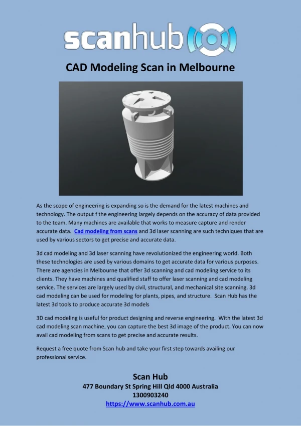
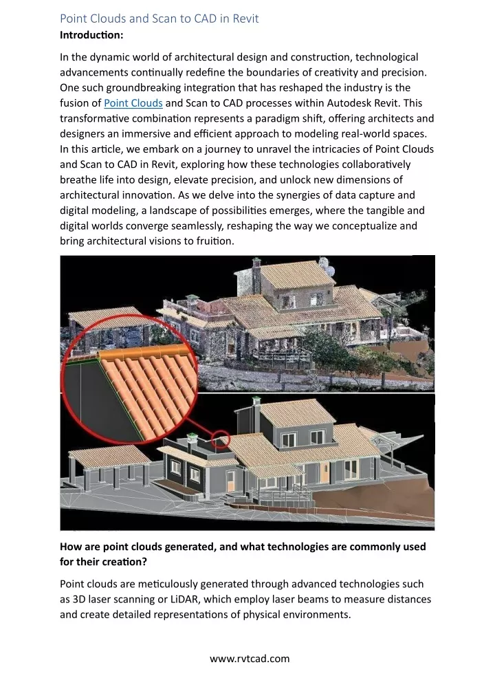
Point Clouds and Scan to CAD in Revit Introduction: In the dynamic world of architectural design and construction, technological advancements continually redefine the boundaries of creativity and precision. One such groundbreaking integration that has reshaped the industry is the fusion of Point Clouds and Scan to CAD processes within Autodesk Revit. This transformative combination represents a paradigm shift, offering architects and designers an immersive and efficient approach to modeling real-world spaces. In this article, we embark on a journey to unravel the intricacies of Point Clouds and Scan to CAD in Revit, exploring how these technologies collaboratively breathe life into design, elevate precision, and unlock new dimensions of architectural innovation. As we delve into the synergies of data capture and digital modeling, a landscape of possibilities emerges, where the tangible and digital worlds converge seamlessly, reshaping the way we conceptualize and bring architectural visions to fruition. How are point clouds generated, and what technologies are commonly used for their creation? Point clouds are meticulously generated through advanced technologies such as 3D laser scanning or LiDAR, which employ laser beams to measure distances and create detailed representations of physical environments. www.rvtcad.com
Terrestrial Laser Scanning (TLS) and Mobile Laser Scanning (MLS) involve stationary or mobile scanners, respectively, capturing multiple scans to compile a comprehensive point cloud. Airborne LiDAR and satellite LiDAR leverage aerial platforms to emit laser pulses and gather 3D data on a larger scale. Photogrammetry, utilizing Structure from Motion (SfM) with overlapping photographs, contributes to dense point clouds. Time-of-Flight (ToF) cameras emit infrared light pulses, while underwater sonar technology maps submerged structures and terrain. The choice of technology depends on factors like project scale, required detail, and the scanning environment. Continued advancements in these technologies continually refine the precision and efficiency of point cloud generation, making them indispensable across various applications, from architectural design to environmental monitoring and industrial inspections. SCAN TO CAD: Scan to CAD services involve the conversion of raw point cloud data, acquired through advanced scanning technologies like laser scanning or LiDAR, into editable and usable Computer-Aided Design (CAD) models. This process is essential for translating real-world, physical environments into a digital format that can be manipulated, analyzed, and integrated seamlessly into various design and engineering applications. Scan to CAD services typically employ specialized software and skilled professionals to process large and complex datasets, ensuring accuracy and precision in the resulting CAD models. These services find widespread application in fields such as architecture, engineering, construction, and surveying, where the need for detailed and accurate representations of existing structures or landscapes is critical for effective planning, design, and decision-making. Scan to CAD services play a pivotal role in transforming the way professionals interact with and manipulate spatial data, offering a powerful toolset for creating, modifying, and optimizing digital designs based on real-world conditions. Primary purpose of the Scan to CAD process in the field of design and architecture: The primary purpose of the Scan to CAD process in the field of design and architecture is to bridge the gap between the physical world and the digital design environment. It involves converting three-dimensional point cloud data, obtained through laser scanning or other surveying methods, into a format compatible with Computer-Aided Design (CAD) software. This transformation allows designers, architects, and engineers to work with accurate and detailed representations of existing physical spaces in their digital models. www.rvtcad.com
The Scan to CAD process enhances precision, efficiency, and adaptability in the design workflow, providing a foundation for creating realistic and informed digital models that closely mirror real-world conditions. It is a crucial step in modern design practices, facilitating more accurate planning, analysis, and visualization throughout the entire lifecycle of a construction project. How they work together SCAN to CAD and POINTCLOUD in Revit? The seamless integration of Scan to CAD and point cloud technologies in Autodesk Revit represents a dynamic synergy that revolutionizes the architectural design process. Point clouds, generated through advanced scanning techniques, serve as a rich and detailed source of spatial information, capturing the intricacies of physical environments. Scan to CAD acts as the intermediary, translating this raw point cloud data into editable CAD models within the Revit environment. This transformative workflow empowers architects and designers to leverage the unparalleled precision of point clouds while working within the familiar and versatile platform of Revit. The integration facilitates the creation of highly accurate digital models that mirror real-world conditions, allowing for immersive visualization and informed decision-making. Designers can navigate existing structures, capture minute details, and seamlessly incorporate this data into their Revit projects, resulting in a more efficient and precise design process that bridges the gap between the physical and digital realms. CONCLUSION: In conclusion, RVTCAD the harmonious collaboration between Scan to CAD, point cloud technologies, and Autodesk Revit is reshaping the landscape of architectural design and digital modeling. Point clouds, acting as detailed 3D snapshots of physical environments, provide an unparalleled level of accuracy and realism. Scan to CAD, as the intermediary process, smoothly translates this wealth of data into editable and adaptable CAD models within the intuitive framework of Revit. This integration not only expedites the design process by eliminating manual measurements but also enhances precision and visual fidelity. With the capabilities of Revit, architects and designers can seamlessly navigate, analyze, and manipulate these detailed digital models, fostering a more immersive and informed design experience. www.rvtcad.com