Download
1 / 33
330 likes | 437 Views
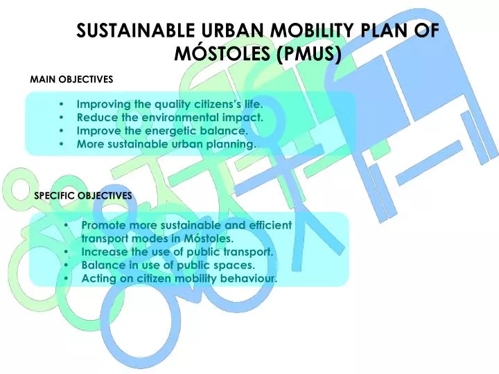
SUSTAINABLE URBAN MOBILITY PLAN OF MÓSTOLES (PMUS). MAIN OBJECTIVES. Improving the quality citizens’s life. Reduce the environmental impact. Improve the energetic balance. More sustainable urban planning. SPECIFIC OBJECTIVES.

E N D
SUSTAINABLE URBAN MOBILITY PLAN OF MÓSTOLES (PMUS) MAIN OBJECTIVES • Improving the quality citizens’s life. • Reduce the environmental impact. • Improve the energetic balance. • More sustainable urban planning. SPECIFIC OBJECTIVES • Promote more sustainable and efficient transport modes in Móstoles. • Increase the use of public transport. • Balance in use of public spaces. • Acting on citizen mobility behaviour.
227 Tn CO2 y 77,1 TeP 371 Tn CO2 y 125,7 TeP SUSTAINABLE URBAN MOBILITY PLAN OF MÓSTOLES (PMUS) ENERGETIC AND ENVIRONMENTAL ASSESSMENT OF PMUS • We achieve to reduce the contaminants emissions in 144 Tn de CO2 y 48,6 TeP
SUSTAINABLE URBAN MOBILITY PLAN OF MÓSTOLES (PMUS) CHARACTERISTICS OF MOSTOLES’S PMUS • Implementing measeures to promote the use of the rounds system, downloading traffic from Portugal Avenue. • Building a specific infraestructure to plubic transport (BUS, TAXI) like a reserved platforms (BUS platform thorugh the Portugal Avenue). • Optimizing existing surface parking and expanding the sypply of rotation and deterrence. • Promote drafting specific plans to develop the PMUS in several areas. Specific Plans • Implementing of Areas 20 y 30’s Plan. • Implementing the School Routes Plan. • Traffic Calming and safety road’s Plan. • Pedestrian routes’s Plan. • Bicycle Promotion Plan in the urban environment.
SUSTAINABLE URBAN MOBILITY PLAN OF MÓSTOLES (PMUS) STRENGHTS • The Mostoles’s PMUS affects all the urban environment including Coimbra Park, Industries and others minorities areas. • It promotes non-motorized modes such as walking and cycling. • Lower contaminant emissions. • As consequently, air quality will be increased. • The use of Rounds system of Móstoles will improve the traffic in our city. • Recovery the city centre for pedestrians and cyclists. • The implementation of PMUS will involve a change in the mentality of the people. WEAKNESSES • Economic situation
SUSTAINABLE URBAN MOBILITY PLAN OF MÓSTOLES (PMUS) • The first measure to develop PMUS was written the Areas 20 – 30’s Plan.
IMPLEMENTATION OF AREAS 20 y 30 IN MÓSTOLES CENTRE RESASONS FOR THE IMPLEMENTATION OF MEASURE I It’s based in the mobility analysis from Mostoles, wichi is pedestrian such as you can see in the following graphs:
IMPLEMENTATION OF AREAS 20 y 30 IN MÓSTOLES CENTRE REASONS FOR THE IMPLEMENTATION OF MEASURE II
IMPLEMENTATION OF AREAS 20 y 30 IN MÓSTOLES CENTRE REASONS FOR THE IMPLEMENTATION OF THE MEASURE III • As a result of the analysis of mobility in Móstoles, finally it was decided to implement in the city center a reverse priority area Reserved (APR) or Area 20; • Prominence total of pedestrian and bicycle mobility. • Dramatic reduction of pollutant emissions. • Ban on private vehicle access except for residents and emergency services. • Implementation of a surrounding area or approach to Area 20, transition, called Area 30, which coexists in public transport, cycling and private vehicle. • Energy savings.
IMPLEMENTATION OF AREAS 20 y 30 IN MÓSTOLES CENTRE I OBJECTIVES • Recover the center for pedestrians and bicycles. • Incentive the use of non-motorized transport modes such as walking and cycling. • Limit the use of private vehicles in the center. • Creating co-existence roads of motor vehicle, pedestrian and bicycle. • Reduce the speed of vehicles in those shared roads. • Important improvement of the accessibility. • Energetic savings. • Reduce the contaminants emissions. • Sustainable transports. • Recover the centre of the city to pedestrians and ciclysts. • Accessibility in the centre.
IMPLEMENTATION OF AREAS 20 y 30 IN MÓSTOLES CENTRE II SCOPE OF THE MEASURE
IMPLEMENTATION OF AREAS 20 y 30 IN MÓSTOLES CENTRE III HOW HAVE WE DONE? • It was therefore decided to implant in Móstoles two distinct areas: • Área 20 • Área 30 • Área 20: is an area for the coexistence of pedestrians and cyclists. • Área 30: is an area of coexistence between cyclists, public transport and private vehicles with pedestrian moblity perfectly guided through pedestrian routes.
IMPLEMENTATION OF AREAS 20 y 30 IN MÓSTOLES CENTRE IV ÁREA 20 DESCRIPTION • As mentioned before, we can define an Area 20 as an area without road traffic, for main use by pedestrians and bicycles. AREA 20’s SCOPE • It’s limited by a ring road formed by the streets shown below: • Ricardo Medem • Independencia • Reyes Católicos • Juan XXIII Av. • Cristo Str.
IMPLEMENTATION OF AREAS 20 y 30 IN MÓSTOLES CENTRE V ÁREA 20 CHARACTERISTICS OF AREA 20 • Speed is limited in all Area 20 to 20 km/h (kilometers per hour) • Platforms at or with minimal slopes, with a degree of accesibility close to 100%. • Accesibility. • Well conected by public transport: Metro station of L12: Pradillo. • Entrance signaling to Area 20. • Informative signage of pedestrian routes. • Limited access to private vehicles (only residents, municipal services, Freight loading and unloading and emergency). • Installation of bicycle parkings. • Implemmentation of a camera management system and license plate readers. • Future regulation of surface parking. • Future construction of an underground car parking next to the Pradillo Square.
IMPLEMENTATION OF AREAS 20 y 30 IN MÓSTOLES CENTRE VI ÁREA 20 MAIN ELEMENTS OF AREA 20 • Access Gates to Area 20. • Platforms at or with minimun slope. • Specific signaling both area 20 as starting-to pedestrian routes. • Bicycle parkings. • System access management at Area 20.
IMPLEMENTATION OF AREAS 20 y 30 IN MÓSTOLES CENTRE VII STRENGHTS • The works of redevelopment and pedestrianization of the historic center are already implemented 90 %. • The current state allows pedestrians and bicycles to move at the same level and sometimes with separate platforms with minimal slopes. • Accessibility degree close to 100%. • Economy measures and remaining work to be perfomed in order to complete the Area 20. • Reducing pollution in the historical district, due to the limitation of the motor vehicle. • Priority for pedestrians and bicycles. • Intermodality metro, biccycle, pedestrian in Pradillo Metro Station. • Stimulation of economic activity of the historical centre.
IMPLEMENTATION OF AREAS 20 y 30 IN MÓSTOLES CENTRE VIII WEAKNESSES • Problems with the accesss management system at Area 20 (detection and identification).
IMPLEMENTATION OF AREAS 20 y 30 IN MÓSTOLES CENTRE IX ÁREA 30 DESCRIPTION SCOPE • Area 30 is an Area surrounding the Area 20, in which it’s promoted the coexixtence between bicycles and motor vehicles, potentiating walking routes, which serve to pedestrian mobility which converge in Area 20. • Constitución St. • S. Marcial St. • Canarias St. • Palmas St. • Arroyomolinos St. • Huesca St. • Logroño St. • Zaragoza St. • Asturias St. • Juan de Ocaña St. • Portugal Av. • It includes roads that are within the permiter of the Area, which is bounded by the streets listed on the last list.
IMPLEMENTATION OF AREAS 20 y 30 IN MÓSTOLES CENTRE X ÁREA 30 CHARACTERISTICS OF AREA 30 • Speed limited to 30 km/h. • Existence of gates in and out the area specially marked to warn drivers of the enrance to an area of the city completely different from the rest. • Installing traffic calming elements compatible with urban aesthetics. • Platforms at different levels, separating sidewalk pavements. • Motor vehicles, public transport and bicycles in the same platform. Coexistence. • Accessibility at pedestrian crossings, footpaths, bus shelters and street furniture. • Existence of an important P&R underground parking at Herta Barracks Park which has over 800 spaces. • This aread is crossed by a network of adaptated pedestrian routes, which channel pedestrian mobility through Area 30. • Specific signaling for squares and pedestrian routes. • Installation of bicycle parkings. • Future implemmentation of a regulatory system of surface parking.
IMPLEMENTATION OF AREAS 20 y 30 IN MÓSTOLES CENTRE XI ÁREA 30 MAIN ELEMENTS OF AREA 30 • Entrance’s Gates from Area 30. • Bicycle streets. • Pedestrian routes. • Bicycle’s parkings.
IMPLEMENTATION OF AREAS 20 y 30 IN MÓSTOLES CENTRE XII ÁREA 30 PEDESTRIAN ROUTES • They are paths generally radially, which end at Area 20 or Móstoles historic center, starting from differents parts of the city. They serve to channel pedestrian traffic. • Adaptated to normative’s specifications. • Informative signaling referent to: • Initial-ending signaling. • Continuing the route. • Squares, Parks.
IMPLEMENTATION OF AREAS 20 y 30 IN MÓSTOLES CENTRE XIII ÁREA 30 IDENTIFICATION OF PEDESTRIAN ROUTES IN MÓSTOLES
IMPLEMENTATION OF AREAS 20 y 30 IN MÓSTOLES CENTRE XIV ÁREA 30 STRENGHTS • Economy in the implementation of the measures, by not having to make major infraestructure works. • Allow traffic calming environment in the Old Town (historic centre)or Area 20. • Coexistence of private vehicles, public transports and cycling on the same platform. Bicycle streets. • Enhancing pedestrian mobility to create the network of pedestrian routes, which are accessible. • Reducing contaminant emissions by encouraging the use of bicycles and public transport versus private car. • Reducing of pullutant emissions such as CO2, hydrocarbons, noise, vibration.. • Increase energy efficiency.
IMPLEMENTATION OF AREAS 20 y 30 IN MÓSTOLES CENTRE XV AREA 30 WEAKNESSES • Excessive speed of vehicles at certain points of Area 30, which are difficult to control and therefore need special attention.
IMPLEMENTATION OF AREAS 20 y 30 IN MÓSTOLES CENTRE XVI • The Areas 20 and 30 Plan’s is complemented with School routes’s Plan, whose works are executing at the moment in Móstoles.
SCHOOL ROUTES REASONS FOR THE MEASURE DATES TO START • Currently Móstoles has nearly 206.000 inhabitants, of which 30.555 are students. • 17.268 primary school students. • 7.245 secondary education students. • 3.509 in high school. • So there are more than 35.000 daily trips to schools in the city
SCHOOL ROUTES REASONS FOR THE MEASURE PROBLEMS WHICH ARE DETECTED • Along the time, many problems have been detected in the sorroundings of schools: • Road safety problems. • Pedestrian crossings unadaptated. • Mobility problems for public transport. • Lack of traffic lights at some intersections and crosswalks.
SCHOOL ROUTES I OBJECTIVES • Energetic savings. • Eliminate the congestion round the schools. • Raise the security of children because of a implementation of signals, traffic lights, urbanization works in schools areas to improve their access, and other measeures. • Promotion of walking to school. • Less car use at peak times. • Road safety. • Eliminate the congestion problems. SCOPE OF PLAN • CEIP ALONSO CANO • CEIP ANDRÉS SEGOVIA • CEIP BEATO SIMÓN DE ROJAS • CEIP CELSO EMILIO FERREIRO • CEIP LAS CUMBRES • CEIP PÍO BAROJA • CEIP ROSALÍA DE CASTRO
SCHOOL ROUTES II HOW WAS IT DEVELOPED? GENERAL PHASES • Meetings, interviews and surveys with teachers, parents and students. • The information gathered in the previous phase, thorughly analyzed, thereby allowed the analysys of mobility in two areas: On the routes to the College and the College environment. • General solutions for routes were proposed as well as specific solutions for Colleges sorruondings. • Data collection. • Mobility analysis. • Diagnose of the main problems. • Solutions.
SCHOOL ROUTES III PROPOSED SOLUTIONS • The main solutions proposed in the are of the routes are the following: • Establishing a meeting point where different routes converge. • Horizontal signaling pathways, so that children can easily identify them. • Implementation of the “Friendly Shop”. • Implementation Pedibús.
SCHOOL ROUTES IV PROPOSED SOLUTIONS • 2. The following solutions are proposed in the area of the centers: • Build overpasses to ensure access to sidewalk level of the children. • Installation, in certain cases, traffic lights at pedestrian crossings button with poor visibility. • Urbanice several access to schools. • Installing protective fences in those intersections beacuse of its proximity to the centers and traffic density can be considered dangerous. • Implementation of traffic calmed measures. • Installation of vertical signals. • Installation of bicycle parkings.
SCHOOL ROUTES V STRENGHTS • High level of participation in preparing the study by parents, teachers and students. • Simplicity of implementation. • Simple works. • Accesibility. • Economics. • Awareness of students and parents in promoting more sustainable modes of transport to go to the school. • Involvement of the schools in the mobility of their students. • Involvement of neighboring shops in the program.
SCHOOL ROUTES VI WEAKNESSES • High level of private vehicle’s mobility. • As a result of this, double parking persists sometimes causing problems of mobility in the school surroundings. • Pedibús: Problems in its implementation due to the responsibilities assumed by parents volunteers.
VISIT US IN OUR WEB SITE: http://www.mostoles.es/Plan_Movilidad/esTHANKS FOR YOUR ATTENTION