Download
1 / 44
440 likes | 560 Views
Climate change and Urban Vulnerability in Africa. Assessing vulnerability of urban systems , population and goods in relation to natural and man-made disasters in Africa. Course on Hazard , Risk and ( Bayesian ) Multi-risk assessement Napoli 10/24/2011 – 11/ 11 /2011.

E N D
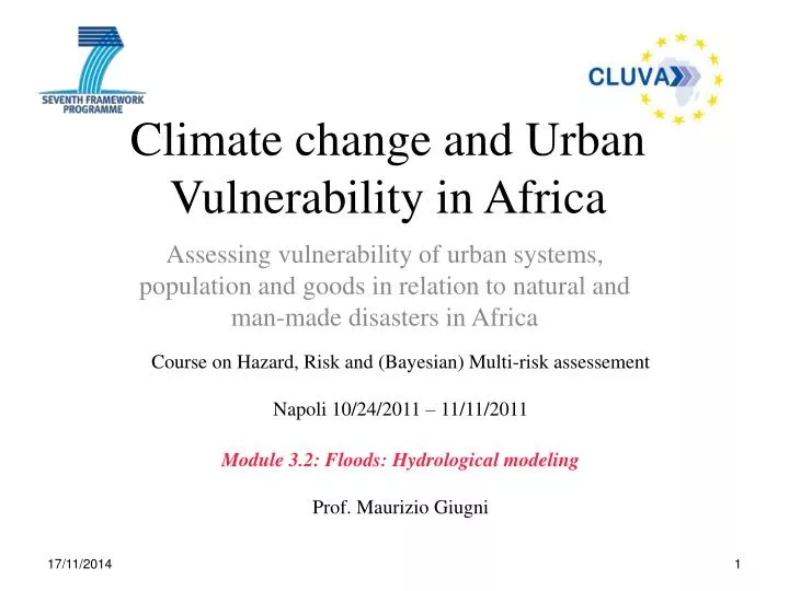
Climate change and Urban Vulnerability in Africa Assessingvulnerability of urbansystems, population and goods in relation to natural and man-made disasters in Africa Course on Hazard, Risk and (Bayesian) Multi-riskassessement Napoli 10/24/2011 – 11/11/2011 Module 3.2: Floods: Hydrological modeling Prof. Maurizio Giugni
the hydrologiccycle Maurizio Giugni
Precipitation is water released from clouds in the form of rain, freezing rain, sleet, snow, or hail. It is the primary connection in the water cycle that provides for the delivery of atmospheric water to the earth. Most precipitation falls as rain. Evaporation is the process by which water changes from a liquid to a gas or vapor. Evaporation is the primary pathway that water moves from the liquid state back into the water cycle as atmospheric water vapor. Studies have shown that the oceans, seas, lakes, and rivers provide nearly 90 percent of the moisture in the atmosphere via evaporation, with the remaining 10 percent being contributed by plant transpiration. Maurizio Giugni
Transpiration. Plants put down roots into the soil to draw water and nutrients up into the stems and the leaves. Some of this water is returned to the air by transpiration. Transpiration rates vary widely depending on weather conditions, such as temperature, humidity, sunlight availability and intensity, wind,precipitation, soil type and saturation, and land slope. Surface runoff is precipitation runoff over the soil surface. When rain hits saturated or impervious soils it begins to flow overland downhill. Surface runoff is affected by both meteorological factors and physical geology and topography of the land. Surface runoff can also be diverted by humans for their own uses. Maurizio Giugni
Some of the precipitation infiltrates into the soil (ground waters). Some water travels close to the soil surface and emerges very quickly as discharge into streambeds, but, because of gravity, much of it continues to sink deeper into the ground. As the figure shows, the direction and speed of groundwater movement is determined by the various characteristics of aquifers and confining layers of subsurface rocks. Water that infiltrates in depth depends on the permeability (how easy or difficult it is for water to move) and on the porosity (the amount of open space in the material) of the subsurface soils. Ground-WaterDischarge Maurizio Giugni
Factors affectinginfiltration • Precipitation: The greatest factor controlling infiltration is the amount and characteristics (intensity, duration, etc.) of precipitation that falls as rain or snow. • Evapotranspiration: Some infiltration develops near the soil surface, where plants put down their roots. Vegetation needs this shallow ground water to grow, and, by the process of evapotranspiration, water is moved back into the atmosphere. • Soil characteristics: Some soils, such as clays, absorb less water at a slower rate than for example sandy soils. Soils absorbing less water result in more runoff overland into streams. • Soil saturation: Like a wet sponge, soil already saturated from previous rainfall can't absorb much more, thus more rainfall will become surface runoff. • Land cover: Some land covers have a great impact on infiltration and rainfall runoff. Vegetation can slow the movement of runoff, allowing more time for it to seep into the ground. Impervious surfaces, such as parking lots, roads, and urban infrastructures, act as a "fast lane" for rainfall that drains directly into sewers or streams. Agriculture and the use and management of soil also changes the infiltration patterns of a landscape. • Soil slope: Water falling on steeply-sloped soils obviously runs off more quickly and infiltrates less than water falling on flat soils. Maurizio Giugni
The hydrographic drainage basin is an area where surface waters from rain and melting snow or ice converge to a single point (closure section), usually the exit of the basin, where the waters join another water body, such as a river, lake, reservoir, estuary, wetland, sea, or ocean. DrainageBasin Maurizio Giugni
BasinmainCharacteristics • Area S [Kmq] • Lengthofmainchannel [Km] • Medium Slope • Drainage density DD • where: • li i reach length • Pi i reach slope Maurizio Giugni
Average HEIGHT Hm Maurizio Giugni
BasinCharacteristics Soiltexture Landuse Maurizio Giugni
Rainfall Runoff Drainage basin Rainfall-Runoff Model Rainfall-runoffmodel Maurizio Giugni
Rainfall RainfallProbability Curve • h: rainfall height (mm) • t: rainfall duration (hours) • T: return period (years) • t: mean value of annual maximum rainfall heights of duration t • KT: “growth” rate, independent on duration t and dependent only on return period T and probabilistic model used (Gumbel, Pearson, TCEV, etc) Maurizio Giugni
Rational formula Qp = k C i A where k = unit conversion factor = 1/3.6 Qp = peak discharge (m3/s) i = critical rainfall intensity (mm/h) A = drainage area (km2) C = runoff coefficient i = average intensity of rainfall corresponding to a duration equal to time of concentration. Maurizio Giugni
Runoffcoefficient Maurizio Giugni
Timeofconcentration S drainage area [kmq] L lengthofmainchannel [km] Hmaveragealtitude [m] tc [h] Giandotti (Italy) Maurizio Giugni
example Qp = k C i(t) A • Case t = tc Q0 = 0 Q(t1) = kCi(tc)(A1) Q(t2) = kCi(tc)(A1+A2) Q(t3) = kCi(tc)(A1+A2+A3) Q(tc) = kCi(tc)(A1+A2+A3+A4) Q(tc+t1) = kCi(tc)(A2+A3+A4) Q(tc+t1+t2) = kCi(tc)(A3+A4) Q(tc+t1+t2+t3) = kCi(tc)(A4) Q(2tc) = 0 Maurizio Giugni
example Qp = k C i(t) A • Case t = t3 < tc Q0 = 0 Q(t1) = kCi(t3)(A1) Q(t2) = kCi(t3)(A1+A2) Q(t3) = kCi(t3)(A1+A2+A3) Q(tc) = kCi(t3)(A2+A3+A4) Q(tc+t1) = kCi(t3)(A3+A4) Q(tc+t1+t2) = kCi(t3)(A4) Q(tc+t1+t2+t3) = 0 Maurizio Giugni
example Qp = k C i(t) A • Case t = t5 > tc Q0 = 0 Q(t1) = kCi(t5)(A1) Q(t2) = kCi(t5)(A1+A2) Q(t3) = kCi(t5)(A1+A2+A3) Q(tc) = kCi(t5)(A1+A2+A3+A4) Q(t5) = kCi(t5)(A1+A2+A3+A4) Q(t5+t1) = kCi(t5)(A2+A3+A4) Q(t5+t1+t2) = kCi(t5)(A3+A4) Q(t5+t1+t2+t3) = kCi(t5)(A4) Q(t5+tc) = 0 Maurizio Giugni
example t1=1 h t2 =2 h t3 = 3h t4 = 4h A1 = 1.7 kmq A2 = 3.7 kmq A3 = 4.3 kmq A4 = 2 kmq C = 0.4 a = 42.66 mm/h n = 0.31 Maurizio Giugni
example Maurizio Giugni
CN method The runoff curve number CN is an empirical parameter used in hydrology for predicting direct runoff or infiltration from rainfall excess. The curve number method was developed by the USDA- Natural Resources Conservation Service, which was formerly called Soil Conservation Service or SCS. The number CN is still popularly known in the literature as a "SCS runoff curve number". The runoff curve number is based on the drainage basin characteristics (hydrological soil group, land use, land management) and hydrological condition. References, such as from USDA, indicate the runoff curve number for characteristic land cover descriptions and a hydrologic soil group Maurizio Giugni
CN method • where: • - Pnet : accumulated runoff depth (mm) • - P : accumulative rainfall depth (mm) • - Ia : initial abstraction (mm), or the amount of water before runoff, such as infiltration, and rainfall interception by vegetation • - S : potential maximum soil moisture retention after runoff begins (mm). • Assuming Ia = 0.2S Maurizio Giugni CN fundamental relationship: 18/10/2011 25
CN method The runoff curve number, CN, is then related to potential maximum soil moisture retention, S, by: CN has a range from 30 to 100. Lower numbers (permeable soils with high infiltration rates)indicate low runoff potential. Larger numbers are for increasing runoff potential. Maurizio Giugni 18/10/2011 26
CN graph Maurizio Giugni
HydrologicSoil Group Curve Number based on hydrological soil groups: Group Ais composed of soils with very high infiltration rate and low runoff potential Group Bsoils with high infiltration rate when thoughly wetted and moderate runoff potential Group Csoils with low infiltration rate and moderately high runoff potential Group Dsoils with low infiltration rate even when saturated and high runoff potential Maurizio Giugni
Antecedentmoisturecondition - amc Corrective coefficients of CN Maurizio Giugni
example Maurizio Giugni
Peak hydrograph (Mockus) L [km]; s[%] tl: catchment lag time (time between the hydrograph centroid and the net rainfall centroid) • V [mm] • A [km2] • ta [h]
swmm Storm Water Management Model SWMM - US EPA Maurizio Giugni
Hec-rasHydrologicEngineering Center - River Analysis System – onedimensionalmodel HEC-RAS is designed to perform one-dimensional hydraulic calculations for a full network of natural or constructed channels. Based on Bernoulli equation: • Geometric Data (cross section data - inline structures - bridge - culvert…) • Steady or unsteady condition • Boundary conditions (supercritical or subcritical conditions) • Results (water surface - velocity - critical depth - etc...) Maurizio Giugni
Inundationmodel Depth-averaged shallow water equations on land surface Maurizio Giugni
Two - dimentionalModel Maurizio Giugni
Floodriskmitigation Maurizio Giugni
Forecasting and warningactivities Maurizio Giugni
Floodproofing Maurizio Giugni
Structuralmeasures Levees Channelimprovement Maurizio Giugni
Structuralmeasures Maurizio Giugni
Structuralmeasures On streamfloodplainstorage Off streamfloodplainstorage Maurizio Giugni
Structuralmeasures Secchia River Panaro River On stream floodplain storage Off stream floodplain storage Maurizio Giugni