Download
1 / 28
280 likes | 282 Views
This article provides an overview of earthquakes and volcanoes, including their causes, effects, and how they are measured. It also discusses seismic waves, seismology, and predicting earthquakes. Additionally, it explores the major earthquake and volcano zones, such as the Ring of Fire and the Mediterranean Zone.

E N D
Earthquakes • An earthquake is the shaking and trembling that results from the sudden movement of part of the Earth’s crust. • The most common cause of earthquakes is faulting. During faulting, energy is released. Rocks continue to move until the energy is used up.
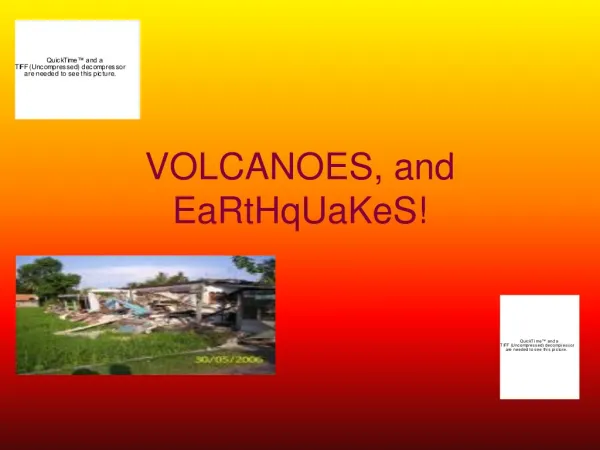
Pancaked Building - 1985 Mexico City Earthquakes don’t kill people - buildings do!
Locatingand Measuring Earthquakes • Determining the Location of an Earthquake • Measuring the Size of an Earthquake • Location and Size of Earthquakes in the United States
Effects of Earthquakes • Tsunamis • World Distribution of Earthquakes • First-Motion Studies of Earthquakes
San Andreas Fault • The San Andreas fault extends 960 km from Mexico to the north of California. • The land to the west is moving north. The land to the east of the fault is moving south. All the rocks do not move at the same time so earthquakes occur in one area and then another.
San Francisco Quake • In 1906, movement along the San Andreas fault caused an earthquake in San Francisco.
Tsunamis • Earthquakes which occur on the ocean floor produce giant sea waves called tsunamis. Tsunamis can travel at speeds of 700 to 800 km per hour. As they approach the coast, they can reach heights of greater than 20 meters.
Focus • Most faults occur between the surface and a depth of 70 kilometers. • The point beneath the surface where the rocks break and move is called the focus. The focus is the underground origin of an earthquake.
Epicenter • Directly above the focus, on the Earth’s surface is the epicenter. Earthquake waves reach the epicenter first. During an earthquake, the most violent shaking is found at the epicenter.
Seismic Waves • There are three main types of seismic waves. • Primary • Secondary • Surface
Primary Waves • Seismic waves that travel fastest are P waves. They travel through solids, liquids and gases. • They move at different speeds depending on the density of the material through which they are moving. As they move deeper in the Earth they move faster. • P waves are push-pull waves.
Seismic Wave Types Body Waves Surface Waves
Secondary Waves • Seismic waves that do not travel through the Earth as fast as P waves do are called secondary or S waves. • S waves travel through solids but not liquids or gases. • S waves cause particles to move from side to side. They move at right angles to the direction of the wave.
Surface Waves • The slowest moving seismic waves are called surface waves or L waves. • L waves originate on the Earth’s surface at the epicenter. They move along the surface the way waves travel in the ocean. The Earth’s surface moves up and down with each L wave. • L waves cause most of the damage.
The Seismograph • Invented in 1893 by John Milne, a seismograph detects and measures seismic waves. • A weight attached to a spring remains nearly still even when the Earth moves. A pen attached to the weight records any movement on a roll of paper on a constantly rotating drum. The drum moves with the Earth and affects the line.
Seismologists • Seismologists study earthquakes. They can determine the strength of an earthquake by the height of the wavy line recorded on the paper. • The seismograph record of waves is called a seismogram. • The Richter scale is used to calculate the strength of an earthquake.
The Richter Scale • The amount of damage created by an earthquake depends on several factors. • The earthquake’s strength • The kind of rock and soil that underlie an area • The population of the area • The kind of buildings in the area • The time at which the earthquake occurs
Predicting Earthquakes • Scientists have identified warning signals the help predict earthquakes with greater accuracy. • Often changes occur in the speed of P and S waves before an earthquake occurs. • Sometimes slight changes in the tilt of the Earth’s surface can be detected. • Some scientists believe animals behavior is affected.
Volcano and Earthquake Zones • Most major earthquakes and volcanic eruptions occur in three zones of the world. Scientists believe that there is a great deal of movement and activity in the Earth’s crust in these three zones.
Ring of Fire • One major earthquake and volcano zone extends nearly all the way around the edge of the Pacific Ocean. This zone goes through New Zealand, the Philippines, Japan, Alaska and along the western coasts of North and South America. The San Andreas fault is part of this zone.
Mediterranean Zone • A second Major earthquake and volcano zone is located near the Mediterranean Zone and extends across Asia into India. Many countries in the zone, including Italy, Greece and Turkey, have violent earthquakes. Many volcanic eruptions also occur in this zone.
Mid-Atlantic Ridge Zone • The third major earthquake and volcano zone extends through Iceland and to the middle of the Atlantic Ocean. There is under the ocean a long range of volcanic mountains called the Mid-Atlantic Ocean Range. Scientists believe that the volcano and earthquake activity are due to the formation of new parts of the Earth’s crust along the ridge. The volcanic island of Iceland is part of this zone.