Download
1 / 9
100 likes | 115 Views
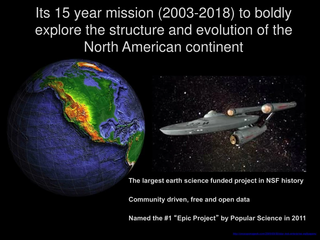
Its 15 year mission (2003-2018) to boldly explore the structure and evolution of the North American continent. The largest earth science funded project in NSF history Community driven, free and open data Named the #1 “ Epic Project ” by Popular Science in 2011.

E N D
Its 15 year mission (2003-2018) to boldly explore the structure and evolution of the North American continent The largest earthscience funded project in NSF history Community driven, free and open data Named the #1 “Epic Project” by Popular Science in 2011 http://onceuponageek.com/2009/09/30/star-trek-enterprise-wallpapers/
Exploring the Structure and Evolution of the North American Continent: Measuring the motions and the properties that constrain the processes Interactive Geology Project, CU Boulder http://igp.colorado.edu/animations.html Professor Ron Blakey, Colorado Plateau Geosystems
ThreeObservatories San Andreas Fault Observatory at Depth (SAFOD) By integrating scientific information derived from its multi-disciplinary observatories, which use a wide variety of geophysical instrumentation, EarthScope yield a comprehensive, time-dependent picture of the continent beyond that which any single discipline can achieve. • Scientific Drilling • Core Samples • Geophysical monitoring • 3 km deep hole US Array Seismic Network • Includes 400 Transportable Array (TA) Stations • Each Station occupies a site for 1.5 – 2 years • 10 years to leap-frog across the country (now in Alaska) Plate Boundary Observatory (PBO) • Geodetic data • Network of more than 1,200 continuous GPS instruments, borehole strainmeters & seismometers, tiltmeters
San Andreas Fault Observatory at Depth (SAFOD) Three Observatories Plate Boundary Observatory (PBO) US Array Seismic Network Seismic MT Geodetic Seismic Samples Seismic/EM SAFOD Core
A new way of doing big science: Community governed Freely available, high precision data can be viewed as the most important legacy of the National Science Foundation's largest investment in solid-Earth Science. • Uncovered unexpected findings . . . • PBO H20 project • Tracking hurricanes & tornadoes • USArray “hears” the Chelyabinsk Meteorite & volcanoes • Earthquake Early Warning System
Outreach & Education Inspire Educate Collaborate
Online community: earthscope.org Online Resources #earthscope #earthscope @EarthScopeInfo earthscope
Rotating EarthScope National Office Oregon State University (2006 – 2011) Arizona State University (2011 – 2015) University of Alaska Fairbanks (2015 – 2018) uaf-earthscope@alaska.edu
Acknowledgements EarthScopeis a multi-disciplinary project funded by the National Science Foundation (NSF) that is governed by a science plan. EarthScope facilities are being operated and maintained as a collaborative effort with UNAVCO Inc. and the Incorporated Research Institutions for Seismology (IRIS) with contributions from the U. S. Geological Survey (USGS), National Aeronautics and Space Administration (NASA), and several other national and international organizations. The EarthScope National office is located at the University of Alaska Fairbanks.