Download
1 / 19
190 likes | 196 Views
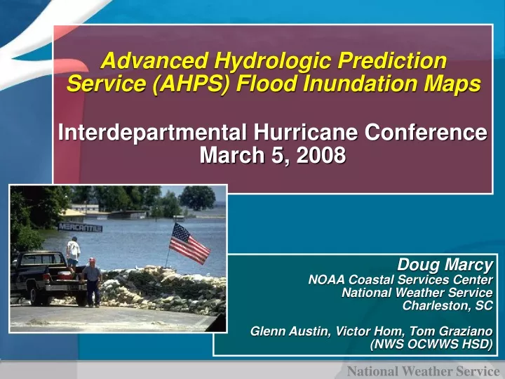
Advanced Hydrologic Prediction Service (AHPS) Flood Inundation Maps Interdepartmental Hurricane Conference March 5, 2008. Doug Marcy NOAA Coastal Services Center National Weather Service Charleston, SC Glenn Austin, Victor Hom, Tom Graziano (NWS OCWWS HSD). Presentation Outline.

E N D
Advanced Hydrologic Prediction Service (AHPS) Flood Inundation MapsInterdepartmental Hurricane Conference March 5, 2008 Doug Marcy NOAA Coastal Services Center National Weather Service Charleston, SC Glenn Austin, Victor Hom, Tom Graziano (NWS OCWWS HSD)
Presentation Outline • Background and Impetus for Inundation Mapping Effort • Demonstration Projects and Future Plans • Partnering to Better Communicate Flood Risk
Advanced Hydrologic Prediction Service (AHPS) Objectives • More precise forecasts at many time-scales • Information to make risk based decisions • Easy product access • Visually oriented products
Enhancing the Communication of Flood RiskBackground • • For over 25 years, the NWS has utilized a 3-tier, impact based, flood severity scale with the categories minor, moderate, and major flooding • For each NWS river forecast location, flood stage and the stage associated with each of the NWS flood severity categories are established in cooperation with local • public officials • NCC049-107-070200- • /O.NEW.KMHX.FL.W.0001.010407T1300Z-000000T0000Z/ /KINN7.1.ER.010407T1300Z.010412T0100Z.000000T0000Z.NO/ • 200 PM EDT FRI APR 6 2001 • THE NATIONAL WEATHER SERVICE IN NEWPORT HAS ISSUED A • FLOOD WARNING FOR NEUSE RIVER AT KINSTON • FROM SATURDAY MORNING UNTIL FURTHER NOTICE • AT 9 AM EDT FRIDAY THE STAGE WAS... 13.5 FEET • MINOR FLOODING IS FORECAST * FLOOD STAGE IS...14.0 FEET • FORECAST...FLOOD STAGE WILL BE REACHED AT 900 AM SATURDAY. MAXIMUM STAGE WILL BE 15.0 FEET AT 900 PM EDT WEDNESDAY. THE RIVER MAY REMAIN ABOVE FLOOD STAGE FOR SEVERAL WEEKS. THE EXACT FLOOD DURATION IS DIFFICULT TO PREDICT DUE TO THE VERY SLOW RISE AND FALL TIMES FOR THIS RIVER. • AT 14 FEET...WATER WILL BEGIN TO OVERFLOW INTO LOWLANDS ADJACENT TO THE NEUSE RIVER. $$ http://www.weather.gov/ahps/
Enhancing the Communication of Flood RiskRecent Events • • The Inland Flood Forecasting and Warning System Act of 2002, Pub. Law No. 107-253 • Championed by Representative Bob Etheridge (2nd District NC) • Authorizes NOAA to conduct activities to improve inland flood forecasting, develop a new flood warning index, train and educate officials regarding improved forecasting techniques and the inland flood warning index
Enhancing the Communication of Flood RiskRecent Events • Since 2002, NWS has conducted extensive outreach to objectively determine whether our current flood severity index satisfies user needs • Partnered with Claes Fornell International (CFI) Group to survey users of NOAA’s hydrologic information via the American Customer Satisfaction Index (ACSI) • Conducted user forums with State and Local Officials in North Carolina • Partnered with David Ford Consulting Engineers, Inc to conduct a national survey of emergency managers • Conducted additional local and regional user outreach
Enhancing the Communication of Flood RiskFlood Category Evaluation • Customers are telling us they…. • are familiar with NWS flood severity categories • find them useful • do not want changes to the existing flood severity indices • need communication of flood risk to be enhanced by use of inundation graphics (maps)
Enhancing the Communication of Flood RiskFlood Category Evaluation • "The problem for our emergency responders during flooding is that we rush over our floodplain maps but they are basically a 100 year storm event that rarely informs the expected flooding from a particular storm event." • Floodplain Manager • Baltimore Area
Real-Time Flood Forecast MappingTar River Basin, NC • Goal – To provide real-time flood inundation maps to emergency managers during flood events. • Used partnered data (LIDAR Topo Engineering Data) from FEMA and NC Floodplain Mapping Program • Built unsteady hydraulic model for 73 miles of Tar River • Mapped flood forecasts in a GIS and presented results via the Web • SERFC used as flood forecast tool during Hurricane Isabel – Sept. 2003
High Results / Low Effort High Results / High Effort Results / Outcome Low Results / Low Effort Low Results / High Effort Amount Of Effort / Resources Future of Flood Mapping – Where We Want to Be? • Flood Severity Mapping for forecast points • Map Libraries to show flood impacts for range of river stages • Collaborate with FEMA Map Modernization • GOAL – Larger # of Forecast Points Mapped
Graphical Flood Impact Information Neuse River at Goldsboro, NC • Partnering with NC Floodplain Mapping Program Office, FEMA, and USGS to develop prototype user-requested graphics to better convey flood threat
Methods and Standards for NWS Flood Severity Inundation Maps • Created for NWS by Watershed Concepts via EarthData International and being created as federal guidance • Minimum standards for mapping topographic and base data • Vertical Datums • Hydraulic modeling methods • Inundation map data standards • Mapping methods • Map scales and layout • Consistent with FEMA DFIRM standards • Pilot mapping study (Goldsboro, NC)
Demonstration Projects and Future Plans • Provided Web Access to 17 North Carolina Flood Inundation Map Libraries at NWS forecast points in October 2007 • http://www.weather.gov/ahps/inundation.php • Hurricane Supplemental Funds are being used to create an additional 35 libraries in 4 Gulf Coast States (FY08) • Topographic and engineering data inventory for future mapping at 526 points • Flood inundation map libraries to be delivered via the AHPS web pages
Partnering to Communicate Flood Risk Floods…a National Issue …America needs map products that not only convey flood risk but also flood severity and damage impacts
NOAA-FEMA Collaboration (& other agencies) • Both agencies convey flood risk • FEMA for regulatory/legal insurance purposes to reduce damage costs • NOAA/NWS for protection of life and property • Opportunity for educating users about FEMA and NOAA flood map products and how they should be used • Decision-makers need additional/integrated inundation maps/information to most effectively mitigate the impacts of floods • Integrate NOAA/NWS inundation library guidelines with FEMA/FIS guidelines • Potentially forming interagency working group on risk mapping – Galloway (USGS, USACE, FEMA, NOAA, maybe others)
Partnering to Reduce Costs and Improve Efficiency Efficiency goes up Costs go down • Cost per county average for updating FIS and maps: ~300 - 400 K • Additional cost to complete one inundation map library as part of the FIS: 5 – 6 K (~1-2% cost increase) • Cost doubles and time increases if inundation map library is created after FIS is completed: 11 - 12K • Developing inundation libraries in conjunction with FIS yields significant user benefit for small incremental cost.
Summary • For NWS river forecast locations….. • Enhance the communication of flood risk by a developing a library of inundation maps and linking them with observed/forecast river stages • Each library will include NWS flood severity categories and FEMA flood frequency events
AHPS Flood Inundation Mapping http://www.weather.gov/ahps/inundation.php Questions?