Download
1 / 25
250 likes | 257 Views
Visualizing Impacts of Sea-Level Rise on Coastal Marshes: A regional pilot project in Maine, New Hampshire, and Massachusetts. Adrianne Harrison NOAA Coastal Services Center. Gulf of Maine Council Meeting December 13, 2012. Overview. Management Need

E N D
Visualizing Impacts of Sea-Level Rise on Coastal Marshes:A regional pilot project in Maine, New Hampshire, and Massachusetts Adrianne Harrison NOAA Coastal Services Center Gulf of Maine Council Meeting December 13, 2012
Overview • Management Need • Model Selection: NOAA’s Sea Level Rise & Coastal Flooding Impacts Viewer • Regional Pilot Project: ME, NH & MA • Key Findings • Next Steps
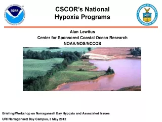
Management Need • New England Governors’ Conference* subgroup focused on coastal land conservation formed in 2009 • Resulted in Recommendation to NEGC • “Safeguard Coastal & Estuarine Lands” • Coordinated mapping & modeling of projected sea level rise & its impacts to coastal & estuarine lands • Identified coastal marshes as focus for a regional pilot project
Management Need • Develop regional assessment of marsh vulnerability to sea level rise • How vulnerable are New England’s marshes to sea level rise? • Identify marsh systems for conservation & restoration activities • Is natural marsh migration possible? • What are the natural & anthropogenic barriers to marsh migration?
Model Selection • Selected NOAA’s Marsh Migration Tool • Component of the Sea Level Rise & Coastal Flooding Impacts Viewer • Model Considerations: • Use best available & accessible elevation data • Ability to account for accretion • Incorporate local/regional tidal variations • Cost & available assistance
Northeast Viewer Available in Summer 2013 Available via NOAA Digital Coast www.csc.noaa.gov/digitalcoast
Components • Impacts of Sea Level Rise • Visualize impacts for mean higher high water (MHHW) 6-foot SLR scenarios overlaid on aerial imagery, street map & terrain map • Photos of SLR on individual structures will illustrate site-specific impacts Unconnected Low-Lying Areas
Components • Communicate Mapping Confidence • Visualize mapping confidence of inundation area based on uncertainty of elevation data & MHHW tidal surface Zone of Uncertainty
Components • Coastal Flood Frequency • Communicate that today’s flood is tomorrow’s high tide • Use 3 years of observed water level data at National Ocean Service National Water Level Observation Network (NWLON) stations to show increased frequency of everyday flooding. National Weather Service Coastal Flood Warning Areas
Components • Social and Economic Vulnerability • Include Social Vulnerability Index (SOVI) from USC & data from Bureau of Labor Statistics (BLS) showing impacts on society & economy Social Vulnerability Index (Cutter) Bureau of Labor Statistics (Department of Labor) - Businesses - Employees - Wages
Components • Visualize Marsh Impacts • Visualize the impacts of SLR scenarios on marshes using Coastal Change Analysis Program (C-CAP) data.
Regional Pilot Project • Geographic Scope: • Kennebunkport, Maine through Salisbury, Massachusetts • Model Inputs: • Elevation data - Northeast LiDAR data • Land cover data - C-CAP data • Accretion rates – used 2 mm/year • Highlight results for Hampton-Seabrook marsh system
Regional Pilot Project: Key Findings • 2 ft of sea level rise seems to be a threshold for the saltwater marsh habitat • Net gain in salt water marsh environments, net loss in fresh water marsh environments • Migration potential limited by topography & development
Regional Pilot Project: Next Steps • Share information on marsh impacts • Develop a snapshot for pilot area (draft available) • Summarize key findings & share with NEGC, North Atlantic Landscape Conservation Cooperative & NROC • Comparisons • Maine methodology; SLAMM in New Hampshire • Identify additional management questions • Complete assessment for Great Marsh
Regional Coordination • Regional working session sponsored by NROC (12/17) • Discussion Topics: • Identifying regional marsh migration research & management questions • Model & parameter considerations • How will model outputs be used in management decision-making • Moving forward with a regional outlook on New England marshes & migration potential
Marsh Migration & Modeling Resource • www.csc.noaa.gov/ • digitalcoast/publications/ • marshesonthemove
Additional Resources: Snapshots • Wetland benefits • Flood exposure • Ocean jobs
Questions? • www.csc.noaa.gov/slr • adrianne.harrison@noaa.gov • jamie.carter@noaa.gov • nate.herold@noaa.gov