Download
1 / 28
280 likes | 365 Views
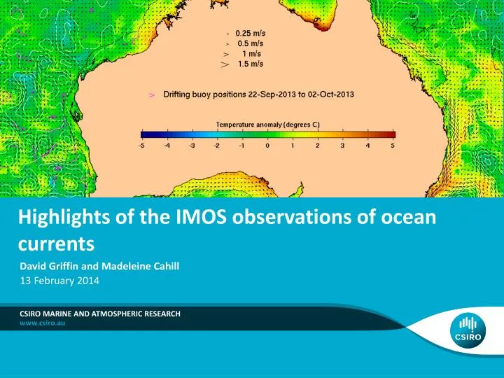
Highlights of the IMOS observations of ocean currents. David Griffin and Madeleine Cahill. 13 February 2014. CSIRO Marine and Atmospheric Research. Extreme Bonney Coast upwelling last week, seen by satellites and tidegauges.

E N D
Highlights of the IMOS observations of ocean currents David Griffin and Madeleine Cahill 13 February 2014 CSIRO Marine and Atmospheric Research
Extreme Bonney Coast upwelling last week, seen by satellites and tidegauges
..and HF radar. One of the strongest recorded.5 Feb 2014. NB Eyre Peninsula.
In BRAN, the EAC normally goes straight across the complex topography of the SGBR.
sometimes a 50km eddy forms. 0.5m/s currents 10cm sea level anomaly Line=Altimeter track
IMOS CBG (Capricorn Bunker Group) HF radar comprises antennas at TAN and LEI
SST and radar suggest a ~50km cyclonic eddy over the Plateau Jul 16 2010 10:30
track-normal altimeter velocities are fairly consistent with the radar velocities +2 weeks to Jul 30 2010
26 Aug 2008 • Radar sees ~50km anticyclonic eddy • and a v small (~10km) cyclonic eddy forming at shelf edge
29 Aug 2008 10:30 • Altimeter samples both the meso and sub-mesoscale eddies!
Aug 29 2008: First known transect of a (20km radius) sub-mesoscale eddy. ALES re-processed ‘raw’ 18Hz data. Height (m)
Conclusions Showed a few recent highlights of IMOS data: Extreme Bonnie Coast upwelling last week Co-incident NSW-Vic upwelling Perth canyon sub-mesoscale eddy Rottnest Island ‘plume’ Southern GBR plateau eddies, including first known sampling of height, velocity (and temperature) in a sub-mesoscale eddy. FFI: http://oceancurrent.imos.org.au/
Thank you David.Griffin@csiro.au www.marine.csiro.au/~griffin
Griffin et al. (1987) wondered if a semi-persistent eddy contributed to the mean NW-ward they observed near the 200m isobath.