Download
1 / 21
210 likes | 217 Views
STATISTICS LITHUANIA. NMA LITHUANIA. Report on the use of GI in the NSI and NMA in Lithuania. Vilius Zilevicius - Institute of Aerial Geodesy, Lithuania Raminta Adamonyte - Statistics Lithuania Workshop on GI/GIS matters for PHARE Countries. NMA LITHUANIA.

E N D
STATISTICS LITHUANIA NMA LITHUANIA Report on the use of GI in the NSI and NMA in Lithuania Vilius Zilevicius - Institute of Aerial Geodesy, Lithuania Raminta Adamonyte - Statistics Lithuania Workshop on GI/GIS matters for PHARE Countries
NMA LITHUANIA Law of Geodesy and Cartography on the 28th of June, 2001 State geodetic network, topographic and special maps: • Geodetic network • Aerial photography and satellite images • Orthophoto production • Topographic mapping in 1:10000-1:1000000 scales • Georeferencial databases
NMA LITHUANIA Municipalities • Mapping materials in 1:500-1:5000 scales • Content of geodata bases • Data for NMA for basic and special mapping Ministries and state organizations (including NSI): • Participate in planning of state mapping, creation of GDB and updating programmes • Thematic DB on the basis of georeferencial data
NMA LITHUANIA Integrated Geographical Information System (InGIS) • Defines principles and rules for creation, registration, standartisation and administration of geodata • Interconnects cadastres and registres which are based on georeferenced (cartographic) background • Defines main principles for interaction of different (thematic) geodata bases created by various organisations
NMA LITHUANIA Cartographic DataBase (KDB) • Practical realization of GIS is connected with specified scale, which determines content of database and positional accuracy • Cartographic DataBase (KDB) – georeferencial database with specified scale and additional data for visualization in traditional form
NMA LITHUANIA Levels of KDB • Mikro – hydrography, roads, railroads, place names, geodetic network – used with orthophoto backdrop • Mini – some additional data – used with orthophoto backdrop • Midi – standard topographic map according specification • Maksi – additional thematic information
NMA LITHUANIA Geographic Information Systems Based on two different co-ordinate systems: • LKS94 – for large scale (1:500-1:20000) mapping. One zone for whole country, based on GRS80 ellipsoid, ETRS89 co-ordinate system, TM projection with scale coefficient 0.9998 and 24° central meridian • UTM – for medium and small scale (1:25000-1:100000) mapping. Two zones for whole country, based on WGS84 ellipsoid, WGS84 co-ordinate system, UTM projection with scale coefficient 0.9996 and 21°, 27° central meridians
NMA LITHUANIA Data collection • Aerial photography and satellite images • Additional data from 20 organizations (including NSI) • Photogrammetry: scanning, analytical plotters, digital photogrammetric workstations • Cartographic workstations using Intergraph and ESRI software
NMA LITHUANIA Database driven cartography • Production of GIS-oriented cartographic data • Based on ESRI compatible software • ArcInfo™, ArcView™, GeoVektra in use, PLTS in implementation • Best technical solution at European ESRI User Conference, Florence’1998 • Award “Special Achievement in GIS” at World ESRI User Conference, San Diego’1999
NMA LITHUANIA Main products and projects • MapBSR – 1:1000000 scale database for Baltic Sea Region • SABE – Seamless Administrative Boundaries of Europe • GDB200 – 1:200000 scale GIS database • LTDBK50000-V – 1:50000 scale vector database derived from satellite imagery • KDB10LT – 1:10000 scale cartographic database with different levels of data complexity • ORT10LT – digital orthophoto with 0.5m resolution
NMA LITHUANIA Data updating and quality • Working groups of EuroGeographics (former CERCO/MEGRIN): on Data Maintenance (former Updating) and on Quality • Updating for 1:10000 scale base map data – 10 years period or on demand • Preparations for ISO 9000 certification
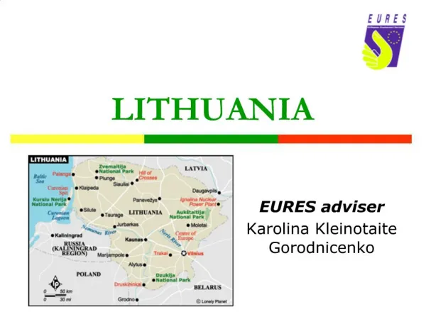
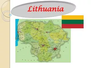
STATISTICS LITHUANIA Regional breakdown: The territory of Lithuania is divided into 3 regional levels: NUTS 3 - Counties (10) NUTS 4 -Municipalities (60) NUTS 5 - Seniunija (462) - smallest local administrative unit
STATISTICS LITHUANIA Codification Attribute data are coded according InGIS standard. All geographical objects are divided into themes according criteria.
STATISTICS LITHUANIA Codification Structure of geocode: - Code of theme - Object number in the theme For example: administrative boundaries of counties as 02 code of themenumber of object in this theme
STATISTICS LITHUANIA • GIS in Statistics Lithuania • GIS subdivision to Population Census Division was established on 2001 09 01. • Main tasks: • Analyses and dissemination of Census data and other statistical information using GIS tools; • Preparation of thematic maps of Census and statistical data on different levels of administrative units; • Internet for dissemination statistical information (thematic maps); • Comparison of statistical data between countries using GIS tools.
STATISTICS LITHUANIA • GIS in Statistics Lithuania • Software: • ArcView 3.1 and ArcView 3.2 for Windows • ArcPress for ArcView • ArcView Network Analyst for Windows • Spatial Analyst for Windows • NT ARCINFO and ArcPress • NT ARCINFO Network • MO Internet Map Server
STATISTICS LITHUANIA GIS in Statistics Lithuania • In our GDB there are boundaries of: • Counties • Municipalities • First task to update our GDB : • Seniunija - smallest local administrative unit • Residential areas - urban and rural
STATISTICS LITHUANIA GIS in Statistics Lithuania • Point map of one city of Lithuania . • There georeferencial foundation is linked with address data bases and register data bases. • Those data basis is linked through UAK (unique address code).
X Y UAK 6177618.00 521943.51 234851980006000 6177620.57 521978.63 234851920003500 6177632.76 521983.07 234851947008700 6177651.01 521980.45 234851975009200 6177650.72 521940.94 234851940018900 UAK Address point STATISTIC LITHUANIA Georeferencial background
STATISTIC LITHUANIA Dissemination of Census results Statistical publications CD Internet
STATISTIC LITHUANIA Dissemination of Census results • Statistical publications, Yearbook, CD Census data will be presented on thematic maps • Internet Following data will be presented: Hydrology, roads, geographical names, administrative units. Population,population by age group, sex, education, etc. It will be possible to work with the information of Internet: zoom in, zoom out, push and pick out objects, to choose the colors of the map according to needed classification.