Download
1 / 83
1.43k likes | 3.2k Views
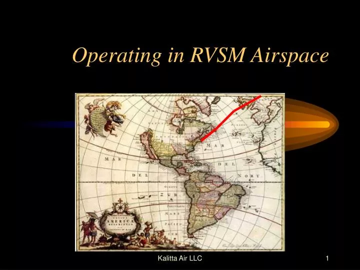
Operating in RVSM Airspace. Introduction. Objective: This course provides training for safe operation in the RVSM operations in MNPS airspace. (MNPS Ops. Manual Chapter 9). MNPS - Minimum Navigation Performance Specification. Provides orderly flow between North America and Europe

E N D
Operating in RVSM Airspace Kalitta Air LLC
Introduction Objective: This course provides training for safe operation in the RVSM operations in MNPS airspace. (MNPS Ops. Manual Chapter 9) Kalitta Air LLC
MNPS - Minimum Navigation Performance Specification • Provides orderly flow between North America and Europe - The Area is: From 27 degrees North to North Pole - Fl 285 to Fl 420. Kalitta Air LLC
MNPS • East boundary: Santa Maria - FIR Shanwick - FIR Reykjavik - FIR • West boundary: Gander - FIR New York - FIR Kalitta Air LLC
MNPS • Vertical Area of MNPS: - FL 285 thru FL 420 - 1000 ft. vertical separation, and 20 minutes Longitudinal - can be reduced by ATC to 10 minutes to maintain separation. Aircraft must maintain assigned Mach number Kalitta Air LLC
MNPS • Lateral Separation: 1 degree latitude 1 degree latitude = 60 miles Kalitta Air LLC
MNPS Accomplished by: The Organized Track System Kalitta Air LLC
Organized Track System Provides optimum crossing of the Atlantic using most favorable winds and weather, composed of a set of Latitude and Longitude combinations: 50°N 050°W or 51°N 040° W. Kalitta Air LLC
OTS • Two Traffic Flows: • (changes every 12 hours) • - Eastbound (evening) 0100 - 0800 UTC • Gander Oceanic Control • “T” thru “Z” Z being the southern • most track Kalitta Air LLC
OTS • - West bound (morning) 1130 - 1800 UTC • Shanwick Oceanic Control • “A” thru “E” A being the Northern • most track Kalitta Air LLC
RVSM - Reduced Vertical Separation Minimums • Allows for greater use of track airspace… - More aircraft , better time and fuel savings, projections indicate that within the next 10 years there will be 3 to 4 times the air traffic. Kalitta Air LLC
RVSM - Reduced Vertical Separation Minimums • Implemented in two Phases using the same OTS as MNPS for lateral separation. Kalitta Air LLC
RVSM • Phase 1 • FL 330 thru FL 370 Effective March 1997 • Phase 2 • FL 290 thru FL 410 Effective March 1998 • Gander Oceanic Control • 709-256-6770 or 6772 Kalitta Air LLC
Random Tracks in RVSM DURING THE NAT WESTBOUND OTS @ 30° W with 1000 feet separation WESTBOUND………………..FL 280, 320, 380 JOINING THE OTS Kalitta Air LLC
Random Tracks in RVSM DURING THE NAT EASTBOUND OTS @ 30° W with 1000 feet separation EASTBOUND…………….…..FL 290, 310, 410 JOINING THE OTS Kalitta Air LLC
Random Tracks in RVSM OUTSIDE THE NAT OTS @ 30° W with 1000 feet separation WESTBOUND…………….FL 280, 320, 380 etc EASTBOUND……………..FL 290, 310, 390 etc Kalitta Air LLC
Flight Planning and MEL Implications • The Flight Follower must confirm the following prior to dispatching the Flight crew: • - The aircraft is in RVSM status • - Reported & forecast weather on • flight route Kalitta Air LLC
Flight Planning and MEL Implications • - Minimum Equipment requirements • pertaining to height, keeping systems • in accordance with OP SPECS B46a Kalitta Air LLC
Flight Planning and MEL Implications • - Indicate “W” in Block 10 of the ICAOFlight Plan (indicates RVSM approval) • - “X” to indicate MNPS approval (still used) • - Indicate “R” in Block 10 of the ICAO Flight Plan (indicates RNP 5 approval) • - Indicate “Y” in Block 10 of ICAO Flt. Plan (indicates 8.33 Khz VHF COMM for Europe) • - Indicate “P” in Block 10 (indicates mode “S” transponder, TCAS equipment) Kalitta Air LLC
Pre-Flight of Aircraft • Review log book to ensure: • - Maintenance actions of required • RVSM equipment have been • cleared. Kalitta Air LLC
Pre-Flight of Aircraft • External Preflight Pay Special • Attention to: • - condition of static ports • - condition of fuselage skin near • - static ports • - any other components which may • affect altimeters Kalitta Air LLC
Pre-Flight of Aircraft • - Aircraft altimeters should be set to • local altimeter setting (QNH) and • should display known elevation • within limits. • - The two primary altimeters should • agree within limits. Kalitta Air LLC
Pre-Flight of Aircraft • - Alternate procedures using (QFE) • may be used. • (MAX value for altimeter checks from Ops • Manual is 50 feet.) • - RVSM equipment must be • operational. Any malfunctions must • be resolved prior to dispatch. Kalitta Air LLC
Required Equipment Prior to Entering MNPS/RVSM Airspace • Prior to RVSM entry, the following equipment is required: Kalitta Air LLC
Required Equipment Prior to Entering MNPS/RVSM Airspace • - Two independent altitude measuring • systems • - Altitude Alert System • - Auto Pilot • - Altitude Reporting Transponder Kalitta Air LLC
Required Equipment Prior to Entering MNPS/RVSM Airspace • If any of the RVSM systems fail prior to entry of RVSM, a new clearance that avoids RVSM airspace must be requested. • - You have two possibilities: Kalitta Air LLC
Required Equipment Prior to Entering MNPS/RVSM Airspace • 1. Fly above or below RVSM airspace • 2. Divert for maintenance Kalitta Air LLC
In Flight • - Comply with aircraft operating • restrictions • - Set 29.92/1013.2 hPa on passing • transition altitude and check for • proper reading Kalitta Air LLC
In Flight - Cruise at Cleared Flight Level Adhere to ATC Clearances Except for emergency or contingency situations, aircraft should not deviate from CFL unless cleared by ATC. Kalitta Air LLC
In Flight If an Assigned Altitude Deviation (AAD) Alert is received from ATC is greater than 300’... return to CFL as soon as possible. Kalitta Air LLC
In Flight - When Changing altitude: DO NOT over or under shoot level off by more than 150 ft. (maintain 500 to 1000 ft./min. vertical rate) Kalitta Air LLC
In Flight - Have auto pilot system engaged in cruise, except when: Re-Trimming aircraft In Turbulence Kalitta Air LLC
In Flight - Altitude Alert System should be Operational. -At Coast Out: Gate Way Check Cross check Captain and F/O’s altimeters and record on plotting chart next to coast out fix. Kalitta Air LLC
In Flight Cross check at each way point should agree within 200 feet. (If not, notify ATC of defective system) Kalitta Air LLC
In Flight - Altitude system being used to control aircraft should be selected to provide input to altitude reporting transponder to ATC. Kalitta Air LLC
In Flight - If aircraft has been identified by a Height Monitoring Unit exhibiting a Total Vertical Error greater than 300 feet, and/or Altimeter System Error of 245 feet…follow established FIR procedures. Kalitta Air LLC
Mandatory Pilot Reports apply to both RVSM and CVSM • Read back altitude assignments • “Connie 703 climbing FL 360” • Report reaching assigned altitude • “Connie 703 @ FL 360” Kalitta Air LLC
When Able Higher Report • Aircraft entering New York FIR should prepare to advise ATC of time & position aircraft can accept higher altitude. Kalitta Air LLC
When Able Higher • If aircraft is capable of higher altitude than Pilot prefers to go, the maximum altitude should be listed on WAH report. Kalitta Air LLC
When Able Higher • ATC Acknowledgement of WAH report is NOT a clearance to that altitude. Kalitta Air LLC
When Able Higher • Eastbound aircraft entering RVSM/ • MNPS in New York FIR may be requested by ATC to provide estimate for next higher flight level… • (Response should be ASAP) Kalitta Air LLC
When Able Higher • Westbound aircraft entering RVSM/MNPS in New York FIR, include in the initial position report, time or location of next higher altitude acceptable. Kalitta Air LLC
When Able Higher - “CONNIE 703 40°N 040°W @ 1010 FL 350 EST. 40°N 050° W @ 1110, 40°N 060° W NEXT. ABLE FL 360 @ 1135” Pilots may give more: - “ABLE FL 360 @ 1035, ABLE FL 370 @ 1145. ABLE FL 390 @ 1300” Kalitta Air LLC
Transition Areas. • ATC will provide most transitions by radar. Kalitta Air LLC
Transition Areas. • Transition areas may be structured for limited times for one-way traffic in which inappropriate FL’s for the direction of flight may be assigned. Kalitta Air LLC
Transition Areas. • Operations North of 65° 30' N and transitioning Edmonton FIR will be assigned transition altitudes by Reykjavik ACC within Reykjavik FIR Kalitta Air LLC
Non-RVSM Aircraft Climbing or Descending thru RVSM • ATC may clear non-RVSM aircraft thru RVSM airspace • Aircraft must maintain standard rate of climb • No provisions for cruise-climb or level-off Kalitta Air LLC
RVSM Aircraft Climbing or Descending thru RVSM • If unable to comply due to performance and/or navigation function • - Advise ATC ASAP Kalitta Air LLC
RVSM Aircraft Climbing or Descending thru RVSM • Broadcast position on 121.5/123.45 • - Include ATS designator or Track • code until new ATC clearance is • received Kalitta Air LLC
RVSM Aircraft Climbing or Descending thru RVSM • Use aircraft lights to maximize visibility Kalitta Air LLC