Download
1 / 33
410 likes | 685 Views
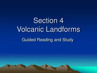
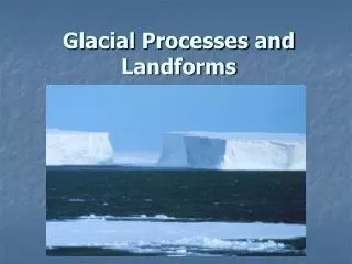
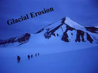
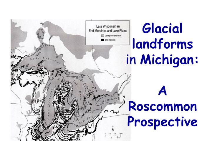
Glacial landforms in Michigan: A Roscommon Prospective. The MOST recognized feature of Michigan is the GREAT LAKES. All of Michigan, including the lakes, beaches, streams and abundant fresh water, are a result of glaciation.

E N D
Glaciallandforms in Michigan: A Roscommon Prospective
All of Michigan, including the lakes, beaches, streams and abundant fresh water, are a result of glaciation All of Michigan, including the lakes, beaches, streams and abundant fresh water, are a result of glaciation
{CLICK} When you click on the mouse, a block diagram of a glacialfeature found in Michigan will appear. {CLICK} When you click on the mouse a secondtime the name of that feature will appear in the lower right corner of the slide. This was done to help you become familiar with the terms and what they mean
A physiographic region is one that has similar landforms and similar evolutionary history Roscommon County is located in the physiographic region called the High Plains and Moraines. This glacial landscape differs from the areas to the south in that the concentrations of sandy soils are much higher, the moraines are more massive and rolling, and the general elevation is higher.
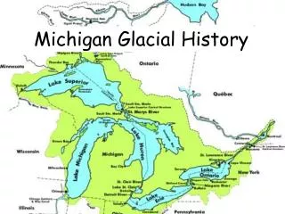
This physiographic regional map was constructed in part by the moraine map of the Wisconsin Glacial period, which was the last glacial event to occur in Michigan, even though many have occurred before that.
Detroit Point-Higgins LakeThis is an example of an outwash plain. It consists of flat layered (stratified) sediment deposited by a stream of meltwater from a glacier. A plane in math class means a flat surface. A plain in geology means almost the same thing, but a better word to use would be “uniform”, which means the same.
Porath Cement is located off the end of a kame/moraine just south of Houghton Lake, off Old US 27 Highway. Why do you think they chose this place for their business?
Pioneer Hill The picture to your left is Pioneer Hill, which some of you probably sled on in the winter. It used to be an old ski resort. It is located a kame/moraine complex that borders southeast end of Higgins Lake. In the distance is another moraine in Crawford County. Both moraines drain or shed water into Higgins Lake on their down slope sides that face the lake and border what is known as the Higgins Lake Watershed. In between these moraines is an ancient lake plain. The picture on the right is Sunset Blvd, which is 100yds south of the sled hill. It shows this moraine is a series of moraines as the road travels down to the lake.. A glacier advances and recedes, bulldozing the landscape in an uneven fashion. These moraines are called recessional moraines.
Denton Township ORV Trails. Located south of Prudenville by Houghton Lake down Highway 18 is a ORV trail system located on a small kame/moraine complex. The lower left picture shows a profile of a kame. A kame is a steep sided hill which formed when sediment collected in an openings in stationary glacial ice. It is composed of sand and gravel. The picture on the right is not my truck between moraines, but……
is in a basin-shaped depression known a a kettle, whichformed when buried blocks of glacial ice melted within this kame/moraine complex leaving a cavity. Most lakes in Michigan are referred to as kettle lakes because they formed by this process, however, they retained their water.
RMS: Roscommon Middle School Our school is built on an edge of a kame/moraine complex located west of Higgins Lake. The picture to the right was taken from behind the RMS shop looking down the road leading to the bus garage and Roscommon Elementary School. Located to the right of the new path is our Wastewater Treatment facility Why did they put it there?
There is other evidence that these landforms were formed by glaciers. Have you ever been out in the woods or walking in a field and found a big rounded rock all bt themselves-just sitting there? These are called glacial erractics. These were the large boulders illustrated in the videos you watch before which were carried along with by the glacier. We know this because the boulder is an igneous rock –basalt, which probably was plucked from somewhere in Canada where we see out crops of this rock today.
If we were in other places in the state, like Houghton in the Western U.P. where bedrock is exposed, we might see glacial grooves like these in an outcrop of basalt. How do we know this??
Do you notice any similarities in these two different pictures? Focus on the Higgins Lake area on the Glacial Landform Map. Is there a relationship going on here? Soil you think there is! We will start profiling this in the next lesson literally.. Higgins Lake Watershed Tree Map Roscommon County Glacial landform Map
References -Geology Resources for Teachers and Students http://michigan.michigan.gov/documents/deq/For_Students_and_Teachers_323888_7.pdf Accessed 7/10/2010. -Glacial landforms in Michigan http://www.geo.msu.edu/geogmich/glacial_landforms.html Accessed 7/10/2010. -Soil Survey of Roscommon County, Michigan. http://soildatamart.nrcs.usda.gov/Manuscripts/MI143/0/Roscommon_MI.pdf. Accessed 8/12/2010. -