Download
1 / 23
230 likes | 309 Views
Lecture 9 Constructing a Coastal Data Model for Nearshore Puget Sound. Learning Objectives. 9.1 What’s the motivation for a coastal data model? 9.2 What was the information (knowledge) integration process? 9.3 What are the results? 9.4 What are the valuable conclusions and directions?.

E N D
Lecture 9Constructing a Coastal Data Model for Nearshore Puget Sound
Learning Objectives • 9.1 What’s the motivation for a coastal data model? • 9.2 What was the information (knowledge) integration process? • 9.3 What are the results? • 9.4 What are the valuable conclusions and directions?
General Motivation… CZM and GIS • Coastal zone management (CZM) requires robust geospatial information to be effective • Particularly for nearshore areas… land development impacts surface water runoff in watersheds that drain into coastal waters • CZM is a multi-stakeholder process that can make use of geographic information systems (GIS) • Using GIS can help develop a shared insight about problems, challenges and solutions about how to management coastal resources
Community Motivation… Revitalizing Puget Sound • Puget Sound is the 2nd largest estuary in the U.S. • In 2005, WA State Governor Gregoire established the Puget Sound Partnership (PSP) for Nearshore Restoration, and in 2007 the larger PSP became a state agency. • Goal of the Puget Sound Partnership (2006, p.10) is to “…ensure that Puget Sound forever will be a thriving natural system, with marine and freshwaters, healthy and abundant native species”. • Goal of the Puget Sound Nearshore Partnership (2006, p.1) is to “identify significant ecosystem problems, evaluate potential solutions, and restore and preserve critical nearshore habitat.” • Overall revitalization activity expected to last until 2020, and will cost several billion dollars
Focusing the Motivation…Linking Research, Teaching, Service Learning • CZM is the motivating substantive theme in an intermediate course in GIS at U Washington - Geography 460. • Students in the Geog 460 have a one-course background in GIS mapping, but little background with coastal issues other than everyday experience • Geog 460 is a learning community • Learning about GIS data can enhance understanding of the complexities of the fish and plant life and how human activities affect nearshore habitat. • Students learn about the “coastal GIS data community”. • Data community – collection of organizations who “share interests” in a data theme and negotiate meaning & value
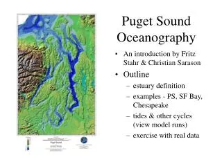
Puget Sound Nearshore as a basis for data community …area of marine and estuarine shoreline extending approximately 2,500 miles from the Canadian border, throughout Puget Sound and out the Strait of Juan de Fuca to Neah Bay.
What is at issue with the PS Nearshore? • The integrity of the nearshore ecosystem is in jeopardy. • Nine of the ten species listed as endangered or threatened within the Puget Sound region inhabit the nearshore. • Pollution in parts of Puget Sound has caused lesions and tumors in flatfish eaten by eagles, seals, birds, and porpoises. • Urban and suburban developments along the Puget Sound shoreline have taken away critical shoreline, and estuarine and nearshore habitats. • Changes in the physical processes include limiting food and nutrient sources for marine life, deteriorating beach sediment movement, and altering the flows of surface and groundwater.
Data modeling assists learning about CZM and GIS • Conceptual, logical, physical data modeling is useful for learning about how to represent coastal features associated with water flow from watersheds into estuarine ecosystems – a core issue in previous described problems • Focus on a nearshore coastal data model to address Puget Sound Partnership concerns
Developing a data model… • Everyone has a mental model of the problem • Data models help scaffold our mental models • Fully articulated data model consists of three components (Codd 1981): • geospatial constructs for structuring data, • operations that can be performed on those structures to derive information from the data, and • rules for maintaining the integrity of data.
Developing a Coastal Data Model through information integration • Goal: Develop an overall “conceptual data schema” - a collection of feature classes and potential relationships that form the core of a PS nearshore database design • Information integration involves identifying, comparing, contrasting, synthesizing feature classes • Three steps in the method used… • each used a different source of “community knowledge” knowledge to perform integration analysis
Integration Analysis - Three Steps • Step 1 - integrate watershed data (ArcHydro Data Model) and marine data (ArcMarine Data Model) • Step 2 - identify coastal feature classes described within a textbook reader about coastal zone management and add them to the feature class list for the coastal data model. • Step 3 - use recommendations from Puget Sound Nearshore Partnership report to further contextualize the coastal data model • Knowledge from a different “community of practice” associated with each step…and integrated into an overall data model
Step 1 - Using ArcHydro and ArcMarine Data Models • ArcHydro Data Model describes geospatial and temporal data about surface water resource features in watersheds (Whiteaker, Schneider, Maidment 2001) • Addresses principal water resource features on a landscape • Describes how water moves from feature to feature through multiple connective networks and channels over time • ArcMarine Data Model provides integration of important features of the ocean marine realm, both natural and human-made (Wright 2006) • Considers how marine and coastal data can be most effectively integrated within 4D space-time; that is the multidimensional and dynamic nature of ocean data and processes
Step 2 - Feature Classes from a Coastal Zone Management Book • Collection of feature classes and several attributes compiled from a text reader about coastal zone management • Another form of expert knowledge (Coastal Zone Management - Beatley, Brower, and Schwab 2002 published by Island Press) • Authors of a textbook are themselves experts in a topic, and that topic is peer reviewed by other experts familiar with the topic
Step 2 Results - CZM feature classes(see table 2 in reading) • Barrier Islands • Estuaries • Coastal Marshes • Coral Reefs • Rocky Shores • Bluffs • Tides (dynamic, temporal) • Currents • Wind (Currents/Patterns) • Erosion and Accretion • Pollution and Toxic Contaminants • Wetlands (Protected/Unprotected) • Habitats – endangered species • Land use and zoning of areas • Building code • Soil Composition/make-up • Catch Basins/ catchments • Watershed areas • Streams/Rivers/Water Flow • Ports – Freight and Passenger • Ferry Systems/Water Taxi • Continental Shelf/Slope • Water Depth/Slope • Land Cover – (e.g. Beach/Dunes) • Present Buildings/Structures • Infrastructure (on land, underneath)
Step 3Puget Sound Nearshore Partnership • On October 13th, 2006, the Puget Sound Partnership executive committee released recommendations for focusing efforts in the Puget Sound area • Recommendations are useful for… a) identifying fundamental theme for improving the health of Puget Sound, b) identifying features that can corroborate the list identified from reviewing Beatley, Brower, and Schwab (2002) as well as those in the integration of the ArcHydro and ArcMarine Data Models, and c) identifying primary and secondary processes that encourage a type of GIS data analysis to derive information as a basis for decision support to restore the Sound
Step 3 Results – Processes(see table 3 in reading; possible geog 460 final project topics) • Protect existing habitat and prevent further losses • Restore amount and quality of habitat; reduce fragmentation • Reduce toxics entering the Sound • Reduce pollution from human and animal wastes into the Sound • Promote and support new and existing treatment facilities • Improve water quality and habitat; managing stormwater runoff • Identify, prioritize, and implement retrofits where stormwater runoff is causing environmental harm; mitigation strategies • Provide water for people, fish and wildlife, and the environment • Protect ecosystem biodiversity and recover imperiled species • Implement existing recovery plans and create recovery programs for species at risk of extinction lacking current recovery plans
Overall Results • Feature classes identified in steps 1, 2, and 3 are collected together in Table 1 in proceeding (Table 4 page 6 in paper handout on your table) • The feature classes are grouped into feature datasets • We identify the most likely geospatial data type to act as a database representation • Not all features would be used in all applications, so it is important to identify which feature classes and processes are to be manipulated by what data operations
Coastal Data Model Features and Geospatial Data Construct Types(see Table 4 in reading)
Conclusions • Data models enable and limit GIS applications for communities of practice (groups using data) • Different communities of knowledge practice (per the three integration steps) result in different data models, but there are commonalties as one might expect • Participatory GIS-based data model development can form the foundation of community-based analytic-deliberative decision processes that draw together diverse stakeholder, scientist, and decision maker perspectives
Directions • Educational activity part of exploratory work on multi-stakeholder participatory modeling addressing coastal environmental improvement programming in which social (community) learning is a key issue. • What is the opportunity for social learning about complex problems when that learning is set within an engaging situation like “revitalizing Puget Sound”? … such engagement is a basis of participatory governance • Research and teaching about participatory GIS web applications to support broad-based analytic-deliberative decision processes (a core issue in participatory governance) is ongoing in Geography at the U of W.