Download
1 / 18
180 likes | 281 Views
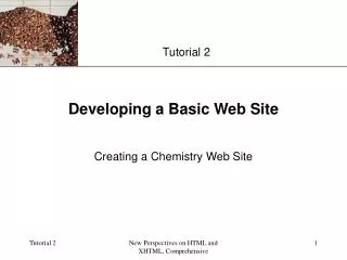
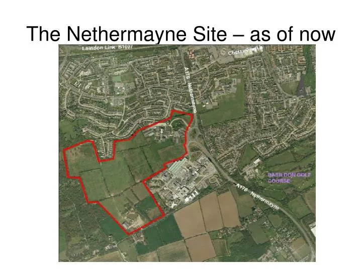
The Nethermayne Site – as of now. 1.3.3. Scheme Description The proposed new neighbourhood at Nethermayne will deliver the following benefits:. • 725 new homes delivered on approximately 22.32 ha residential land at an average net density of 32 dwellings per hectare;

E N D
1.3.3. Scheme DescriptionThe proposed new neighbourhood at Nethermayne will deliver the following benefits: • 725 new homes delivered on approximately 22.32 ha residential land at an average net density of 32 dwellings per hectare; • A 2.1ha site for a primary school that can accommodate up to 2 forms of entry; • 16.7ha of public open space, exceeding the total policy requirements, with additional provision of sports pitches made available through access to school playing fields; • A local centre accommodating 622 sq.m retail floor space featuring a local food store and 3 smaller retail units providing day to day facilities required by residents on their ‘door step’; • 0.81ha of land adjacent to St. Luke’s hospice to allow for future expansion of the hospice.
“Illustrative Masterplan” for Nethermayne Site Policy BAS S3 states that the Nethermayne site is expected to comprise of’ residential development, open space, the provision of the community centre, shops and health centre. No health centre is shown. No community centre
Buildings to be demolished • Basildon (S.Essex) College will be demolished; • Basildon Sports Hall will be demolished; • The Longwood complex will be demolished
Development Phases • 6.2 2014 Opening year • 6.2.1 It is proposed that Phase one of the development will gain access via the Dry Street • junction. This assumes that by 2014, 30 dwellings will be built and will use the existing • Dry Street junction to access the site. • (Transport Assessment Final) • Phase 1: 2014: 30 units • Phase 2: 2016 - 2019: Approximately 225 units • Phase 3: 2019 - 2022: Approximately 198 units • Phase 4: 2022 – 2024: Approximately 110 units • Phase 5: 2024 – 2026: Approximately 164 units
Phase 1 • 6.1.3 Phasing Sequence • Phase 1 will comprise circa 30 units located near the Dry Street entrance to the site. This will require the demolition of the existing equestrian centre. • Assuming planning permission is granted in May 2013, it is anticipated that construction will start towards the end of 2013. • On this basis sales can be expected to commence in 2014. • N.B. If planning permission is granted it is likely to be before May 2013. The outline plan is due to be considered in January or February 2013 Huh ?
Phase 2 6.1.2 Phasing Strategy The phasing strategy is based on 2 strategic phases of development to deliver up to 725 units with the associated mixed uses and open spaces. (Design & Accesss Statement) • Phase 2 is dependant on the creation of increased traffic capacity via the upgrading of Nethermayne roundabout. Phase 2 therefore evolves from the spine road off this junction. • The main construction activity in terms of unit build out will occur in phase 2. The timing of this will allow for the relocation of South Essex College, which is scheduled for July 2015. • From this point a 124 month (10 year) construction programme is envisaged which equates to a construction rate of circa 6 units a month. On this basis the main construction, phase 2, would start in July 2015 with the unit sales commencing a year later in July 2016 at rate of circa 70 units a year until 2026. • In addition to the relocation of South Essex College in advance of the main construction phases, the phasing strategy also proposes delivery of essential works to the Nethermayne roundabout which will trigger commencement of phase 2. The Design & Accessment Statement seems to lump phases 2-5 in one Phase 2.
Access to the finished development Dry Street Junction 10.3.3 Dry Street will be widened to provide additional capacity for this vehicular access – from a four metres country lane to a six-metre wide carriageway. In conjunction with this the existing footpath along Dry Street will be replaced and improved to provide a high quality two metre wide off-carriageway link pedestrians, the on road cycling route will continue to be promoted. 10.3.4 The Dry Street / A176 junction is proposed to be upgraded from a priority junction to a signalised all-movements junction. This will enable traffic from all directions to negotiate the junction safely, in particular traffic coming from Dry Street turning onto the A176.
Access during development • 1.3.2 The first phase of development will be located to the south of the site, for which access will be gained via Dry Street. Further phases will gain access via the Nethermayne Roundabout which will be the main development access. • Phase five will gain access from Dry Street. It is proposed that phases two to five of the development will commence from 2015 when the college has relocated to the town centre site.
Access through Lee Chapel South • 4.3.13 Along with the access points detailed above (that’s the hospital roundabout and Dry Street), additional pedestrian and cycle links will be provided to the north of the site, providing links through to the existing residential areas of Lee Chapel.
“mitigation” Measures • 4.3.16 The proposed junction improvement will consist of the removal of the hospice arm (changing the existing layout from a six arm roundabout to a five arm roundabout), widening the A176 N to three traffic lanes, widening the A176 S and the Hospital arm to two lanes. In addition the circulatory carriageway on the eastern half of the roundabout will be widened from two lanes to three lanes with the provision of spiral road markings and destination markings. • 4.3.25 Mitigation measures have also been drawn up for the Ashdon Way junction to maximise the amount of Green Time to reduce delays and queuing. The scheme includes the installation two signalised, staggered pedestrian crossings and to optimise the road layout. The first of these will be across the A176 to the north of the junction and consist of an 8 metre by 2.5 metre island. The second crossing will be across the entrance on Ashdon Way and included a staggered crossing using the existing road island. The carriageway layout has been modified with a 40 metres right turn only filter lane. The lane width of the Ashdon Way exit is now a uniform 5 metres.
4.3.15 As detailed above, the Nethermayne Roundabout will be the main development access via the existing college arm. The college arm will also provide access to the hospice as, commencing from Phase two of the development; it is proposed that the hospice arm will be closed.
4.3.25 Mitigation measures have also been drawn up for the Ashdon Way junction to maximise the amount of Green Time to reduce delays and queuing. The scheme includes the installation two signalised, staggered pedestrian crossings and to optimise the road layout. The first of these will be across the A176 to the north of the junction and consist of an 8 metre by 2.5 metre island. The second crossing will be across the entrance on Ashdon Way and included a staggered crossing using the existing road island. The carriageway layout has been modified with a 40 metres right turn only filter lane. The lane width of the Ashdon Way exit is now a uniform 5 metres. What is not clear is whether the 40 metres right turn only filter lane is for all traffic, not just buses and taxis.
“The southern exit connects directly with the existing Dry Street, offering users a quiet route to the countryside offerings of Martinhole Wood and Langdon Hills Country Park.” “The southern access on Dry street has limited capacity and the design of the primary street will need to respond to this by directing to use the Nethermayne access.” I thought I already lived in a village called Dry Street “5. Dry Street Village: Located at the site’s southerly end, the Dry Street Village character area has a more rural character reflective of existing residential properties further along Dry Street. This area is connected to the rest of the new neighbourhood by the Neighbourhood Spine which continues to act as the primary route that links residents with the community core.”
So what ? • One of the biggest concerns to users and residents of Dry Street must be the threat of an enormous increase in through traffic. It’s bad enough as it is !! • The planning application assumes that traffic from the new development will use the Hospital roundabout for the most part. • It appears to neglect the strong probability that traffic going North, i.e. towards Basildon TC or West, towards Dunton, Laindon Station or the A127 or A13 will do what it can to avoid the congestion on Nethermayne, using Dry Street instead. • No “mitigation” measures are planned for Dry Street beyond the planned entrance to the new development Between the proposed Dry Street access point and the B1007 there are 15 official footpaths, bridleways and private roads. There are no footpaths.
GROUNDS FOR REFUSAL Send your comments to: Chief Planning Officer Basildon Borough Council St.Martin’s Square Basildon SS14 1DL Land At Nether Mayne Kingswood Basildon Essex SS16 5NL Ref. No: 12/01080/OUT • A. Contrary to Green Belt policy. X • B. Contrary to Development Plan zoning. X • C. Over-development of the site by reason of ……X • D. Prejudicial to the replanning of the area by reason of …… • E. Objection on highway safety grounds. • F. Lack of car parking/servicing facilities. X • G. Damage to residential amenity by reason of …… • H. Damage to visual amenity/poor design by reason of …… • I. Unsatisfactory layout by reason of ……X • J. Objection by the Anglian Water Authority. ?
National Planning Policy Framework 74. Existing open space, sports and recreational buildings and land, including playing fields, should not be built on unless: ●● an assessment has been undertaken which has clearly shown the open space, buildings or land to be surplus to requirements; (we haven’t seen anything like this)or ●● the loss resulting from the proposed development would be replaced by equivalent or better provision in terms of quantity and quality in a suitable location (the HCA have said it will be relocated, but that could be out of Essex!); or ●● the development is for alternative sports and recreational provision, the needs for which clearly outweigh the loss.(which it clearly isn’t)
11. Conserving and enhancing the natural environment 109. The planning system should contribute to and enhance the natural and local environment by: ●● protecting and enhancing valued landscapes, geological conservation interests and soils; ●● recognising the wider benefits of ecosystem services; ●● minimising impacts on biodiversity and providing net gains in biodiversity where possible, contributing to the Government’s commitment to halt the overall decline in biodiversity, including by establishing coherent ecological networks that are more resilient to current and future pressures;