Download
1 / 20
200 likes | 322 Views
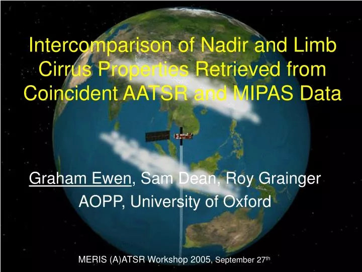
Intercomparison of Nadir and Limb Cirrus Properties Retrieved from Coincident AATSR and MIPAS Data. Graham Ewen , Sam Dean, Roy Grainger AOPP, University of Oxford. MERIS (A)ATSR Workshop 2005 , September 27 th. MIPAS.

E N D
Intercomparison of Nadir and Limb Cirrus Properties Retrieved from Coincident AATSR and MIPAS Data Graham Ewen, Sam Dean, Roy Grainger AOPP, University of Oxford MERIS (A)ATSR Workshop 2005, September 27th
MIPAS • Part of the ENVISAT payload - The Michelson Interferometer for Passive Atmospheric Sounding • High-Resolution (0.025cm-1) Fourier transform spectrometer measuring emission spectra at the Earth's limb • 5 infrared bands ranging from 4.1-14.6 mm (685-2410 cm-1)
Cloud in the Limb View • Clouds are viewed at a small elevation angle - this maximizes their opacity • Limb sounders have an enhanced sensitivity to optically thin cirrus in comparison to nadir-view instruments – long atmospheric path lengths • Predominantly, limb sounders used to obtain information on tenuous cirrus clouds have been occultation instruments • Emission technique potentially has greater sensitivity for differentiating between cloud optical depth • Scattering of upwelling radiation into the line of sight can enhance the ability of limb emission instruments to detect cirrus • (Mergenthaler et al., J. Geophys. Res., 1999. Study of Cryogenic Limb Array Etalon Spectrometer (CLAES) data)
MIPAS/AATSR Intercomparison MOTIVATION • Provides opportunity to evaluate sensitivity of nadir measurements to optically thin cirrus • Optimal Estimation retrievals for individual instruments can be validated against each other – first known attempt to compare limb and nadir directly IMPORTANCE • High-level cirrus has a strong influence on Earth’s radiation budget (Liou, Mon. Wea. Rev., 1986) • Subvisible cirrus plays an important role in the dehydration of air entering the tropical lower stratosphere (Jensen et al., J. Geophys. Res., 1996) • It is now well known that cirrus permanently covers about 30% of the Earth’s surface (Wylie et al., J. Climate, 1994)
Optimal Estimation Retrieval Levenberg-Marquart Method x = state vector F = forward model y = measurement vector K = weighting function matrix (dF/dx) S = error covariance matrix • AATSR cloud retrieval – based on ATSR-2 retrieval engine used in GRAPE • project (see talk by Caroline Poulsen) • MIPAS cloud retrieval – McClouds_RT, developed at University of Oxford • based on use of the Monte Carlo Cloud Scattering • Forward Model – see Ewen et al., J. Quant. Spec. • Rad. Trans, vol. 96, 2005
McClouds Approximations • Approximate cloud as a uniform depth spherical shell layer in the atmosphere • Defined by cloud top height, Ctop, and cloud (radial) depth, Cdepth • Cloud also has finite effective horizontal extent (defined by angle edge subtends at centre of Earth, y) • Homogeneous cloud, assuming hexagonal column habit with variable size distribution defined by effective radius, re
Retrieved State AATSR • x = [tvis, re, pc, f, Ts] • tvis - visible optical depth (at 0.55mm – AATSR channel 1) • re – effective radius • pc – cloud top pressure which can be converted to a cloud top height in kilometres • f – cloud fraction • Ts – surface temperature MIPAS • x = [re,N, Ctop, Cdepth] • re – effective radius • N – total number density • Ctop – cloud top height in kilometres • Cdepth – vertical cloud depth in kilometres
Measurement vector • AATSR – all available channels • MIPAS – optimised channels (for maximum information content) • Sequential channel optimisation - see Rodgers, SPIE vol. 2830, 1996 • In range 750 to 970 cm-1 – first 100 channels selected used in retrieval
East Africa – Case Study COINCIDENT MEASUREMENTS • MIPAS operates with a rearward oscillating scanning geometry in the azimuth • Oscillation in rearward scan so data coverage is near polar orbit • Tangent points in elevation profiles do not exactly overpass ground footprint • MIPAS will only overpass AATSR observations when the rearward azimuth • angle is near zero, i.e. as the spacecraft overpasses the equator • ~7 minute time lag
East Africa – Case Study Profile 23 from orbit 6673 – 0.5 N, 48 E Evidence of photons scattered into line-of-sight from below the cloud – indicates cloud is optically thin
East Africa – Case Study • AATSR view of anvil outflow cirrus • Black box indicates MIPAS approximate region of sensitivity AATSR channel 1 (0.55 mm) AATSR ch. 6 – ch. 7 (T11 - T12) Thick cirrus Thin cirrus
MIPAS Retrieval Results Degrees of freedom for signal = 3.997 Retrieval cost
Comparison (AATSR values are the average from MIPAS sample region) • Effective radius from the two retrievals is in good agreement • Cloud top heights differ by ~3 km, but nadir images are known to underestimate cloud top height of convective cirrus (Sherwood et al., Geophys. Res. Lett.,2004) • High variability of AATSR cloud top within sample region (up to 15 km) – unlikely for actual anvil cirrus which is generally laminar even if inhomogeneous wrt ice particle number density and size distribution • High cloud top coincides with low effective radius and low optical depth
AATSR Retrieval Diagnostics (In MIPAS sample region) Cloud top height versus optical depth Retrieval cost versus optical depth • High cost for optical depths less than 0.5 • Cloud top height has higher variability for optical depths less than 1.0 • AATSR retrieval not reliable for optically thin cirrus (less than ~0.5)
Possible Explanations (1) • Due to McClouds approx of spherical cloud layer – unclear how retrieved cloud top height will behave if true cloud height is spatially variable • Could be sensitive to mean cloud top level or to highest point • Possible that true cloud field in case study is two layers in sample region: • - High unbroken thin cirrus layer at ~ 15km • - Underlying broken layer of thick anvil blow-off at ~ 11km • MIPAS would be sensitive to upper layer and AATSR more sensitive to thicker inhomogeneous lower layer • AATSR difficulty in retrieving expected thin cirrus in north half of sample region
Possible Explanations (2) • Dual layer would explain optical depth difference – MIPAS thin • cirrus and AATSR thicker anvil cirrus • Alternatively – if cloud is single layer the difference in optical • depth could be due to inhomogeneity and the fact that the • sample region is only partially filled with ice cloud • Unclear how McClouds_RT will behave for a partially filled • sample region • If relationship linear – approximate third filled sample region • would account for the approximate factor of three difference in • optical depth
Conclusions • As the first known attempt to compare cloud properties derived from coincident limb and nadir observations the case study is successful • For optically thick cirrus (greater than 0.5) horizontal inhomogeneities are likely to occur – further model studies required to understand the effect on MIPAS measurements • AATSR retrievals are unreliable for optically thin cirrus (less than 0.5) – further work required to investigate forward model used – also may need to add forward view to retrieval • Further thought required on interpreting differences in viewing geometry • Larger number of comparisons need to be made to obtain statistics • Great potential for improving global cirrus information and improving AATSR cirrus retrievals from comparisons