Download

1 / 24
250 likes | 421 Views
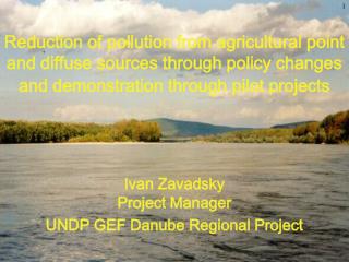
Danube RB - River Coding Test of WISE recommendations. Gabriela Vincze Ingrid Roder Friedrich Unterfrauner. WISE TG Meeting Ispra, 22/23 January 2009. Background. WISE GIS guidance: chapter 5.4.3 „European coding system for hydrological features“

E N D
Danube RB - River CodingTest of WISE recommendations Gabriela Vincze Ingrid Roder Friedrich Unterfrauner WISE TG Meeting Ispra, 22/23 January 2009
Background • WISE GIS guidance: chapter 5.4.3 „European coding system for hydrological features“ • Test the implementation of the hydrological feature code • Supported by ICPDR: national data provided (Danube GIS) • Data used: • CCM2.1 (river network, catchments) • National data: rivers > 1000 km²
Danube River Basin 2nd largest river basin of Europe 801,463 km² 18 states
Elements of the hydrological code Format: HSIICCCCCPPPPPPPPPPPPEELL
Hydrological System and Sea Region HSIICCCCCPPPPPPPPPPPPEELL • Danube: M5
Pfafstetter Commencement Code HSIICCCCCPPPPPPPPPPPPEELL • Danube: 2 Black seacoastalordering: Alfred de Jager, JRC
River Segment Code – 1st Order HSIICCCCCPPPPPPPPPPPPEELL River codes Danube: M52 Siret: M522 Sava:M524 Tisza: M526 Drava: M528
River Segment Code -2nd Order HSIICCCCCPPPPPPPPPPPPEELL River codes Tisza: M526 Maros/Mures: M5262 Hármas-Körös: M5264 Sajo: M5266 Bodrog: M5268
Methodology (1) • Selection of rivers > 1000 km² in CCM2.1 via matching with national data • Selected CCM2.1-rivers > 1000 km² provided to Danube countries for approval • Creation of Pfafstetter code at segments of the dataset of rivers >1000 km² (CCM2.1 rivers) • Pfafstetter code at CCM2.1 segments already available, but segmentation of selected rivers is different (lower level of detail!) • Analysis of the differences and problems in CCM2.1
Methodology (2) • Adaption of CCM2.1 river segment code of selected rivers dataset according to national data • Documentation of the cases which have to be resolved with Danube countries and discussion of open issues • Complete coding of CCM2.1 river segment code of selected rivers • Transfer the code to national data via intersection procedures • Creation of a hydrological river code for rivers > 1000 km²
Differences between CCM2.1 and National Data • Level ofdetail(rivers > 1000 km²) • Itis not alwayspossibletoidentify 4 greatesttributarycatchments, riversmayhavelessthat 9 sub-catchments • Identificationofthemainriverin the sub-catchments • Sub catchmentselectionisdonebycatchmentsize (attheconfluence) • Next step: themainrivercourse (sourcetomouth) hastobeidentifiereitherby • Length (longestpath) or • Name
Example - Less than 9 sub-catchments • Drina (River 42) has in the dataset of rivers > 1000 km² only 7 sub-catchments • In the detailed CCM2.1 dataset a river draining into the segment 421 is identified as first sub-catchment 422 • Thus the coding of the less detailed river dataset is different to CCM2.1 detailed data • 424 CCM2.1 422 rivers > 1000 km² • 425 CCM2.1 423 rivers > 1000 km² • etc. Drina 422
Example – Identification of main river Sava river • In CCM2.1 theriverKupa was identifiedtobetheheadwater in the Sava riverbasin code49.. (redfigures) • Sava rivergotthecode46.. 49..isthecorrectcode (blackfigures) Correct code Sava Kupa
Differences between CCM2.1 and National Data • Missing river segments • Missing rivers • Missing river connections • Displaced river connetions • No artificial rivers, channels
Findings Transfereof CCM2.1 segmentcodesto national data not straightforward – obstacles: • Level ofdetail • Identificationofmainriverof sub-catchments • Problems CCM2.1 – missingsegments, missing/ displacedriverconnections, etc. • Nature vs. model rivers (e.g. hungarianplain: riversareflowing in a „circle“) Differences in thehydrologicalnetwork/river order (river a flowsintoriver b) andcatchmentsize(wrongriverconnections) thusdifferences in thehydrologicalsegmentcode
Findings – Danube, rivers > 1000 km² PfafstettercodeofDanuberivers > 1000 km² will be different from CCM2.1 in manycasesbeginningwiththe 3rd order ofthecode (HSIICCCCCPPPPPPPPPPPPEELL) (Sava river basin also beginning with the 2nd order)
Next steps • Solve open issues with Danube countries (IM+GIS EG Meeting, 3&4 February 2009) • Complete coding of CCM2.1 river segment code of selected rivers • Transfer the code to national data via intersection procedures • Creation of a hydrological river code for rivers > 1000 km²