Download
1 / 34
440 likes | 1.12k Views
BIHAR. A STATE OF SELF INDUCED TRAGEDY. FLOOD PRONE AREAS…. ABOUT NORTH BIHAR. North Bihar has an area of about 5.4 million hectares Playfield of eight major rivers – Ghaghra, Gandak, Burhi Gandak, Adhwara group of rivers, Bagmati, Kamla, Bhutahi Balan, Kosi and Mahananda.

E N D
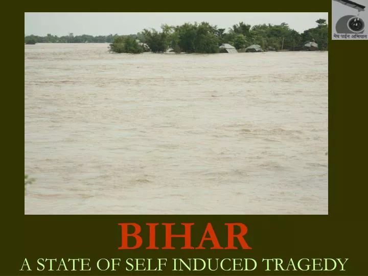
BIHAR A STATE OF SELF INDUCED TRAGEDY
ABOUT NORTH BIHAR • North Bihar has an area of about 5.4 million hectares • Playfield of eight major rivers – Ghaghra, Gandak, Burhi Gandak, Adhwara group of rivers, Bagmati, Kamla, Bhutahi Balan, Kosi and Mahananda. • 17 per cent of the total flood affected area of the country is in Bihar • 57 per cent of the total floods affected people in the country belong to Bihar. Out of which 76 per cent reside in north Bihar
MYTHS AND FLOODS • Just ONEform/type of floods destroys north Bihar persistently • Floods is a NATURALphenomenon • Floods in north Bihar OCCURdue to Nepal • People of north Bihar have got USED to the recurring phenomenon • State government has been GENUINELY working to minimize the incidence of floods • There are VARIOUS reasons for north Bihar’s under-development
CHANGING CHARACTER OF FLOODS • Historical times – Way of life; Prosperity; Self-reliance; Harmony; Festivity • Post-independence – Skepticism; Insecurity; Displacement; Conflicts; Politicized; Enthusiasm; Opportunity • Present day – Intense; Frequent; Devastating; Sorrow; Chaos; Scarcity; Loss; Destructive; Opportunity
FLOOD CONTROL MEASURE!! Taming of Rivers (Breach in the embankment, River Kamla Balan, Madhubani 2007)
…EMBANKMENTS • An EARTHEN WALL built along the river which divides the landscape into two prominent sections – riverside and countryside • Purpose ‘was’ to PREVENT river water spilling into the countryside and thereby reducing its impact on human, livestock and agriculture
HISTORICAL FACTS • First public announcement on 6th April 1947 at Nirmali in Supaul district on flood management strategy… • Dam on the Kosi at Barahkshetra in Nepal. Expected to irrigate 1.25 million hectares of land. Produce 3,300 megawatts (MW) of electricity • Embankments was referred to as the most outdated technique to control floods
The estimated cost of the proposed (1947) was 1,000 million INR, and project cost shot up to. 1,770 million INR by 1952 • Project was eventually shelved due to the cost factor • The government preferred to emphasize on excessive power generation as the reason for not executing the project. Then the total power generated in the country was 1,750 MW
Heavy floods in north Bihar in 1953 • Government was forced to take some immediate steps to tackle floods on an adhoc basis
GOVERNMENT’s PLOY! • On getting the political sanction of constructing embankments, in May 1954, Rai Bahadur Kanwar Sain, Chairperson, and Dr K L Rao, Director, Central Water Power Commission (now Central Water Commission) were sent to China to study River Hwang Ho • It was a strange approach, the decision of constructing embankments had already been taken and the experts were sent to primarily justify the decision.
RIVER HWANG HO!! • The embankments of famous Hwang Ho river in China had breached on 1500 occasions, changed its course 26 times and could not be brought within the embankments 9 times (recorded since 1047 – 1954) • The embankments had breached 200 times between 1855 - 1954 • In the floods of 1933, the embankments breached in 50 points affecting 11,000 square kilometres (sq km) and killing 18,000 people
CASE IN INDIA…NOT CONSIDERED • The British government had started to embank Damodar River in 1854 to safeguard the railway line between Howrah and Raniganj • Following the construction of the embankment • Natural tanks and lakes in the countryside started dying an unnatural death • Impacted on the fertility of the soil
‘THEIR’ STRATEGY! • The British government was compelled to demolish the 32 km long right embankment of the river • The situation only became normal in 1863
LESSON OVERLOOKED • It does not pay to tamper with the flow of the river carrying heavy sediments • Embankments along the river can result in ‘a net loss’ in one single incident of their breaching
GOVERNMENT’s VIEW • The CONTROL the flow of floodwater could only be checked by reducing the area of its spread and hence increasing its velocity • Hence, the eroding capacity increases proportionately, which erodes the banks and dredges the bottom of the river • This results in adding to the width and depth of the river, thereby enhancing the discharge capacity of the river
SUPPORTING ARGUMENTS BY THE STATE! • No other alternative • The benefits outweigh the costs • Designed by EXPERTS • Employment generation • Example of forward thinking • People raising issues were termed as misguided and anti social elements
COMMON SENSE • Embankments prevent a river from overflowing its banks • But they also prevent the entry of floodwater leading to a major problem of excess water drainage from the countryside • The situation got aggravated by seepage from under the embankments • Sluice gates should have solved the problem but, they become useless as the bed level of the main river rises above the surrounding land AND due to the vested interest
THE NON-ENDING LIST • The natural process of building delta and flood plain gets thwarted • Raising the water and river bed levels (Embanking Kosi has led to an increase of 2 metres in the lower reaches within 30 years of its construction) AND siltation • Occurrence of natural floods have been replaced by human made floods causing erosion of productive land
Excessive water logging – as per state government’s report, approximately 0.8 million hectares of land is waterlogged every year, 15 per centof agriculturalland is rendered useless affecting livelihood of 6 millionpeople • 76 per cent of the land in north Bihar is flood affected and approximately 86 per cent of people depend on agriculture for their existence
FLOOD IMPACTS…. • 1974 – 16.39 million people affected • 1987 – 28.2 million population devastated • 2004 – 21 million population ravaged 2007 – 25 million population plundered
FLOURISHING BUSINESS Vicious cycle that perpetuates mismanagement of public fiscal resources
OVERPOWERING NEXUS FLOOD MISMANAGEMENTBY THE TRIPARTITE NEXUS
RESULTANT • In 1952, the state had 160 kilometres (kms) of embankment and the flood prone area was only 2.5 million hectares (mh) • In 2002, the embankment was 3,430 km and the flood prone area of the state has extended up to 6.88 mh
WHAT ELSE FACILITATES FLOODS IN BIHAR • Reckless construction of roads, and to an extent railway lines without any proper drainage facilities • Inadequate sluice gates in the embankments to channelize the flow of rainwater/tributaries into the river
CUMULATIVE IMPACT • Sufferings termed/projected, as way of life • Compromised survival • Total dependency on external support and aid • Social development processes manipulated by short term relief interventions • Stunted interest in investing in long term development commitments and engagements • Local solutions made irrelevant despite rich wisdom • Institutionalized patron client relationship • Huge expenditure on health services • Inaccessibility/unavailability of government services • Dwindling/unpredictable/limited/loss of livelihood opportunities • Rampant migration
FACTS ABOUT KOSI… • Catchment area of about 74,000 sq kms • 85 per cent is located in Tibet and Nepal • Total length of 468 kms of which 248 kms lies in the Indian territory • Silt load of 9,495 hectare metres • River has shifted westward in past 250 years by 112 kms
FLOOD CONTROL STRATEGY… • GOI approved Kosi Project in 1953, and the river was embanked during 1955-60, paving way for embanking all other major rivers • The eastern embankment of Kosi - 125 kms long, stretches from Birpur in Supaul to Kopadia in Saharsa • Western embankmement – 126 kms long, stretches from Bhardah in Nepal to Ghongepur in Saharsa • Embankments were supposed to protect 214,000 ha of land from recurring floods • The embankment has breached 8 times
Contd… • Barrage constructed near Birpur in 1963 to facilitate irrigation of 712,000 ha through Eastern Kosi main cannal • Another canal called the western Kosi canal is yet to be completed. After completion it is expected to irrigate 325,000 ha of agricultural land • Approximately 380 villages spread over 13 blocks and 4 districts are trapped between the embankments