Download
1 / 35
370 likes | 805 Views
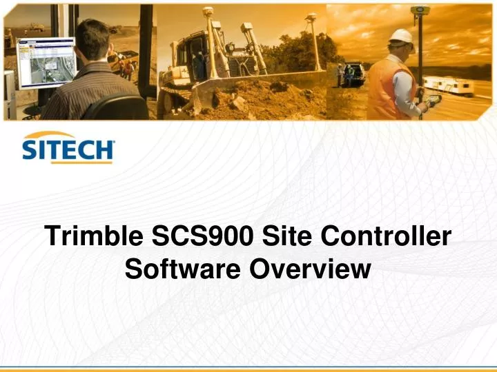
Trimble SCS900 Site Controller Software Overview. Welcome. How often has a job been delayed because you have to wait for someone else to provide information or position?

E N D
Welcome How often has a job been delayed because you have to wait for someone else to provide information or position? By the end of this session on SCS900 Basics you will understand how Trimble SCS900 systems for a Site Supervisor, Foreman or Leading hand can be used on your job site to increase efficiency and productivity by putting information in the hands of those who need it when they need it.
What we will cover • Who are SCS900 users? • Basics of the Trimble Connected Site workflow • Parts of the system • Folder structures • Data flows • Basics of operation • Examples of field use • Advanced Modules • The bottom line
The BIG connected picture Online Applications Project Managers Equipment Managers Site Managers Dispatch Dealers & OEMs Off Site SCS900 Users internet Field Systems Asset Operators Machine Operators Grade Checkers Surveyors Supervisors Foreman Inspector Geotech Partner Applications Engineers Clients Owners Subcontractors Public Online Data Storage Everyone Wireless Site Comms Office Software Estimators Bid Teams Data Managers Surveyors Cable or Media On Site
SCS900 roles include • Site Positioning • Site Reconnaissance • Control and Base setup • Progress Monitoring • As-built survey • Inspection • Sampling and testing (eg. Soil testing) • Requests for Information (RFI) • QA/QC • Grade checking • Progress volumes • Site Management • Asset tracking • Control of materials • Scheduling
Who are SCS900 users? • Supervisors • Foremen • Grade Checkers • Site Surveyors • Site Engineers
Site Supervisor A stake less site leaves the Supervisor “in the dark” SCS900 empowers them with: Access to up-to-date cut/fill levels Latest design info, long and cross sections Measure/check as you drive Mobile Office Regain job satisfaction Supervisor takes pride and ownership because he has the tools
Inspector • Site Inspectors • Record as-builts and compare work completed against design • Project Managers • Leverage tools to streamline site management • Geotechnical Engineers • Navigate to soil measurement locations and remotely send data back to the office • SCS700 on TCA1 Controller • Integrated GPS • Camera • 3G phone for voice and data
Inspector Inspection tasks Request for Information (RFI) As-built position Soil sample Position data attributes add value Photo Notes Mobile tasks Send and receive emails Make phone calls Synchronize data with TCC No need to take phone/PDA and SPS controller into the field. Just take the TCA1 and pay for only one cell phone and data subscription
The Basics The System Components The Data Structure The Workflow Basic Operation and Features
The System Trimble Business Centre Data prep and office software Manage design files and work orders SCS900 Tablet Edition The heart of the Supervisor and field crew systems, can be run on.. Trimble Tablet Laptop or tablet running Windows SPS882 GNSS Receiver Location RTK 0.3ft (10cm) H Precision RTK Vertical
The Project The SCS900 Data folder Each device running SCS900 has a data folder The data folder contains Sites Each Site contains: Site calibration, Control points, Background map, Designs and Work orders Designs Multiple designs per site Design data for earthworks, roads, services etc Work Orders A job or task to be completed on the site Refers to a specific design Includes settings, tolerances and instructions Includes a record of all measurements made, points staked, and reports generated.
The Office Workflow New Project Import files New Job Site Site Calibration and Control points Background files Work Order Create Assign Visualize and check Send to field crew directly Email Data Card Synchronize with TCC • Business Centre (BC):
The Field Workflow SCS900 system: Synchronize with TCC New Work Order Updated Design Measure, check and navigate Synchronize with TCC New pick ups Completed Work Order Synchronize locally Email to anyone Cable connection with office PC Data card for Machine
Intelligent data Design and measured data can be synchronized so everyone has the latest information New designs from office to field Pick ups and reports from field to office Synchronize files between Controller, machine, office and TCC Using Cable, bluetooth, WiFi, cellular or media
Data synchronization TCC Trimble Synchronizer Data Folder Internet Email
Data Flow Online Apps and Services Fleet Management Location / Tracking Maintenance & Health Hours & Fuel Production / Productivity Dashboards / Indicators VRS and IBSS SCS900 Data Internet Field Systems Fleet Management Machine Control Site Positioning Inspection Control QA/QC Progress Monitoring 3rd Party Input/Output Planning Design Maintain & Operate Public Awareness / PR Online Data Storage File Storage / Archiving Database Management Collaboration Data Mining & Visualization Data Flow Control Office Software Takeoff / Estimating Site / Project Planning Data Preparation Data Management QA/QC & As Built Reporting & Progress Wired or Media Comms
SCS900 Operation SCS900 has 2 levels of operation Basic features Use an existing site and calibration Measure, check and navigate work modes Designed for the less skilled operator Each operator is assigned their own login type Simple interface Easy to use with 3 icons to control software Starts with main screen Limited to GPS support Advanced functions Manage control points and Site Calibration Setup a Base Internet connection Full features No limitations
Basic features The 3 Icons Setup Menu Work Modes Menu Measure surface Check Plane Navigation Settings Menu Dependent on Work Mode
What can SCS900 do? Measure Topo Surface – As builts progress and stockpile volumes Check Elevation / grade and laid material thickness Navigate To a point or line Review Interrogate the design • SCS900 has 4 basic functions
Typical Tasks - Measure How much concrete in this pad? Use Review Design features to Calculate volume by area and thickness. How much pipe for this run? How much silt fence in this location? Use Review Design features to measure a distance How much material is needed to finish the current lift? Use Measure Surface to record points when standing/walking/driving
Typical Tasks - Check What slope is this batter/embankment? Displayed on the X-Section view of Tablet What's the Elevation here and what Cut / Fill do I have? Always displayed in Basic mode What construction details on this trench? Where (roughly) is the existing electrical cable in this area? What type of manhole at this location What type of pipe in this trench Check on DXF design drawing loaded as background file How much longer are we going to need this excavator / grader / compactor / trucks / etc? May be resolved by driving along design and getting a rough idea of volumes
Typical Tasks – Navigation/Stakeout Stakeout site features Embankments grading limits Utilities Pads Structures and Manholes. Stake writer SCS900 will always display a useful stake writer report that shows the operator exactly what needs to be written on the stake The Side Slope & Catch Point stakeout function allows you to control the stakeout of complex side slopes in the field, without having to compute them first in the office. It adjusts automatically to live ground elevations enabling you to find the exact catch point location.
SCS900 Road Module • SCS900 Road Module is targeted at all heavy and highway contractors involved in the development of major highways • Also addresses the needs of DOT Highway inspectors • Applications for grade checking, materials thickness checking, staking road features, catch points and side slopes with or without subgrades
Features of the road module • Supports a complex road model that is accurate everywhere. Road model can comprise multiple road jobs. • Very efficient data flow from Office to field and through to finished reports • Allows the user to select where and what they want to stake out • Supports all international methods of stakeout, with comprehensive reporting of results • Simplifies the stakeout and checking process • Automates the QA / QC and reporting of highways measurement and stakeout
Advanced Measurement Module • Improvement to measurement functions • Improves productivity by automating functions • Add intelligence to data being recorded • For any user that utilizes the Measurements menu • Targets those frequently performing As-Builts
Advanced Measurement Module • Advanced Feature Coding • Codes allow automation when interfacing with BC • New Intuitive User Interface • Quick pick list improves speed in filed • Attribute Support • Store more information on the measured data • Intelligent Feature Codes • Code knows if it is a point or line, part of surface or not • Code Management • Group, sort, and create quick pick list for codes • Media Points • Photos associated with points • Cross-section Pickup • Allows cross sectional pickup along roads • Offset Point • Record offset location when unable to get to it • Offset Line • Record more than one line simultaneously
The Bottom Line Productivity gains Cost savings
Productivity Gains On the same page Surveyors, grade checkers, supervisors and machine operators – are all working with the same up-to-date information. Forward planning Plant and materials requirements can be regularly checked and scheduled No waiting Topsoil striping and cut/fill can begin without waiting for stakeout or machine control Adding value to your workforce Supervisors take over basic survey operations and volume calcs Leading hands and foremen can plan ahead Surveyors can focus on high level tasks Improved communications between field and office personnel
Improved Productivity • Collective data management • Everyone working on the same data • Everyone has access to the data • Everyone can collect new data • Empower site operatives (DIY) • No waiting for data from engineers • No waiting for set-out or check from surveyor • No waiting for someone else's report
Cost savings • No hard copy drawings • Travel time, down time, fuel costs and rework can be avoided • No staking and re-staking • Machines require GCS system • Cost of Survey crew • Cost of materials • Cost of delays waiting for re-staking • Quote: “To purchase survey equipment for 4 survey crews (required for staking) and pay wages over the 3 year life of the project would cost approximately $AU4 million dollars”
Cost Savings • Its Monday and you need to check grade on an area you think you’re finished with • The surveyor can’t make it until next week… • How much money does down time cost you? • How much money do idle machines cost you? • SCS900 gives you the ability to do the work yourself!
Closing statement SCS900 empowers your team with the information and tools to: Plan ahead Resolve issues quickly Take ownership of the job The benefits can be measured in: Increased efficiency from a higher value workforce Reduced survey costs Reduction of delays and rework Better forward planning
Questions? Thank You