Download
1 / 59
900 likes | 2.62k Views
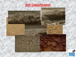
Soil Classification. Dr. Attaullah Shah. Purpose. Main soil types are; Clay, Silt, Sand, Gravels, Boulders etc. Above types seldom exist separately in nature Natural soil deposits comprise mixture of above types in varying proportions

E N D
Soil Classification Dr. Attaullah Shah
Purpose • Main soil types are; Clay, Silt, Sand, Gravels, Boulders etc. • Above types seldom exist separately in nature • Natural soil deposits comprise mixture of above types in varying proportions • Soil classification means to arrange soil in groups and label them based on their properties and behaviour. • Soil Classification Systems have been developed by different organizations
Basis for Classification • Classification is based on the following physical properties • Grain Size Distribution (GSD) • Liquid limit (LL) • Plasticity Index (PI) • Classification gives some idea about the general behaviour of soil • However to predict true behaviour additional information based on geotechnical properties are yet required
Communicate between engineers Classification system (Language) Estimate engineering properties Achieve engineering purposes Simple indices GSD, LL, PI Use the accumulated experience • Classifying soils into groups with similar behavior, in terms of simple indices, can provide geotechnical engineers a general guidance about engineering properties of the soils through the accumulated experience.
Soil Classification Systems (SCS) • Classification systems developed by different organizations 1.Unified soil classification system. 2. AASHTO (American Association of state Highway and Transportation Officials) soil classification system. 3. FAA (Federal Aviation Administration) soil classification system. 4. Textural soil classification system. 5. USDA (U.S. Department of Agriculture) soil classification system.
2. Classification Systems • Two commonly used systems: • Unified Soil Classification System (USCS). • American Association of State Highway and Transportation Officials (AASHTO) System Most widely used to classify soil for use in foundation & dam engineering. Most widely and exclusively used for highways and airfields
3. Unified Soil Classification System(USCS) Origin of USCS: This system was first developed by Professor A. Casagrande (1948) for the purpose of airfield construction during World War II. Afterwards, it was modified by Professor Casagrande, the U.S. Bureau of Reclamation, and the U.S. Army Corps of Engineers to enable the system to be applicable to dams, foundations, and other construction (Holtz and Kovacs, 1981). • Four major divisions: • Coarse-grained • Fine-grained • Organic soils • Peat
Liquid and plastic limit tests. • Particle size analysis test. • Tests required for classification of soil are; • Broad Classification includes the following two types; • Coarse-grained soil • Fine-grained soil • The soil is classified in to 15 groups. • Each group is designated a symbol consisting of two capital letters • The first letter is based on main soil type • The second letter is based on gradation and plasticity
Symbols for main soil types Coarse-grained soil is subdivided into two subgroups based on gradation, W-- for well-graded soil P -- for poorly-graded soil Fine-grained soil is subdivided in two subgroups based on their plasticity characteristics L-- for low plasticity soil (liquid limit < 50) H-- for high plasticity soil (liquid limit > 50)
Soils possessing characteristics of two groups are known as borderline soils and designated by dual symbols e.g., GC-GM, GW-GM, GW-GC, GP-GM, GP-CG, SC-SM, SW-SM, SW-SC, SP-SM, SP-SC, CL-ML. Total number of groups in USC system, therefore are twenty six (26), The Unified Soil Classification System is based on the following: 1. Textural characteristics of coarse-grained soils with such small amount of fines, that fines do not affect the behaviour. 2. Plasticity characteristics of fine-grained soils where the fines affect the engineering behaviour. Textural characteristics are evaluated by particle-size analysis. Plasticity characteristics are evaluated by the plasticity chart.
To classify a soil, following information based on particle size analysis and Atterberg limits should be available. • %age of gravel, that is, the fraction passing 3-in. (76.2mm) sieve and retained on the No.4 (4.75mm) sieve. • %age of sand, that is, the fraction passing No.4 sieve (4.75mm) and retained on the No.200 (0.074mm) sieve. • %age of silt and clay, that is, the fraction finer than the No.200 (0.075mm) sieve. • Uniformity coefficient (Cu) and the coefficient of gradation (Cc), which actually depend on the shape of particle-size-distribution curve. • Liquid limit and plasticity index of the fraction of soil passing No.40 sieve, plotted on the plasticity chart
3.1 Definition of Grain Size No specific grain size- use Atterberg limits Silt and Clay Gravel Sand Cobbles Boulders Coarse Fine Coarse Medium Fine No.200 0.075 mm No.4 4.75 mm 300 mm 75 mm No.10 2.0 mm 19 mm No.40 0.425 mm
50 % Coarse-grained soils: Gravel Sand Fine-grained soils: Silt Clay NO.200 0.075 mm NO. 4 4.75 mm • Grain size distribution • Cu • Cc • PL, LL • Plasticity chart 3.2 General Guidance 50% LL>50 LL <50 Required tests: Sieve analysis Atterberg limit
Soil symbols: G: Gravel S: Sand M: Silt C: Clay O: Organic Pt: Peat Liquid limit symbols: H: High LL (LL>50) L: Low LL (LL<50) Gradation symbols: W: Well-graded P: Poorly-graded 3.3 Symbols Example: SW, Well-graded Sand SC, Clayey Sand SM, Silty Sand, MH, Highly Plastic Silt
L H PI LL (Holtz and Kovacs, 1981) 3.4 Plasticity Chart • The A-line generally separates the more claylike materials from silty materials, and the organics from the inorganics. • The U-line indicates the upper bound for general soils. • Note: If the measured limits of soils are on the left of U-line, they should be rechecked.
3.5 Procedures for Classification Coarse-grained material Grain size distribution Fine-grained material LL, PI Highly (Santamarina et al., 2001)
3.7 Organic Soils • Highly organic soils- Peat (Group symbol PT) • A sample composed primarily of vegetable tissue in various stages of decomposition and has a fibrous to amorphous texture, a dark-brown to black color, and an organic odor should be designated as a highly organic soil and shall be classified as peat, PT. • Organic clay or silt( group symbol OL or OH): • “The soil’s liquid limit (LL) after oven drying is less than 75 % of its liquid limit before oven drying.” If the above statement is true, then the first symbol is O. • The second symbol is obtained by locating the values of PI and LL (not oven dried) in the plasticity chart.
3.8 Borderline Cases (Dual Symbols) • For the following three conditions, a dual symbol should be used. • Coarse-grained soils with 5% - 12% fines. • About 7 % fines can change the hydraulic conductivity of the coarse-grained media by orders of magnitude. • The first symbol indicates whether the coarse fraction is well or poorly graded. The second symbol describe the contained fines. For example: SP-SM, poorly graded sand with silt. • Fine-grained soils with limits within the shaded zone. (PI between 4 and 7 and LL between about 12 and 25). • It is hard to distinguish between the silty and more claylike materials. • CL-ML: Silty clay, SC-SM: Silty, clayey sand. • Soil contain similar fines and coarse-grained fractions. • possible dual symbols GM-ML
3.8 Borderline Cases (Summary) (Holtz and Kovacs, 1981)
Group Symbols for Gravelly Soil - No.200, means passing No.200 sieve
Table: Group Symbols for Sandy Soil - No.200, means passing No.200 sieve.
Range of plasticity & material % for low plastic inorganic silty & clayey soil (ASTM-1986)
Range of plasticity & material %-age for highly plastic silty & clayey soil (ASTM-1986)
Range of plasticity & material %-age for organic soil (ASTM-1986)
Group symbols & their characteristics related to Roads & Airfields
Group symbols & their characteristics related to Roads & Airfields
DESCRIPTION OF USC-GROUPS COARSE GRAINED SOIL 1. GW and SW groups: • Well-graded gravelly and sandy soils with little or no fines (≤ 5%). • Fines must not change the strength & free-draining characteristics • In areas prone to frost action, they should not contain 3% of grains smaller than 0.02 mm. 2.GP and SP groups: • Poorly graded gravels and sands with little or no fines. • Poorly or Gap-graded materials are non-uniform mixtures of very • coarse material and very fine sands with intermediate sizes lacking. 3.GM and SM groups: • Silty gravel & silty sand with fines (12%) of low or no plasticity. • These lie below the “A” line on the plasticity chart. • Both well and poorly-graded materials are included in these groups. • GMd and SMu groups: • Suffices “d” and “u” mean desirable and undesirable base materials • This subdivision applies to roads and airfields only • Subdivision is based on the liquid limit and plasticity index • Suffix “d” is used when LL is 25 or less and the PI is 5 or less; • Suffix “u” is used otherwise.
4. GC and SC groups: • Gravelly or sandy soils with fines ( 12 %) that are more clay-like. • The fines range in plasticity from low to high. • The LL and PI of these groups plot above “A” line on plasticity chart. • Both, well and poorly-graded soils are included in these groups. FINE-GRAINED SOIL 1. ML and MH groups: • Sandy silts, clayey silts, or inorganic silts with relatively low plasticity. • Loess-type soils, rock flours, micaceous and diatomaceous soils are also included. • Some types of kaolinite and illite clays also fall under these groups. • Suffices L & M means low and high • Micaceous and diatomaceous soils generally fall within the MH group but may extend into the ML group when their LL is less than 50. 2.CL and CH groups: • The CL and CH groups include clays with low and high liquid limits • They are primarily inorganic clays. • The medium and high plasticity clays are classified as CH and include fat clays, gumbo clays, bentonite, and some volcanic clays. • The low plasticity clays are classified as CL and usually include lean clays, sandy clays, or silty clays.
3.OL and OH groups: • These groups are characterized by the presence of organic matter. • Organic silts and clays are included in these two groups, and they have a plasticity range corresponding to the ML, and MH groups. Highly Organic Soils • These soils are designated by group symbol (Pt). • They are usually very compressible and have undesirable engineering characteristics. • These includes peat, humus, and swamp soils with a high organic texture. • Common components of these soils are particles of leaves, grass, branches, or other fibrous vegetable matter.
4. American Association of State Highway and Transportation Officials system (AASHTO) Origin of AASHTO: (For road construction) This system was originally developed by Hogentogler and Terzaghi in 1929 as the Public Roads Classification System. Afterwards, there are several revisions. The present AASHTO (1978) system is primarily based on the version in 1945. (Holtz and Kovacs, 1981)
4.1 Definition of Grain Size No specific grain size use Atterberg limits Boulders Silt-Clay Gravel Sand Coarse Fine No.200 0.075 mm No.10 2.00 mm 75 mm No.40 0.425 mm
A1 ~ A3 A4 ~ A7 Granular Materials 35% pass No. 200 sieve Silt-clay Materials 36% pass No. 200 sieve 4.2 General Guidance • 8 major groups: A1~ A7 (with several subgroups) and organic soils A8 • The required tests are sieve analysis and Atterberg limits. • The group index, an empirical formula, is used to further evaluate soils within a group (subgroups). • The original purpose of this classification system is used for road construction (subgrade rating). Using LL and PI separates silty materials from clayey materials (only for A2 group) Using LL and PI separates silty materials from clayey materials
Following are some rules for determination of group index: • If the equation for group index gives a negative value for GI, it is taken as zero. • The group index calculated from the equation is rounded off to the nearest whole number (for example, GI = 4.4 is rounded off to 4; and GI = 4.5 is rounded off to 5). • There is no upper limit for the group index. • The group index of soils belonging to groups A-1-a, A-1-b, A-2-4, A-2-5, and A-3 will always be zero. • When calculating the group index for soils belonging to groups A-2-6, and A-2-7, the partial group index equation related to plasticity index (as given below) should be used. • GI = 0.01(F200 – 15)(PI – 10)
4.4 Classification Table: Classification of Soil-Aggregate Mixtures (with Suggested Subgroups)
4.4 Classification (Cont.) Note: The first group from the left to fit the test data is the correct AASHTO classification. Das, 1998
Fig: Liquid limit and plasticity index ranges for silt-clay material
Round off 4.4 Example Passing No.200 86% LL=70, PI=32 LL-30=40 > PI=32 Passing No.200 86% LL=70, PI=32 A-7-5(33) LL-30=40 > PI=32
Table: Comparison of the AASHTO and unified soil classification systems
COMPARISON OF THE AASHTO AND UNIFIED SOIL CLASSIFICATION GROUPS Table Comparison of the systems
Example 1: • The porosity of a soil sample is 35% and the specific gravity of its particles is 2.7. Calculate its voids ratio, dry density, saturated density and submerged density. • Solution: