Download
1 / 26
260 likes | 365 Views
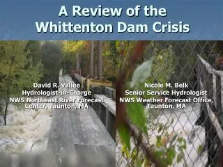
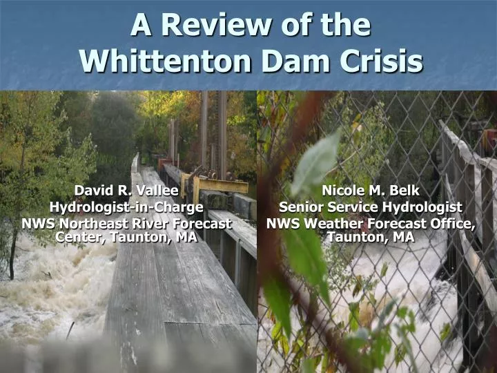
A Review of the Whittenton Dam Crisis. David R. Vallee Hydrologist-in-Charge NWS Northeast River Forecast Center, Taunton, MA. Nicole M. Belk Senior Service Hydrologist NWS Weather Forecast Office, Taunton, MA. Objectives.

E N D
A Review of the Whittenton Dam Crisis David R. Vallee Hydrologist-in-Charge NWS Northeast River Forecast Center, Taunton, MA Nicole M. Belk Senior Service Hydrologist NWS Weather Forecast Office, Taunton, MA
Objectives • Review Hydro-meteorological evolution of events leading up to the potential dam failure • Examine the flood potential should the Whittenton Pond and/or Morey’s Bridge Dam had failed • Discuss the WFO/RFC capabilities to provide support during dam failure events
Hydro-met perspective • Back to back prolific rainfall events • October 7-9 and October 13-16 • First system dropped 3-5 inches • Second system dropped 6-8 inches • Both systems were linked to the deep tropics – deep moisture plume
Round One:Tropical Storm Tammy remnants and a slow moving frontal system October 7-9, 2005
24 Hour Precipitation for October 9th, 2005 SE Massachusetts Event Total: 3-5”
Round Two:Off-shore storm development and remnants of Subtropical TD 22 October 13-16, 2005
24 Hour Precipitation for October 16th, 2005 SE Massachusetts Event Total: 6-8” (most of this fell in a 6 to 12 hour period)
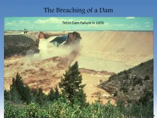
Examining the Potential Dam Failure(s) • Crisis began 3 pm, Monday, Oct 17th • Taunton EMA called in the imminent failure of Whittenton Dam on the Mill River • Just upstream of the city center • Two structures at risk: • Most immediate concern: Whittenton Dam • Built in the late 1800s, limited refurbishment in 1950s • Complicating matters: Morey’s Bridge Dam • Holding back Lake Sabattia
Whittenton Pond Dam Downtown Taunton, MA
NWS CapabilitiesWhat we need from you • Have your local NWS office high on the local notification list for dams in your area • High Hazard dams have Emergency Action Plans (EAPs) – ensure the NWS is high on the notification tree • Most important information for the dam: • The correct name of the dam! • County & town the dam is located • River, stream or lake the dam is on • NID or State ID, Dam Type (earth, concrete) • Condition of the dam • Width of breach • Is the failure in progress or imminent • Is the pool/lake full, ½ full, etc.
NWS CapabilitiesWhat we will provide you • Initial estimate of flood wave and the time to reach the nearest downstream location • For Whittenton Dam – a Flash Flood Warning was issued almost immediately after notification from EMA • Time to fail = 5 minutes; a flood wave producing a peak depth of 5 feet reaching downtown Taunton in ~ 20 minutes
Additional CapabilitiesIf Time Allows! Scenario One: Whittenton Fails
City of interest: Taunton Time elapsed from failure to Peak depth at Taunton: 8-14 minutes Peak depth of flood: 5.4 feet – flood elevation exceeded for 1 hour
Additional CapabilitiesIf Time Allows! Scenario Two: Morey’s Bridge and Whittenton Fail
City of interest: Taunton Time elapsed from failure to Peak depth at Taunton: 20 minutes Peak depth of flood: 6.9 feet - flood elevation exceeded for ~ 12-18 hours
As for the eventual outcome…A near-failure as the USACE was successful in an emergency operation to draw down the pool and gracefully take down the dam! In just a matter of hours – note the bowing of the wooden structure!
USACE to the rescue – While NWS watched Hurricane Wilma like a HawkThey need 84 hours to pull this off – Hurricane Wilma brought rains as forecast ~ hour 96! During The Flooding The New Dam
NWS Response • WFO Taunton was notified 3 pm October 17th – Flash Flood Warning was issued for imminent failure • Upon issuance, the city of Taunton ordered evacuations of all downstream areas in the floodplain • Shut down businesses, schools, city offices • RFC/WFO teamed to produce dam breach simulations (DamCrest) program • WFO/RFC provided both remote and on-site Decision Support to the city of Taunton through the following weekend
A Review of the Whittenton Dam Crisis David R. Vallee Hydrologist-in-Charge NWS Northeast River Forecast Center, Taunton, MA Nicole M. Belk Senior Service Hydrologist NWS Weather Forecast Office, Taunton, MA