Download
1 / 23
470 likes | 1k Views
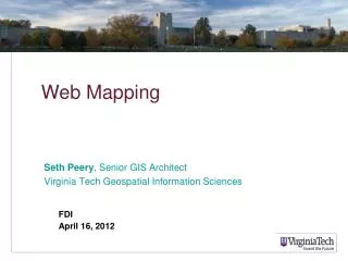
Seth Peery , Senior GIS Architect Virginia Tech Geospatial Information Sciences. Web Mapping. FDI April 16, 2012. Objective: Understand how web maps work, what goes on behind the scenes, and how to actually deploy them in production IT environments

E N D
Seth Peery, Senior GIS Architect Virginia Tech Geospatial Information Sciences Web Mapping FDI April 16, 2012
Objective: Understand how web maps work, what goes on behind the scenes, and how to actually deploy them in production IT environments • Common architectural features of web mapping applications • Web Mapping Workflows • Examples from Google Maps and ArcGIS Server
Web Mapping vs. Supporting GIS components Web Mapping You are here. Cartography Data Management
Software Architecture • This layer consists of web content that’s not the web application – look and feel, formatting, etc. • This layer addresses the functionality of your application – e.g., what happens when the user clicks? • This layer concerns the transport of data from its source format, with the appropriate presentation., to the web application. • This layer concerns map symbology. It is more of a workflow item than a subsystem – it may be handled in the source data or the map svc. Everything from here down is data
Functional Components ofAll Web Mapping Applications • Source data • Data accessible to the web app • Basemap (increasingly coming from third party services) • Thematic layers (your data) • Representation/symbology of the data • Web service to return thematic data • Web map object and application logic • Web application container/interface for the map (presentation)
ArcGIS Server in the Scheme of Things At web applications tier, we can choose between the {Java | .NET} ADF, the JavaScript API, Flex API, Silverlight API SOC/SOM (GIS Server Components) respond to requests for maps and return data or images (e.g., MapService, WMS) ArcGIS Server doesn't care about anything below this point, so you can plug and play with different supported data sources... filesystem vs ArcSDE, etc.
ArcGIS Server Deployment Workflow ESRI says “Author, Publish, Use”… the details are a bit more complex! • Identify source data • Identify server platform • Move source data to a location visible to the server (e.g., ArcSDE, file GDB on server) • Make an MXD with data source references to “production” copy of data • Upload MXD to server or ensure it is visible in a shared location • Author a Map Service based on the MXD, set capabilities • Create a web application that consumes the service • Web API (Flex/SilverLight/JavaScript) • Web ADF (Deprecated) • Customize web application • Publish to Production environment
ESRI Developer Resources • Main ArcGIS Server Resource Center:http://resources.arcgis.com/content/arcgisserver/10.0/about • Flex API Reference:http://help.arcgis.com/en/webapi/flex/apiref/index.html • JavaScript API Reference:http://help.arcgis.com/en/webapi/flex/apiref/index.html
Initial Setup • Assemble data, make a map and make sure the server can access it
REST Services Directory • The map we created in ArcMap is now available as a REST endpoint and can be accessed via the REST services directory by a web mapping application. http://training.gis.vt.edu/arcgis/rest/services
Web Service representations of the map REST SOAP
REST preview • Web Services have no UI – they’re meant to be used by computer programs • The REST services directory provides a minimal preview web application for human viewers • We’re not done yet – this is not a “real” web application. http://training.gis.vt.edu/arcgis/rest/services/samples/BlacksburgRCL/MapServer
Sample Flex Viewer • SFV is a configurable web mapping application from http://resources.arcgis.com • The app is a Flash-based viewer that can be modified (to an extent) via a set of XML files http://help.arcgis.com/en/webapps/flexviewer/index.html
Flex Viewer Example http://training.gis.vt.edu/geog5984/sampleflex/
FlexViewer Source http://training.gis.vt.edu/geog5984/sampleflex/config.xml
ArcGIS Server JavaScript Viewer Example: Blacksburg RCL over ESRI terrain http://training.gis.vt.edu/geog5984/samplejs/example2.htm
ArcGIS Server JavaScript Viewer Example 2: Google Maps Extension http://training.gis.vt.edu/geog5984/samplejs/example3.htm
Google Maps Deployment Workflow • No need to worry about the basemap! • Identify a web server (no special capabilities needed) • For Gmaps v2, obtain an API key (omit in APIv3) • Identify source data, copy to server (or load into DB) • Write page logic to render map and symbology • Design web front-end • Google Maps API Reference is found at • https://developers.google.com/maps/
Google Maps Examples • For all the examples below, refer to the ViewSource for code comments, which provide detailed explanation of each feature. • Basic Google Map of VT Campushttp://training.gis.vt.edu/geog5984/gmaps/gmaps_example1.htm • Basic Map with place name searchhttp://training.gis.vt.edu/geog5984/gmaps/gmaps_example2.htm • All of the above, plus VT Buildingshttp://training.gis.vt.edu/geog5984/gmaps/gmaps_example3.htm • All of the above, plus icon stylinghttp://training.gis.vt.edu/geog5984/gmaps/gmaps_example4.htm
Contact Information Seth Peery Senior GIS Architect, Enterprise GIS Virginia Tech Geospatial Information Sciences 2060 Torgersen Hall (0197) Blacksburg, VA 24061 (540) 231-2178 sspeery@vt.edu http://gis.vt.edu