Download
1 / 22
230 likes | 377 Views
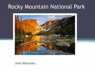
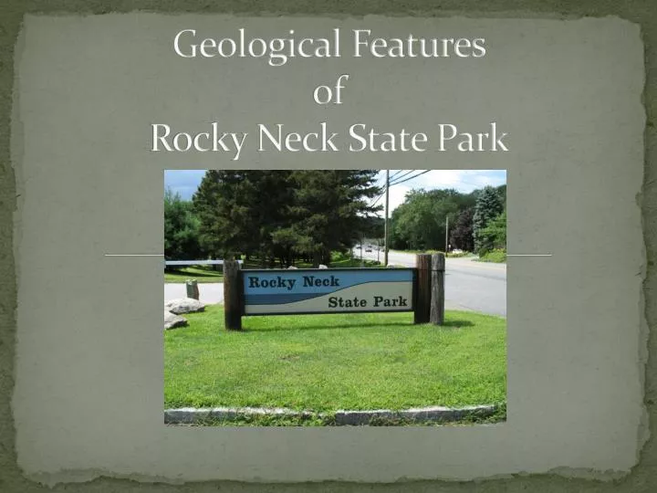
Geological Features of Rocky Neck State Park. Rocky Neck State Park Location. Rocky Neck State Park is located on the shore of Long Island Sound in East Lyme Connecticut. Rocky Neck. Rocky Neck State Park Information.

E N D
Rocky Neck State Park Location • Rocky Neck State Park is located on the shore of Long Island Sound in East Lyme Connecticut RockyNeck
Rocky Neck State Park Information • Known by Native Americans and Colonists for it’s abundance of wildlife and fish • The park was first founded in 1931 • 710 acres were set aside for: • beach goers on it’s rock free white beaches and it clear waters • Hikers to walk on many of it’s diverse trails trough caves and scenic salt marshes • Campers to use one of it’s 160 campsites • Bird watchers to observe many of species such as Cranes , Herons, Swans, and Osprey that utilize Bride Brook salt marsh
Why Rocky Neck State Park? • Rocky Neck has many geological formations that represent both glacial and tectonic activity.
Tectonic history Rocky Neck State Park Proto North America • 450-250 million years ago (Paleozoic era) several crustal plates including Avalonia (island in Atlantic) Africa and Eurasia collide into the Proto North America plate closing the Lapetos Ocean • Collision caused metamorphic changes in the rock causing folding and the creation of the Appalachian mountains • 235 million years (Mesozoic era) plate tectonics had reversed and the super continent known as Pangaea started to break apart causing rift basins to form along the break up • Avalonia stayed attached to North America (southeast Ct) Rift Valley Avalonia
Tectonic history Rocky Neck State Park • Metamorphic Rock- Is transformation of one rock type into another as a result of exposure of intense heat or pressure and forms compressed mineral layers Compressed layers of Granitic Gneiss
Evidence of Tectonic Activity • Tectonic activity compressed the land forming ridges running north and south through out the park forming crescent shaped beaches East Headland Crescent Beach West Headland
Evidence of Tectonic Activity cont. • When the land is compressed near the coast line salt marshes often fill in the valley West ridge East ridge Salt Marsh
Evidence of Tectonic Activity cont. • Compression of plates has resulted rocks to metamorphosis and fold under pressure and heat
Evidence of Tectonic Activity cont. • Potter Hill • Granitic gneiss • Streaks of pink granite • Other Minerals • Pink-Orange Feldspar • Quartz • Granite • Tourmaline • Biotite Potter Hill
Evidence of Tectonic Activity cont. • Granitic gneiss • Metamorphic rock, formed from intense heat and pressure during formation • Banded texture of elongated mierals Granitic gneiss
Evidence of Tectonic Activity cont. • Pegmatite veins in granitic gneiss rock found on Potter Hill • Formed under less pressure and heat Pegmatite vein
Evidence of Tectonic Activity cont. • More ridges as a result of compression from east to west • Woodland environment West ridge East ridge
Glacial History Rocky Neck State Park • 24,000 years ago Connecticut was covered by glacier • For 5,000 years the glacial boundary stayed over Connecticut containing large amounts of loose sediments, sand, rocks, and clay which form terminal moraines marking the furthest boundary of the glacier
Evidence of Glacial Activity • Glacial till consists of loose sediments rocks, sand, and clay covered much of CT’s coastal bedrock Glacial Till
Evidence of Glacial Activity cont. N • Rocks, sand, and clay make up the terminal moraines marking the glaciers boundary and formed: Long Island, Block Island, Martha’s Vineyard, Nantucket, and Cape Cod Glacial direction S Long Island
Evidence of Glacial Activity cont. • Glacial Boulders • Are moved from the north during glacial movement south Glacial Boulders
Evidence of Glacial Activity cont. • Glacial polishing on Potter Hill • As the glacier glides over the rock the ice acts like sandpaper, scratching the bedrock Glacial polishing
Facilities • Local rock was carved to make the pavilion
Work Cited • http://www.ct.gov/dep/cwp/view.asp?a=2716&q=325108&depNav_GID=1650 (2008)
Assessment • Write a paragraph describing how tectonic activity has shaped Rocky Neck State Park • In your paragraph explain two sources of evidence of tectonic activity at the park • Write a paragraph describing how glacial activity has shaped Rock Neck State Park • In your paragraph explain two sources of evidence of tectonic activity at the park