Download
1 / 37
370 likes | 489 Views
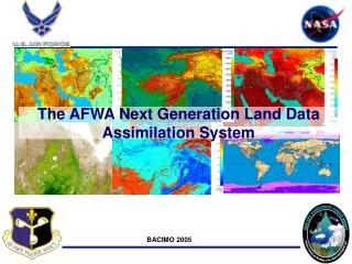
Development and Application of Land Data Assimilation System (LDAS) in NCEP Operations. Youlong Xia 1,2 , Michael B. Ek 1 , Jesse Meng 1,2 , Helin Wei 1,2 , Rongqian Yang 1,2 , and Jiarui Dong 1,2. 1 Environmental Modeling Center (EMC)

E N D
Development and Application of Land Data Assimilation System (LDAS) in NCEP Operations Youlong Xia1,2, Michael B. Ek1, Jesse Meng1,2, Helin Wei1,2, Rongqian Yang1,2, and Jiarui Dong1,2 1Environmental Modeling Center (EMC) National Centers for Environmental Prediction (NCEP) National Oceanic and Atmospheric Administration (NOAA) Camp Spring, Maryland, U.S.A. 2IMSG at NOAA/NCEP/EMC, Camp Spring, Maryland, U.S.A.
NCEP LDAS Climate Forecast System Reanalysis -Global LDAS (CFSR-GLDAS) North American LDAS (NLDAS) Uncoupled/Offline Multiple Models High Resolution (1/8ox1/8o) Semi-Coupled Single Model Coarse Resolution (38km x 38km) Operational Drought Monitoring and Prediction Regional Weather and Climate Model Prediction Global Operational Drought Monitoring and Prediction Global Climate Reanalysis and Prediction
North American Land Data Assimilation System NLDAS Monitoring Mode An Long-term Multi-institutional Collaboration Project (1999-2014)
•NLDAS is a multi-model land modeling and data assimilation system… • …run in uncoupled mode driven by atmospheric forcing (using surface meteorology data sets)… • …with “long-term” retrospective and near real-time output of land-surface water and energy budgets.
NLDAS Data Sets and Setup European Geosciences Union General Assembly 2011, Vienna, Austria, 4-8 April 2011
NLDAS Drought Monitor NLDAS Drought Prediction Anomaly and percentile for six variables and three time scales: • Soil moisture, snow water, runoff, streamflow, evaporation, precipitation • Current, Weekly, Monthly NLDAS website www.emc.ncep.noaa.gov/mmb/nldas
NLDAS Example Ek et al., 2011, Gewex News, 7-9, May 2011 • The web shows not only four-model ensemble mean anomaly and percentile but also separate model anomaly and percentile. • GSWP2 results demonstrated that multi-model ensemble mean gives more robust simulations when compared to the separate model simulations. Therefore, ensemble mean results will be shown in NLDAS drought monitoring.
NLDAS example: ‘88 drought & ’93 flood June 1998 – drought year Monthly total column soil moisture anomalies and model spread (mm/month) • Large similarity and ~small spread
NLDAS example: ‘88 drought & ’93 flood July 1993 – flood year Monthly total column soil moisture anomalies and model spread (mm/month) • Similar characteristics and larger spread
NLDAS Validation Monthly streamflow anomaly correlation over continental United States (1979-2007 USGS measured streamflow) Ensemble Mean Energy flux validation from tower: net radiation, sensible heat, latent heat, ground heat Water flux: evaporation, total runoff/streamflow State variables: soil moisture, soil temperature, skin temperature, snow water equivalent, snow cover Example -Simulation Skill (Anomaly Correlation)
Distribution of NLDAS Products http://www.emc.ncep.noaa.gov/mmb/nldas http://disc.sci.gsfc.nasa.gov/hydrology/data-holdings
NLDAS application to U.S. Drought Monitor 25 August 2009 www.drought.gov • NLDAS soil moisture & total runoff products provided to US Drought Monitor.
North American Land Data Assimilation System NLDAS Prediction Mode A Collaborative Project with Princeton University and University of Washington (2006-present)
Collaboration Partners for NLDAS Seasonal Drought Prediction NCEP Environmental Modeling Center (EMC) Mike Ek, Youlong Xia, and Ken Mitchell (retired) Transition seasonal hydrological forecast system to EMC as a test system Depending on initial conditions of VIC water mode being run by LifengLuo Princeton University Eric Wood, LifengLuo*, Justin Sheffield, and Haibin Li Developing seasonal hydrological forecast system using NCEP Climate Forecast System (CFS) forecast products and Ensemble Streamflow Prediction (ESP) approach Assessment of seasonal forecast system using CFS reforecast products Michigan State University LifengLuo* Extension of seasonal hydrological forecast system to SAC and Noah Run nowcasting of VIC water mode University of Washington Dennis Lettenmaier, Andy Wood, Ben Levnieh Developing seasonal hydrological forecast system using NCEP Climate Prediction Center (CPC) seasonal outlook products NCEP Climate Prediction Center (CPC) Kingtse Mo Test various bias correction schemes to improve seasonal hydrological forecast system skills at Southeast and Colorado basins
Current Forecast System (Configuration)
OBS Bayesian Merging of Information Posterior Likelihood function (relates local scale to GCM scale and above) Prior (local climatology) 1/8th degree scale variable Variable at GCM scale and above Bayes Theorem Approach details, please contact Dr. LifengLuo: lluo@msu.edu
Three Approaches to Generate Surface Forcing a. NCEP Climate Forecast System (CFS) 2 members daily (total members = 2 X number of days for a month), using all predicted monthly precipitation samples to generate probability density function for 1-9 month forecast , bias-corrected monthly precipitation is generated by using Bayesian merging technique b. NCEP/ CPC Official Seasonal Outlook (CPC) The seasonal probability forecast product for precipitation and 2-m temperature from several dynamical models and statistical models c. Ensemble Streamflow Prediction (ESP) Using historical monthly precipitation datasets to make samples of surface forcing
An Example for 3-month Forecast CFS Approach and Different Variables Total Column Soil Moisture Evapotranspiration (ET) Anomaly Probability Forecast Percentile http://www.emc.ncep.noaa.gov/mmb/nldas/
An Example for 2-month Forecast Three Approaches – CFS, CPC, ESP July 2011 total column soil moisture percentile using 1 June 2001 as IC CFS CPC ESP July 2011 probability forecast using 1 June 2001 as IC
Verification Performance of different approach 1st mo 2nd mo 3rd mo 4th mo 5th mo 6th mo
Verification (Continue) JAN FEB MAR
NLDAS Forecast Products http://www.emc.ncep.noaa.gov/mmb/nldas 6 month forecast using three approaches [CFS, CPC, and Ensemble Streamflow Prediction (ESP)] Monthly mean total soil moisture anomaly and percentile, evaporation anomaly and percentile, streamflow anomaly and percentile, precipitation anomaly, drought probability forecast
Support NCEP/CPC Seasonal Drought Outlook CFS 1-month forecast Drought will continue for a while CFS 2-month Forecast CFS 3-month Forecast
NCEP Climate Forecast System (CFS) Global Land Data Assimilation System (GLDAS) NCEP CFS-GLDAS
A new Global Reanalysis of the atmosphere, ocean, sea-ice and land over the 32-year period (1979-2010) • Analysis Systems : Operational GDAS Atmospheric (GADAS/GSI) Ocean-ice (GODAS) Land (GLDAS/LIS) • 2. Atmospheric Model : Operational GFS • New Noah Land Model • 3. Ocean Model : New MOM4 Ocean Model • New Sea Ice Model CFSR Courtesy: SuruSaha, NOAA/NCEP/EMC
CFSR-GLDAS Configuration CFS Reanalysis Execution (24-hr span) : Note daily GLDAS Atmos. Analysis 0Z GSI 6Z GSI 12Z GSI 18Z GSI 0Z GSI 0Z GODAS 6Z GODAS 12Z GODAS 18Z GODAS 0Z GODAS Ocean Analysis 0Z GLDAS 6Z GLDAS 12Z GLDAS 18Z GLDAS 0Z GLDAS Land Analysis Time CFSR – Global Atmospheric Data Assimilation System (GDAS/GSI), Global Oceanic Data Assimilation System (GODAS), Global Land Data Assimilation (GLDAS)
Land Surface Characteristics Topography Land Cover Soil CFSR land analysis Soil Moisture Soil Temperature Snow Noah LSM Precipitation Forcing Non-precip Meteorological Forcing CFSR surface file gdas1.t00z.sfcanl Land Variables Soil Moisture Soil Temperature Snow Land Information System Christa Peters-Lidard et al., NASA/GSFC/HSB
CFSR-GLDAS Configuration (Cont.) Atmospheric Forcing: CFS atmospheric analysis products Blended precipitation to replace GFS analysis precipitation Offline run Land Information System (LIS) Noah model (one day back) when blended P is available. As all atmospheric forcing except P come from coupled system, this offline run is called “semi” coupled run Period: 1 January 1979 - present
CFSR-GLDAS Soil Wetness Comparison CFRR = CFSR-GLDAS GR2 = NCEP Reanalysis Version 2 MAY NOV MAY NOV
CFSR-GLDAS Validation GR2 =NCEP Reanalysis Version 2 NARR = North American Regional Reanalysis
Application of CFSR-GLDAS Products for Climate Prediction Higher Skills Lower Skills Noah model Initial – GR2/GLDAS OSU model Anomaly correlation of JJA ensemble mean precipitation forecasts from 25-yr reforecasts of the four CFS configurations (top left: OSU/GR2; bottom left: Noah/GR2; top right: Noah/GLDAS; bottom right: Noah/GLDAS climatology)
NCEP LDAS System Improvement and Upgrade Land Surface Models Model Development Community Model Forcing Gauge, satellite, radar NLDAS (12 km) GLDAS 25-38 km HRAP-NLDAS (4km) Application of Products: Drought, flood Evaluation and Validation of Products LDAS Products Assimilation Approach Development and Application Observations In situ, satellite
Future Work Transition NLDAS to NCEP operations. Further NLDAS products evaluation/validation. Extend current NLDAS to run under the NASA Land Information System (LIS) & to assimilate land-data, e.g. snow, soil moisture, etc. Improve land-surface models (physics) through collaboration with NLDAS and other partners. Continue to provide support for NCEP Climate Prediction Center and National Integrated Drought Information System. Initial land conditions for coupled models. Global: NCEP Global Land Data Assimilation System (GLDAS) and NCEP CFS.
Thank You! Welcome to use NLDAS and CFSR products NOAA NLDAS Website http://www.emc.ncep.noaa.gov/mmb/nldas/ NASA NLDAS Website http://ldas.gsfc.nasa.gov/nldas/ CFSR NCDC Website http://nomads.ncdc.noaa.gov/ Comments and Suggestions to: NLDAS: Youlong.Xia@noaa.gov,CFSR-GLDAS: Jesse.Meng@noaa.gov NCEP LDAS: Michael.Ek@noaa.gov