Download
1 / 15
150 likes | 218 Views
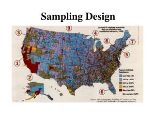
Baseline Groundwater Sampling Program Design Considerations. States with Baseline Sampling Regs.

E N D
Baseline Groundwater Sampling Program Design Considerations
States with Baseline Sampling Regs Information contained herein is the property of and is proprietary to Weston Solutions, Inc. and shall not be reproduced, disclosed, or used without the prior written permission of Weston Solutions, Inc
WESTON’s Baseline Experience • Performed Baseline Sampling in: • Pennsylvania (regulated) • Ohio (regulated) • Texas (voluntary) • Colorado (voluntary when performed, now regulated) • Designed Baseline Programs for: • Regulated and Voluntary Regimes • High and Low Volume Drilling Plans
What is Baseline Sampling? Baseline Sampling – The process of collecting water samples from sources surrounding a well pad to document groundwater conditions prior to drilling.
Baseline Program Design • Establishing the Program’s Goals • Geographic Scope • What to Sample • Where to Sample • Obtaining Permission to Sample • What Analyses to Perform • Managing Information
Establish Program’s Goals • Risk Management • Provides documentation of pre-drilling groundwater conditions • In some States, can satisfy regulatory requirements that also provide operator with some liability protection • Regulatory Drivers • Required to obtain drilling permit in Ohio • Mandatory in some States • Stakeholder Engagement • Shows landowners that the Operator is taking care in how they do business
Geographic Scope • Is Program for one operating unit or multiple/all? • What should be consistent across geographies? • Consider local logistics
What to Sample • Public and private water wells • Surface water sources • Seeps and springs • Agriculture, livestock and potable sources
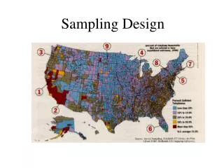
Where to Sample • No consensus among operators or state guidance • Generally surface hole location used as the starting point • ½ to 1 mile radius? • Enough samples to be • representative
Obtaining Permission to Sample • Initial contacts best done over the phone or in person, when possible • Written permission to be on property required • Be ready to explain why samples are being collected • Offer to provide analytical results to the landowner • Be ready for the question: • “When are you coming back to sample after drilling?”
Analyses to Perform • Highly Regional – Driven by Program Goals • General Chemistry • Anions - Cations • Metals • Dissolved Gasses • BTEX • TPH
Managing Information • High-quality data is critical to the program • Recommend the use of a database • Plan to manage the data before you need to manage the data • The amount of information stranded in spreadsheets can be overwhelming
ShaleFast(SM) Viewer - Demo • Features are highly customizable • GIS data can be shown on Web-based interface • Data is linked to well pad, property or other location • Analytical data query and export features are built-in • Data can be pulled from multiple sources, if desired • Data can be verified against quality criteria before being published • http://westonitsolutions.net/shalefastdemo/login.aspx
Contacts: Barbara Denson – 713.985.6764 Ryan Leatherbury – 210.248.2456 Rick Farrand – 303.729.6154