Download
1 / 21
210 likes | 354 Views
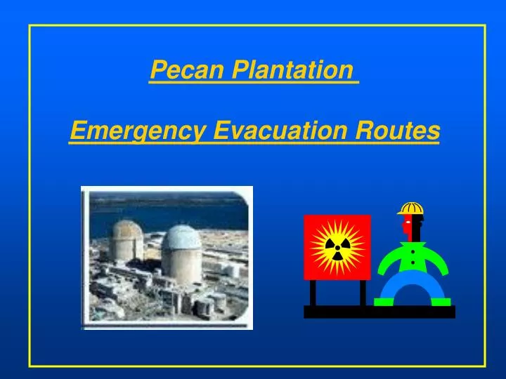
Pecan Plantation Emergency Evacuation Routes. Comanche Peak Evacuation Zones. Pecan Plantation. Quicksilver Gas Plant. Comanche Peak Nuclear Plant. Plan calls for Pecan Residents to go to Cleburne. Existing Road Network. Hwy. 4. Hwy. 167. P.P. Mambrino Hwy. (County Rd.).

E N D
Pecan Plantation Emergency Evacuation Routes
Comanche Peak Evacuation Zones Pecan Plantation Quicksilver Gas Plant Comanche Peak Nuclear Plant Plan calls for Pecan Residents to go to Cleburne
Existing Road Network Hwy. 4 Hwy. 167 P.P. Mambrino Hwy. (County Rd.) About 20 miles to Cleburne from front gate Quicksilver Gas Plant Comanche Peak Plant
TxDOT Evacuation Feasibility Study TxDOT Preferred Route GRANBURY Hwy 167 Pecan Plantation Comanche Peak Plant
Pecan Plantation Front Gate HOOD CO. JOHN- SON CO. Back Gate Plantation Beach Sandy Beach
Pecan Plantation to Cleburne CLEBURNE 19 miles
Aerial View Looking West Pecan Plantation Gas Drilling Service Road
Proposed Crossing Looking East Road Ends
Proposed Crossing Looking West Plantation Beach Park
Pecan Plantation Population Sandy Beach
Connection to Rt. 67 ~1 mi. 8 miles Cleburne = 11 miles Rt. 67 Glen Rose = 8 mi. JOHNSON HOOD. SOMMERVELL
Connection to Rt. 67 (Perspective) 2174 Pecan Gas Plant 1 mile Cleburne Gas Plant 67
Somervell Route Pecan Plantation Sandy Beach Park Well Pad
Possible Crossing - South from Sandy Beach Sandy Beach
Connection to Rt. 67 Rt. 67 Photo 2 JOHNSON HOOD. Photo 3 SOMMERVELL
Johnson County Option • Pave ~ 3.5 miles of private road to Brazos River • (in Johnson Co....landowners opposed) • Build bridge • Connecting road and gate at Plantation Beach
Somervell County Option • Pave ~1 mile of dirt road from the river to county road 2174 (in Hood Co.) • Build bridge • Connecting road and gate at Sandy Beach* * Sandy Beach is close to the most densely populated part of Pecan
Southwest Parkway Project Southwest Parkway is a planned tollway to connect Fort Worth's Central Business District at IH 30 with FM 1187 in Cleburne. The current project links IH 30 and Forest Park Boulevard to Altamesa Boulevard in the southwest region of the city...[finish by 2010] .