Download
1 / 33
340 likes | 441 Views
Weather Resources For the Glider Pilot. 11 February 2012. What You Need to Know. VFR conditions Surface winds at home airport Winds aloft at 3000’ and 6000’ Soaring conditions. Official Weather Briefing.

E N D
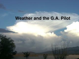
Weather Resources For the Glider Pilot 11 February 2012
What You Need to Know • VFR conditions • Surface winds at home airport • Winds aloft at 3000’ and 6000’ • Soaring conditions
Official Weather Briefing • § 91.103 Preflight action for a flight not in the vicinity of an airport must include obtaining weather reports and forecasts • Only two ways to get an official briefing: • 1-800-WX-BRIEF • DUAT (requires current Medical)
Gotcha! • FAA has no specific fixed definition of “in the vicinity of an airport.” • Meaning is interpreted on a case-by-case basis. • Don’t count on a favorable interpretation. • Example: “congested area…” in 91.119
Non-official Briefing • The Aviation Weather Center has links to all the information provided in an official briefing: • http://aviationweather.gov/stdbrief/ • With one exception (TI), every type of weather info to be discussed here can be accessed from the AWC.
Thought Question • Why can’t you legally fly a glider in IMC? • …even if you have this:
VFR Requirements • Altitude: over a “congested” area,1000’ above highest obstacle within a horizontal radius of 2000’ of the aircraft (91.119) • Weather minimums: Visibility = 3 statute miles; Distance from clouds = 500’ below (91.155, Class E)
Do the Math • Minimum altitude except for takeoff and landing = 750’ + 1000’ = 1750’ MSL • Minimum ceiling: 1750’ + 500’ = 2250’ MSL • Visibility: If you can see all of Mt. Wachusett (including the tower) you’ve got enough.
Prepare for a Quiz • 24-hour forecast • 48-hour forecast • We’ll do this “live”, so there’s no guarantee of flyable weather. We get what we get.
Graphical Forecasts • General weather information, but with some aviation-relevant information: • http://graphical.weather.gov/sectors/box.php
METARs and TAFs • METAR*: Current weather at a specific airport (ICAO) • TAF*: Forecast weather for a specific airport (ICAO) • http://www.aviationweather.gov/adds/metars/ __________________ *MÉTéorologiqueAviationRégulière *Terminal Aerodrome Forecast
Additional Local WX Info • Worcester Airport (KORH) ATIS • 126.55 • (508) 757-0962 • Fitchburg Airport (KFIT) ASOS: • 135.175 • (978) 343-9121
Winds Aloft • Altitudes up to 12,000’ are MSL • Winds and Temperatures Aloft forecast is displayed as: DD ss +/- TT: • DD = Two-digit wind direction (True) • ss = Two-digit wind speed, knots • TT = Two-digit temperature, Celsius • Forecast made four times a day: 0000Z,0600Z,1200Z and 1800Z • http://aviationweather.gov/products/nws/winds • http://www.usairnet.com/cgi-bin/Winds/Aloft.cgi
Winds Aloft Special Cases • Wind speeds over 99 knots are decoded by subtracting 50 from the direction and adding 100 to the speed • Light and variable winds are coded as 9900.
Progs • Analysis and forecast of surface weather conditions: a prog shows pressure centers and frontal positions. Yellow dashed lines indicate troughs of low pressure. • Use progs to estimate flying conditions in the near future (up to 48 hours) • http://www.aviationweather.gov/adds/progs
Prog Details • Analysis data for the "latest analysis" chart is provided every 3 hours. • 12 and 24-hour forecast data are produced four times per day at approximately 0300Z, 0900Z, 1500Z, 2100Z. • 36 and 48-hour forecast data are produced twice daily at approximately 0600Z and 1800Z.
Prog Symbology • Surface front codes • http://www.hpc.ncep.noaa.gov/html/fntcodes2.shtml • Precipitation symbols • http://www.hpc.ncep.noaa.gov/html/pcpnsymbs2.shtml
SIGWX Charts • Graphical forecast of aviation weather hazards • Use for go/no-go decisions • http://www.aviationweather.gov/products/swl/ • Help for interpreting SIGWX charts • http://aviationweather.gov/products/swl/info.php
Weather On Your Smartphone • Weather apps: • https://market.android.com/apps/WEATHER • Also check out the December 2011 issue of Soaring for more aviation apps
Jetstream Online School for Weather • Learn all about weather and weather information sources. • http://www.srh.noaa.gov/jetstream/
Quiz • 24-hour forecast? • 48-hour forecast?
Answer to Thought Question • A glider cannot meet the fuel requirements of 91.167. • No exemption for uncontrolled airspace: flight visibility and cloud clearance rules are still in effect (91.155) • Operating in IMC without an instrument rating is “careless or reckless” operation under 91.13.
Thermal Index • TI is a measure of atmospheric instability • Subtract the temperature of a rising parcel of air from the temperature of the surrounding air at the same altitude. • Negative result means the rising air is warmer and will continue to rise.
Interpreting TI’s • -1 to -2 produce barely soaring conditions • -3 produces minimal soaring conditions • -5 to -9 produce the best soaring conditions • < -9 leads to overdevelopment and thunderstorms
TI Reports • GBSC website provides TI reports for Sterling and Franconia • Direct links for Sterling: • http://world.std.com/~gh/ti/ti.html • http://www.soarforecast.com/ti.cgi?SUBJECT=TI&Upperstation=ALB&Surfacestation=ORH&Forecasthigh=&MaxAltitude=12000