Download
1 / 81
820 likes | 974 Views
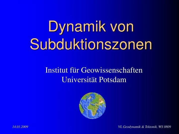
Dynamik von Subduktionszonen. Institut für Geowissenschaften Universität Potsdam. Übersicht zur Vorlesung. Subduktions- zonen. F R - resistance force. simple scaling view. L. W. d. d. F R. v plate. D T. d ~ (k t) 1/2 cooling thickness. r 0 , a. time t. h. D. r 0 a DT

E N D
Dynamik vonSubduktionszonen Institut für Geowissenschaften Universität Potsdam
Subduktions- zonen
FR- resistance force simple scaling view L W d d FR vplate DT d ~ (kt)1/2 cooling thickness r0 , a time t h D r0 a DT density after expansion k - bouyancy force FB
e e s = = v/L and Plate tectonics: scaling view (I) FB = ra DT/2 (dDW) g „bouyancy force“ gravity density size mass acceleration * FR = (v/L) (DW) „resistance force“ stress s area because of
FB FR Plate tectonics: scaling view (II) ~ Ra 2/3
plate velocity ~ 14 cm/yr ! r0 = 3 ·103kg/m3density a = 3 ·10-6 m2/sthermal expansion DT = 1400 Ktemperature difference h = 1022 Pa s viscosity g = 10 m/s2 grav. acceleration L = 3 ·106 m layer thickness k = 10-6 m2/s thermal diffusivity
subduction zones deformation time scales
various kinetic processes during subduction P. van Keken, 2004
What do we want to understand .. • What is the flow pattern in the wedge mantle? • Temperature distribution (how hot is the corner?) • 2-D laminar flow versus 3-D flow involving trench parallel component? • Do subducting slabs contain a large amount of water (serpentine)? • What is the distribution of water in the wedge mantle? • Is the wedge mantle “wet” throughout, or is it “wet” only in limited regions? (Comparison to the continental tectosphere.) • Does basalt -> eclogite transformation occur at equilibrium condition? • Do dehydration reactions cause earthquakes? • could dehydration reactions at high-P (V<0) cause instability? open „todo“ list, MARGINS workshop, Ann Arbor (2002) http://www.nsf-margins.org/MTEI.html
Plate tectonics - potential hazards (I) Volcanism
http://en.wikipedia.org/wiki/1980_eruption_of_Mount_St._Helenshttp://en.wikipedia.org/wiki/1980_eruption_of_Mount_St._Helens Eruption of Mount St. Helens, May 18, 1980
Mt. Saint Helens 1980 eruption USGS Loma Prieta 1989 earthquake
Eruption Mt. Pinatubo, 2001 Sumatra Earthquake, December 26, 2004 Complex plate boundary zone in South-East Asia Northward motion of India deforms all of the region Many small plates (microplates) and blocks Molnar & Tapponier, 1977
Plate tectonics - potential hazards (II) Tsunami waves
December 26, 2004 subductionthrust fault earthquake
Stein & Wysession, 2003 INTERSEISMIC: India subducts beneath Burma microplateat about 50 mm/yr (precise rate hard to infer given complex geometry) Fault interface is locked EARTHQUAKE (COSEISMIC): Fault interface slips, overriding plate rebounds, releasing accumulated motion Fault slipped ~ 10 m = 10000 mm ~ takes 10000 mm / 50 mm/yr = 200 yr Longer if some slip is aseismic Faults aren’t exactly periodic for reasons we don’t understand Sumatra Earthquake, December 26, 2004 HOW OFTEN ?
Banda Aceh, Sumatra, before tsunami http://geo-world.org/tsunami
Banda Aceh, Sumatra, after tsunami http://geo-world.org/tsunami
Plate tectonics - potential hazards (III) Large Earthquakes
3 components of earthquake hazard at SZ (1) Large interplate thrust (rare, but paleoseismology & tsunami history from Japan find big one in 1700): largest earthquakes but further away (2) Intraslab (Juan de Fuca) earthquakes: smaller but closer to population (3) Overriding (North American) plate: smaller but closer to population
Triggered mainshocks Triggering mainshocks Deep Earthquakes Earthquakes and subducted slabs beneath the Tonga-Fiji area(yellow marker - 2002 series, orange marker - 1986 series)
Subduction one plate descends below another, oceanic crust is consumed understanding of subduction process completed formation of theory of plate tectonics provided mechanism for removing oceanic crust generated at mid-ocean ridges
how was subduction “discovered”? “Wadati-Benioff” zones: zones of dipping earthquakes to 100’s kms depth (max: ~670 km) deep shallow seismicity intermediate
plate tectonics: convergent boundaries Wadati-Benioff zone northern Japan epicenters hypocenters red dots are deepest earthquakes so they plot on map as farthest from trench
plate tectonics: convergent boundaries variations in dips of Wadati-Benioff zones
slow fast plate tectonics: convergent boundaries “imaging” the subducting plate with seismic velocities - subducting plate is cooler than surrounding mantle - fast: cooler (denser material) slow: hotter (less dense material)
plate tectonics: convergent boundaries less buoyant plate dives below more buoyant plate oceanic lithosphere density > continental lithosphere 3 types of convergence • ocean-ocean convergence • ocean-continent convergence • continent-continent convergence (collision)
(1) ocean-ocean convergence • one oceanic plate subducts below another • earthquakes occur along interface between two plates • trench, accretionary wedge, forearc basin, volcanic arc
(1) ocean-ocean convergence • trench: deep, narrow valley where oceanic plate subducts • accretionary wedge: sediments that accumulated on subducting plate as it traveled from ridge are scraped off and accreted (added) to overriding plate
(1) ocean-ocean convergence • forearc basin: between accretionary wedge and volcanic arc • volcanic arc: mantle is perturbed by subduction process and melts at depths of 100-150 km, creating magma that rises to the surface to form island volcanoes
(1) ocean-ocean convergence Example: well-developed trenches in Indonesia/ Phillippines http://www.pmel.noaa.gov/vents/coax/coax.html
(2) ocean-continent convergence • oceanic plate subducts below less dense continental crust • features same as with ocean-ocean convergence except that volcanoes are built on continental crust and in some cases a backarc thrust belt may form
(2) ocean-continent convergence • volcanoes (magmatic arc): more silicic from addition of continental material; batholiths form at depth • backarc thrust belt: thrust faults form behind arc in response to convergence; “stickiness” between plates Andes; Cascades
arc-trench gap distance between the trench and volcanoes because the depth at which magmas are generated in subduction zones is about 100-150 km, this distance depends on the dip of the subducting plate if the dip of the subducting plate is flat enough, no volcanoes form subducted plate doesn’t go deep… infer dip by looking at distance between volcanoes and trench
trench can migrate through time response to forcing either by overriding or subducting plate subducting plate steepens and pulls overriding plate toward trench overriding plate pushes trench
• “detached” subducting plate • suture zone - plate boundary (3) continent-continent convergence neither plate wants to subduct (both are buoyant) result is continental collision • mountain belts • thrust faults
(3) continent-continent convergence model for India and Asia collision
(3) continent-continent convergence EURASIAN PLATE Himalayas are part of a long mountain belt that extends to Alps INDIAN PLATE AFRICAN PLATE
(3) continent-continent convergence deformation from collision extends far into Tibet/Asia
what causes plates to move ? ridge push: sea floor spreading and gravity sliding of plate downhill from ridge to trench while being pushed by sea floor spreading
what causes plates to move ? slab pull: weight of subducting slab subducting slab sinks into mantle from its own weight, pulling the rest of the plate with it as subducting slab descends into mantle, the higher pressures cause minerals to transform to denser forms (crystal structures compact)
what causes plates to move ? slab pull is more important than ridge push How do we know ? - Plates that have the greatest length of subduction boundary have the fastest velocities
what causes plates to move ? slab pull is more important than ridge push Forsyth & Uyeda, 1975 How do we know ? - Plates that have the greatest length of subduction boundary have the fastest velocities
what causes plates to move ? mantle convection is the likely candidate, but is it the cause or an effect of ridge push and slab pull ?
How Mantle Slabs Drive Plate Motions C.P. Conrad and C. Lithgow-Bertelloni "How mantle slabs drive plate tectonics" Science, 298, 207-209, 2002